So here we go, it is less than a month till the cycling highlight of this year, an epic, self-supported duo-ride across the Pyrenees from the Mediterranean to the Atlantic coast. The idea came up on a training ride with Willem the past summer, more-or-less simultaneously, but I think Willem was the one who said it out loud first (I will make sure to remind him if necessary while we both suffer pedalling up on one of the numerous steep climbs).
This post is about the planned route itself. I have designed the trajectory of the different stages mostly using the Global Heatmap of Strava and Google Street View on RouteYou (since the Route builder in Strava itself is horrible, it does not have Street View integrated into it, and the elevation gain is typically overestimated). Then I have used the exported .gpx files to make my own overview maps and elevation profiles with my custom-made python scripts ;) The main challenge of the planning was finding a balance between different factors, such as: crossing the Pyrenees over the highest number of epic climbs and cols, but without making unnecessary loops to keep the total distance (and the number of necessary days) at a reasonable level, plus preferably take low-traffic roads, and start and finish the day at locations where we can get a proper hotel for the night. This resulted in a preliminary plan, that was changed slightly when we booked all the hotels (a few start/finish villages were moved up/down along the route). This is how the final route was born before the end of January.
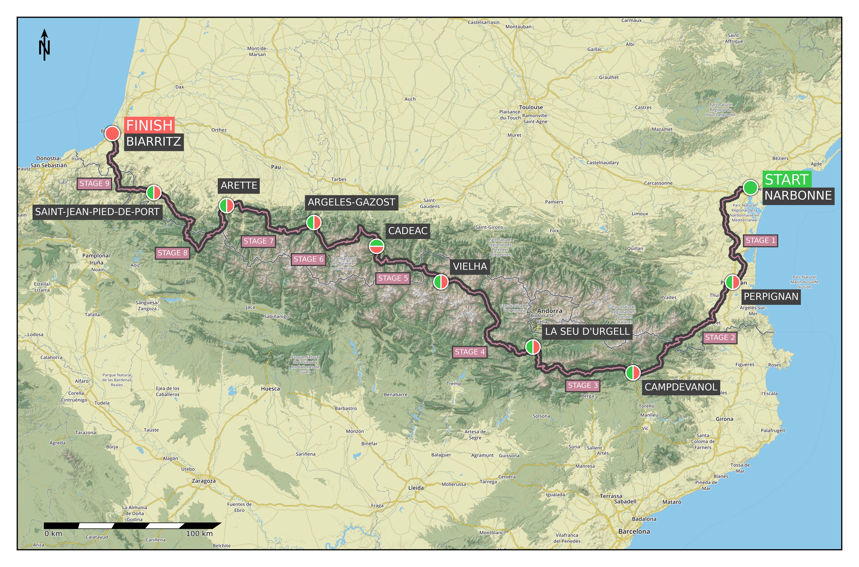
This is a total of 9 stages, 924 km, and 17635 metres of elevation gain over 22 cols (or 23, depending on how you count it). An overview of the elevation profile of the whole route can be seen below. (The climb categories were calculated following the discussion presented here.)
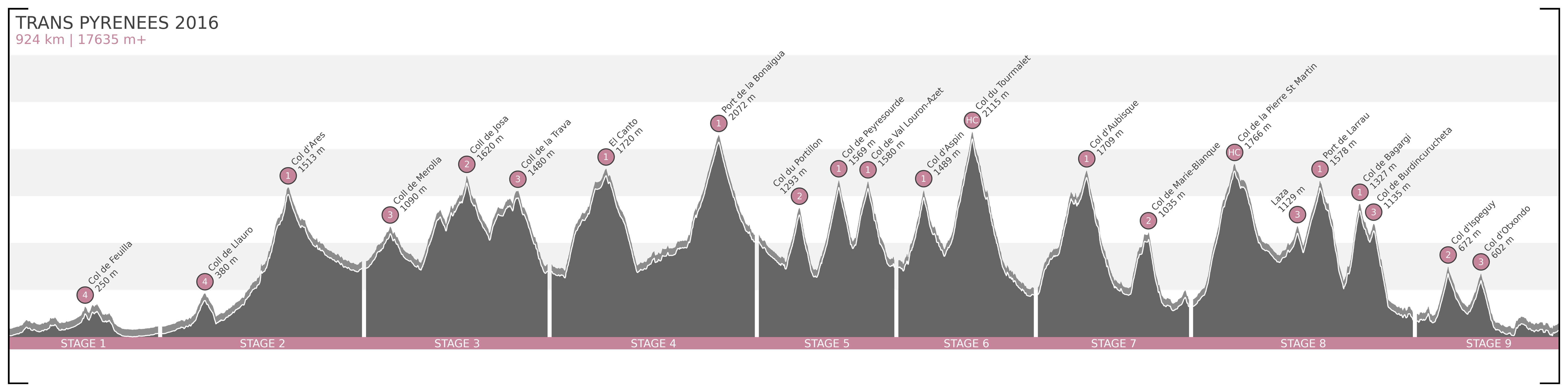
Now here is a detailed overview of the planned stages with distances, elevation gains, maps, profiles, and a list of cols for each day:
- June 3: Driving to Toulouse.
- June 4: On the morning we bike to the train station from the hotel, and take the train to Narbonne, where it all begins.
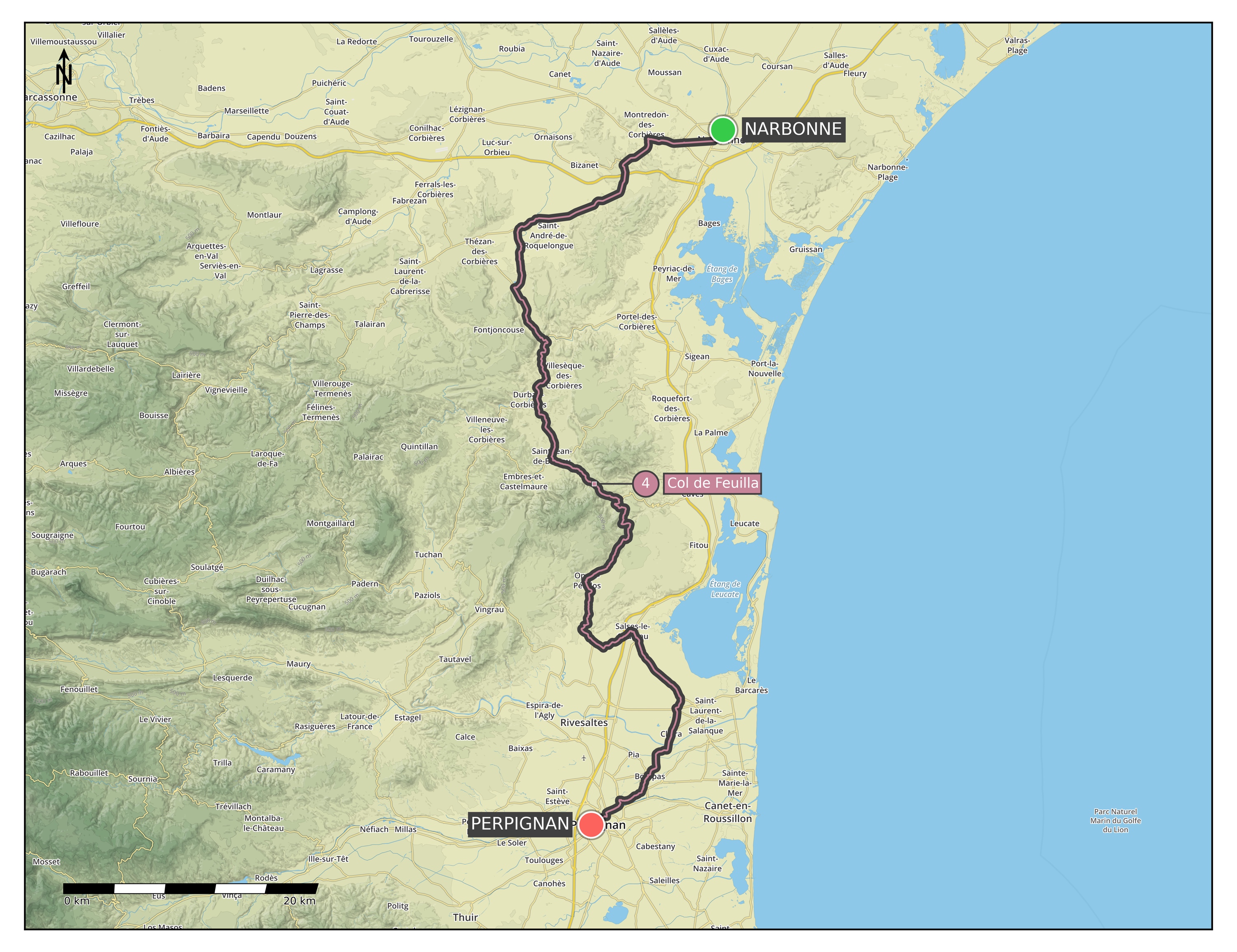
Stage 1) Narbonne – Perpignan: 91 km | 518 m+ (Map / Profile)
– Col de Feuilla [250 m] Cat 4
- June 5:
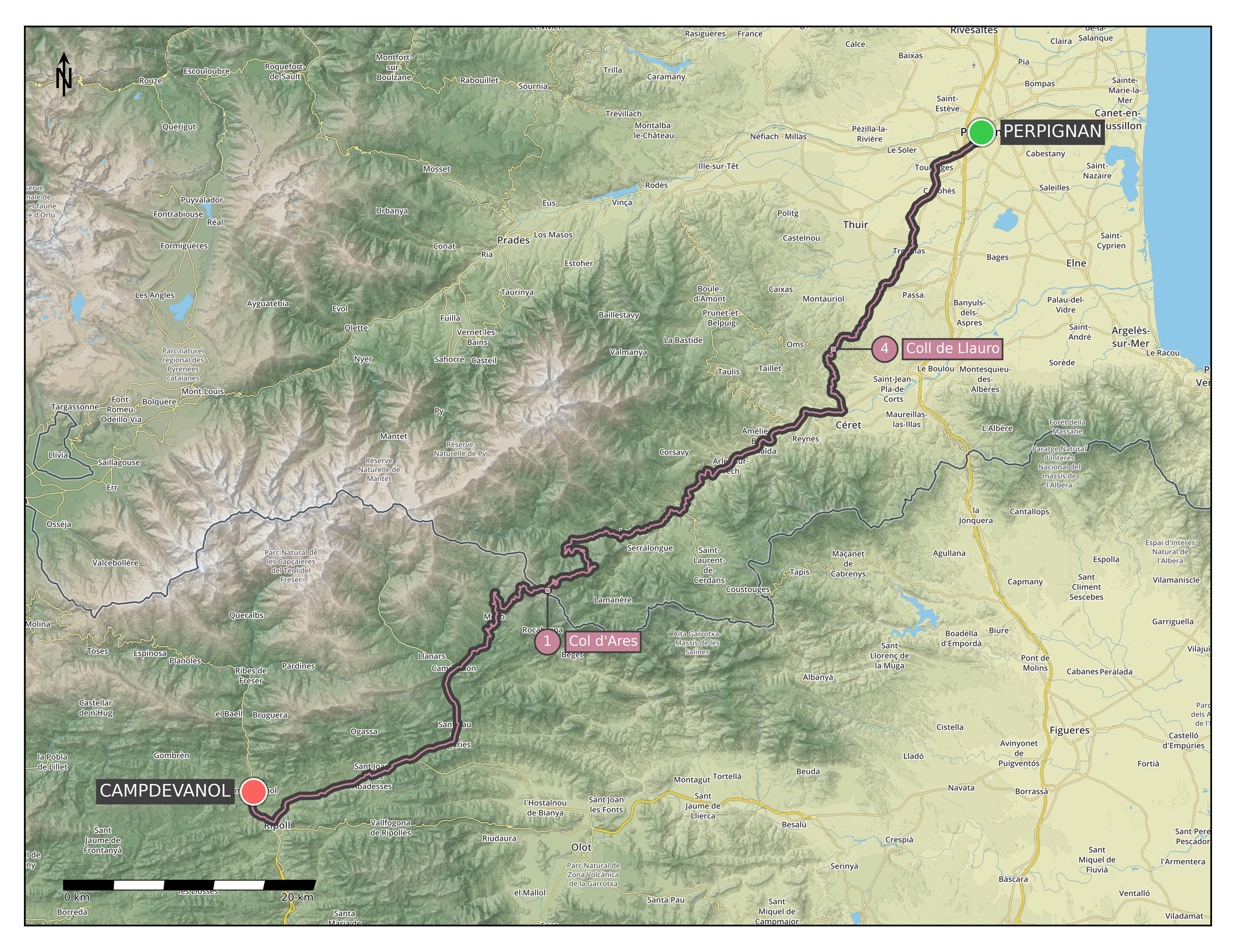
Stage 2) Perpignan – Campdevanol: 122 km | 1757 m+ (Map / Profile)
– Coll de Llauro [380 m] Cat 4
– Col d’Ares [1513 m] Cat 1 - June 6:
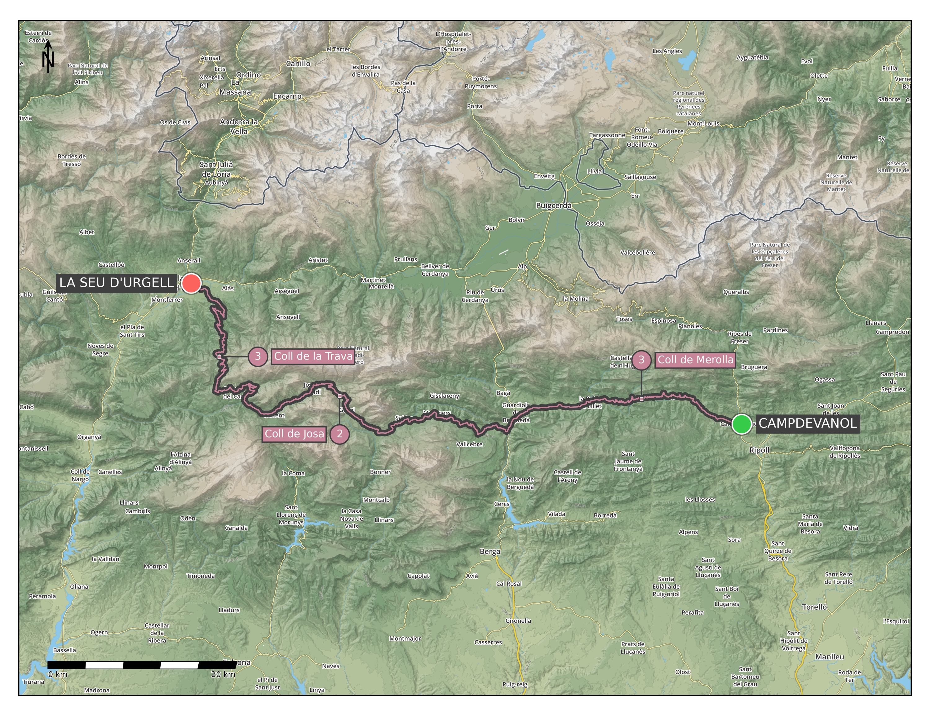
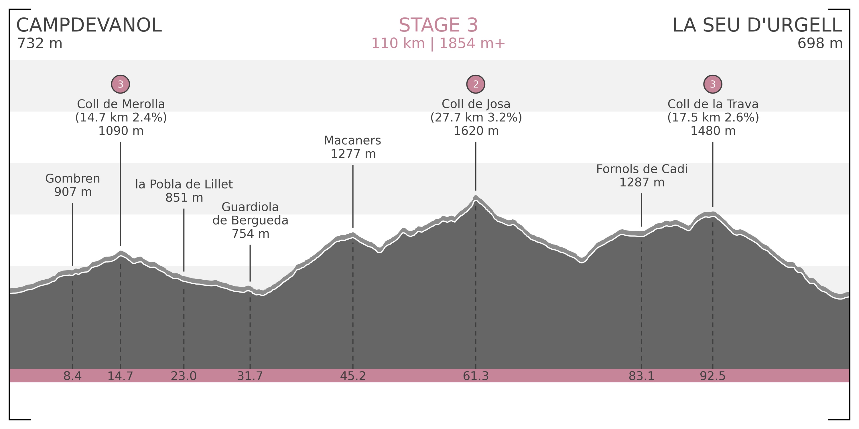
Stage 3) Campdevanol – La Seu d’Urgell: 110 km | 1854 m+ (Map / Profile)
– Coll de Merolla [1090 m] Cat 3
– Coll de Josa [1620 m] Cat 2
– Coll de la Trava [1480 m] Cat 3 - June 7:
Stage 4) La Seu d’Urgell – Vielha: 124 km | 2499 m+ (Map / Profile)
– El Canto [1720 m] Cat 1
– Port de la Bonaigua [2072 m] Cat 1 - June 8:
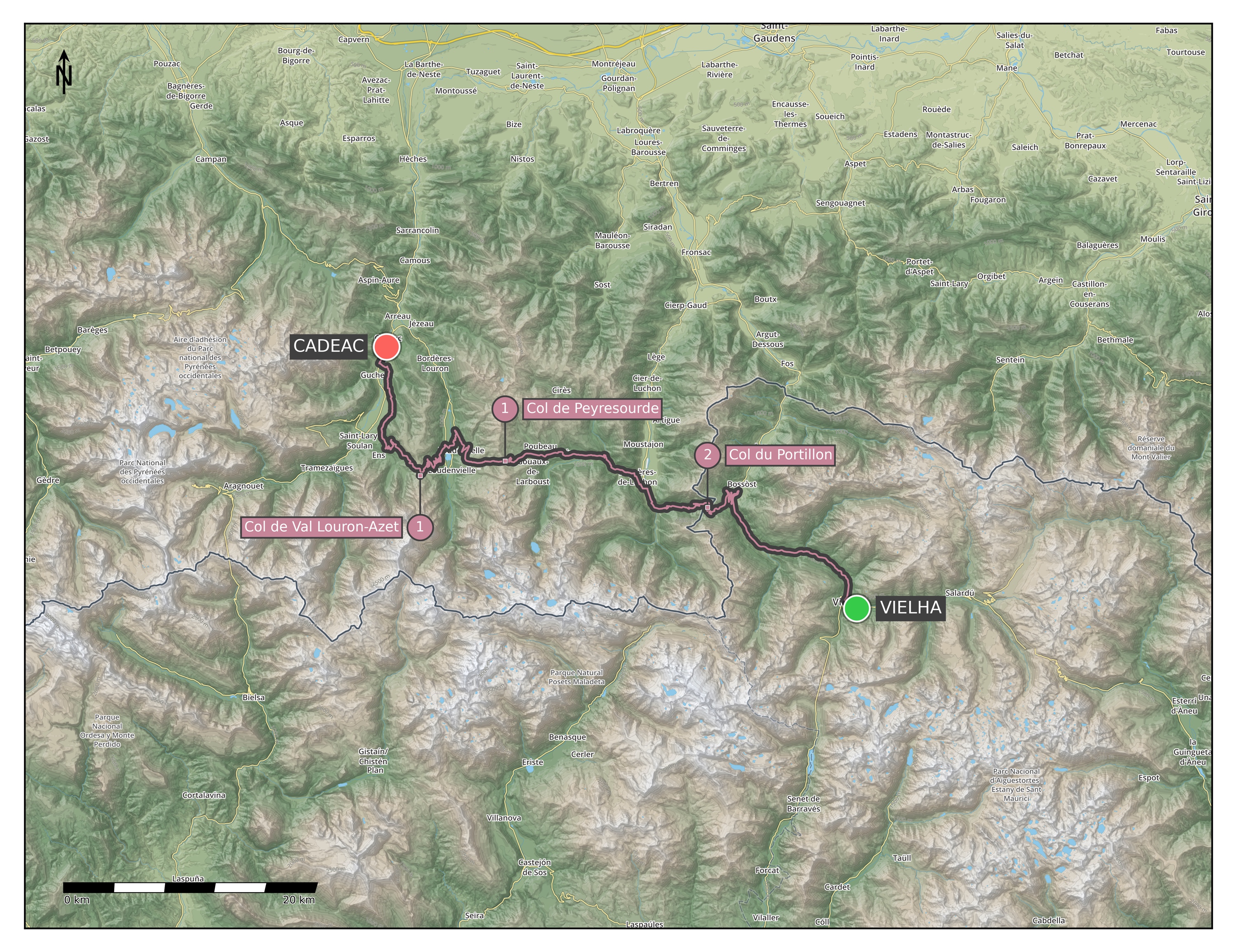
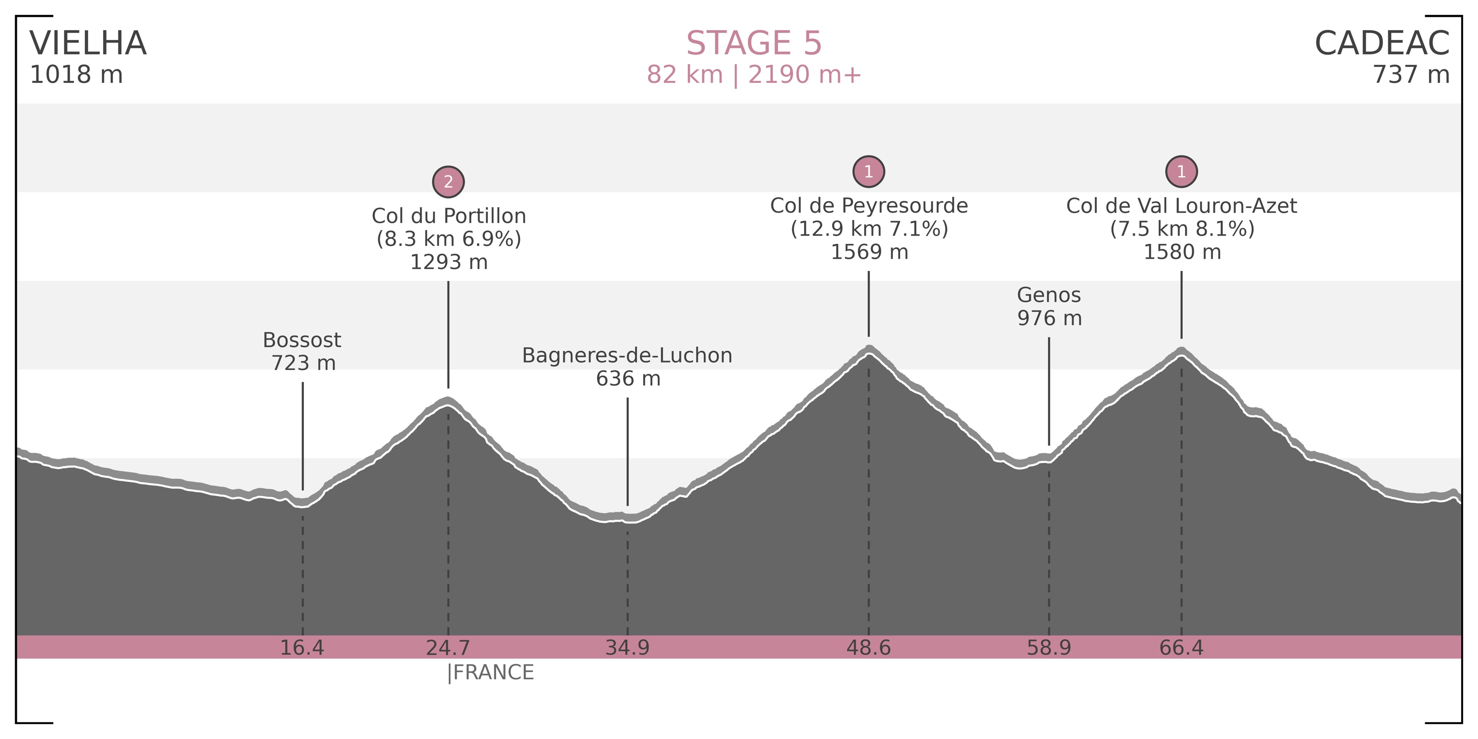
Stage 5) Vielha – Cadéac: 82 km | 2190 m+ (Map / Profile)
– Col du Portillon [1293 m] Cat 2
– Col de Peyresourde [1569 m] Cat 1
– Col de Val Louron-Azet [1580 m] Cat 1 - June 9:
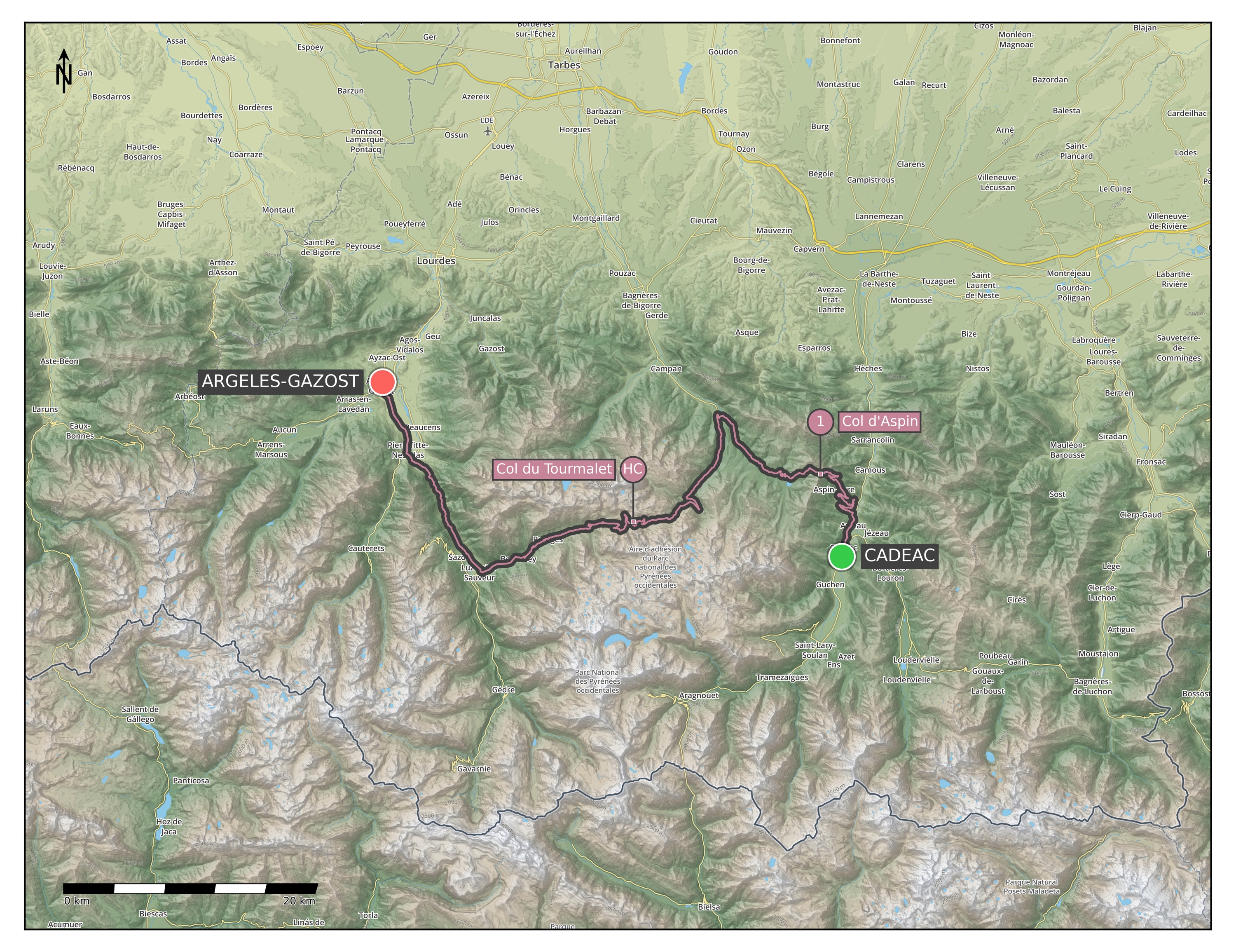
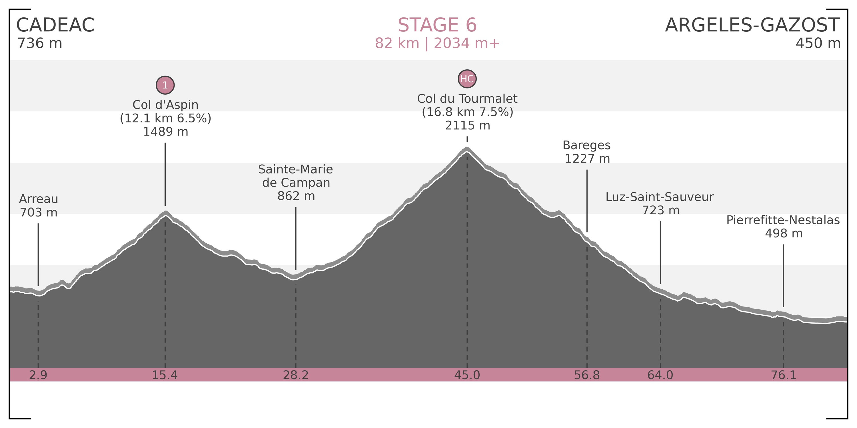
Stage 6) Cadéac – Argelès-Gazost: 82 km | 2034 m+ (Map / Profile)
– Col d’Aspin [1489 m] Cat 1
– Col du Tourmalet [2115 m] HC - June 10:
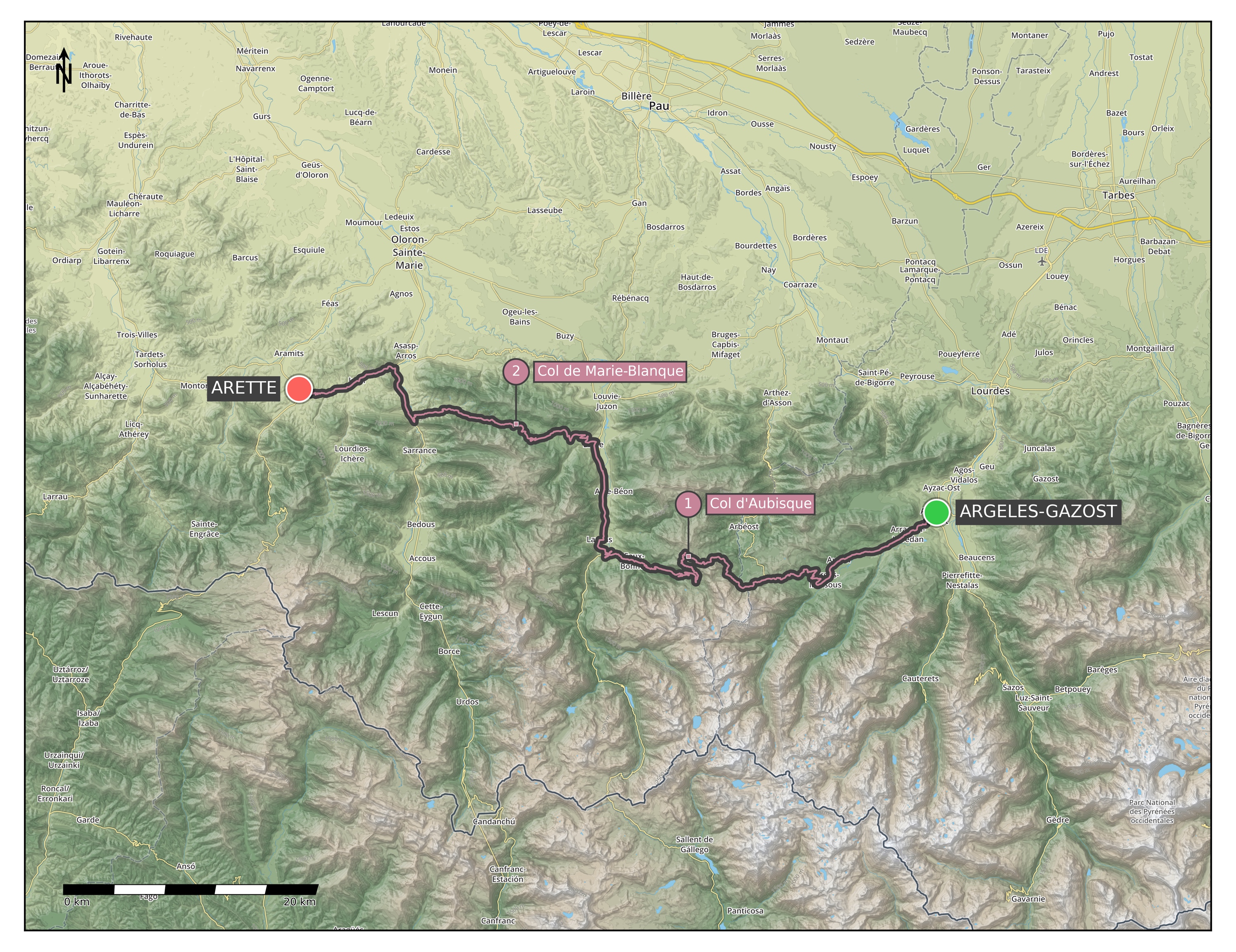
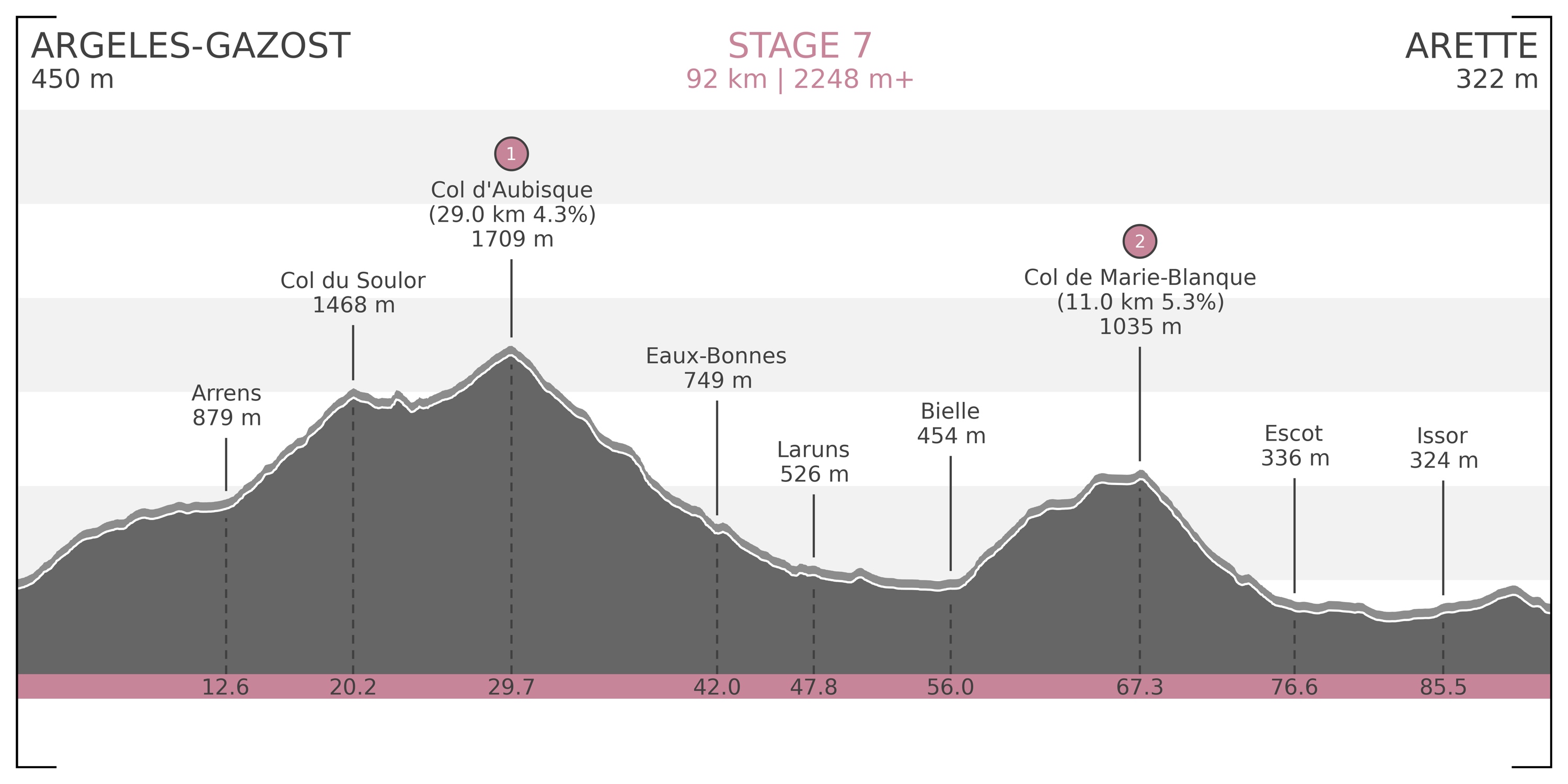
Stage 7) Argelès-Gazost – Arette: 92 km | 2248 m+ (Map / Profile)
– Col du Soulor [1474 m] & Col d’Aubisque [1709 m] Cat 1 (small downhill in between)
– Col de Marie-Blanque [1035 m] Cat 2 - June 11:
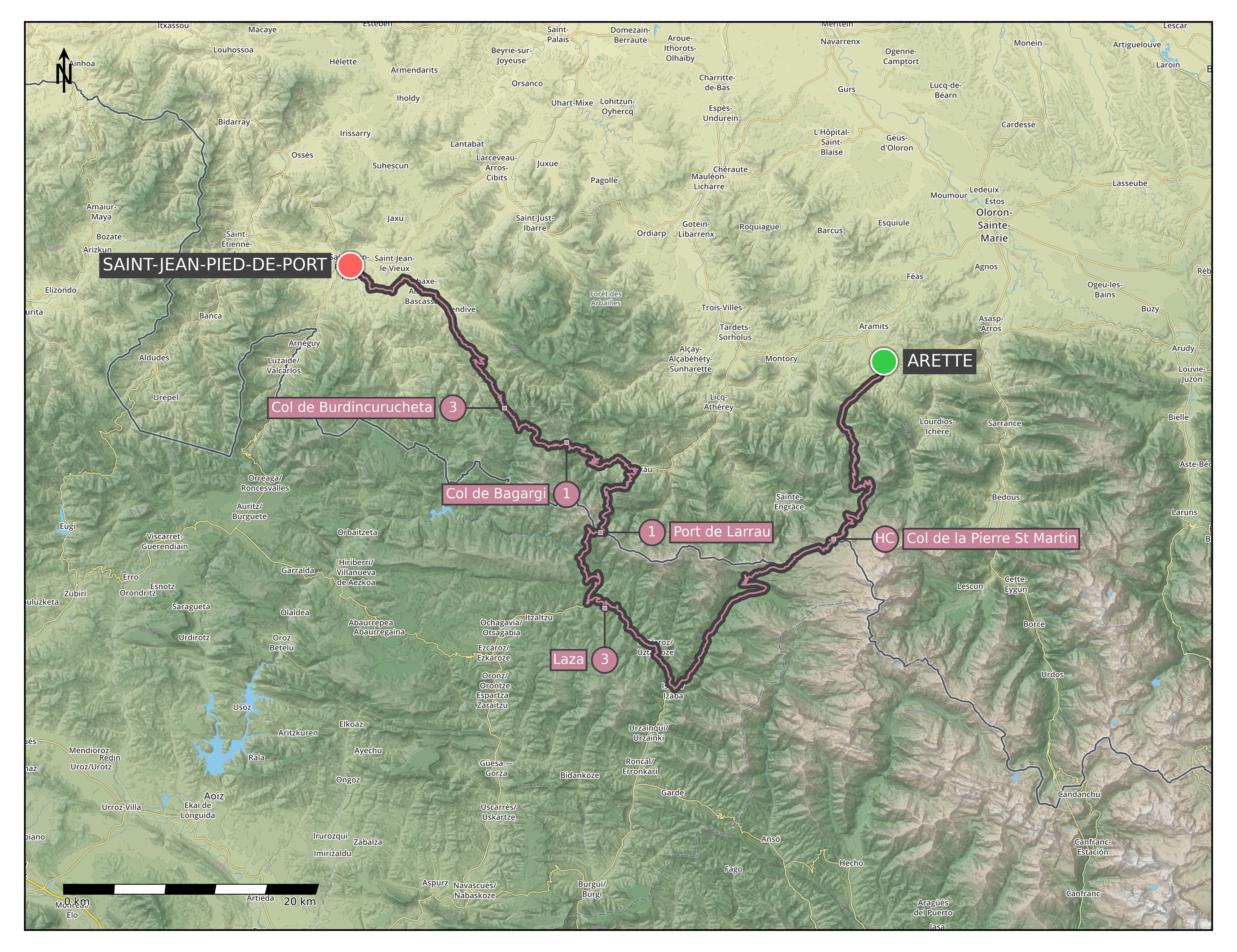
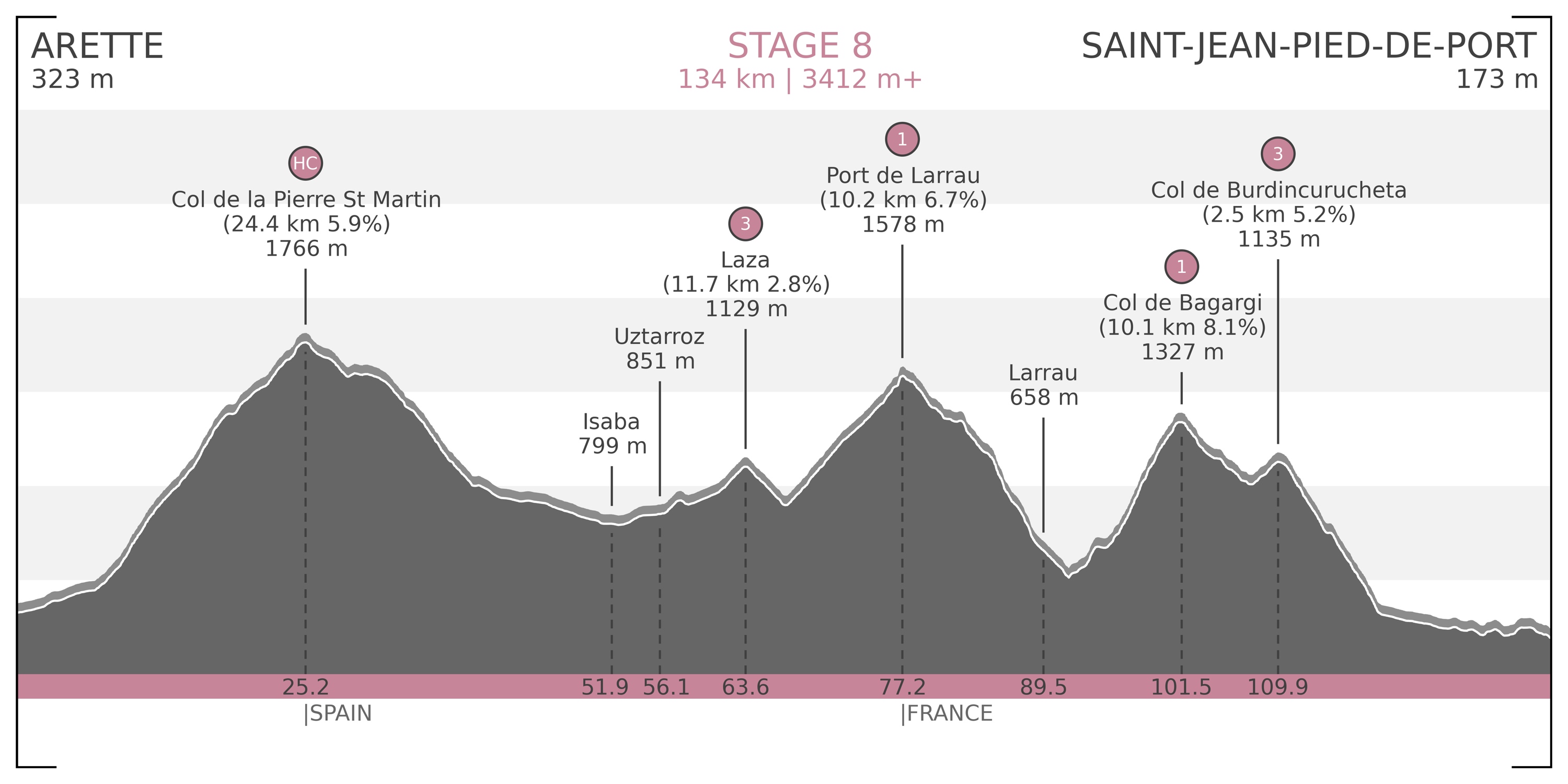
Stage 8) Arette – Saint-Jean-Pied-de-Port ♛: 134 km | 3412 m+ (Map / Profile)
– Col de la Pierre St Martin [1766 m] HC
– Laza [1129 m] Cat 3
– Port de Larrau [1578 m] Cat 1
– Col de Bagargi [1327 m] Cat 1
– Col de Burdincurucheta [1135 m] Cat 3 - June 12:
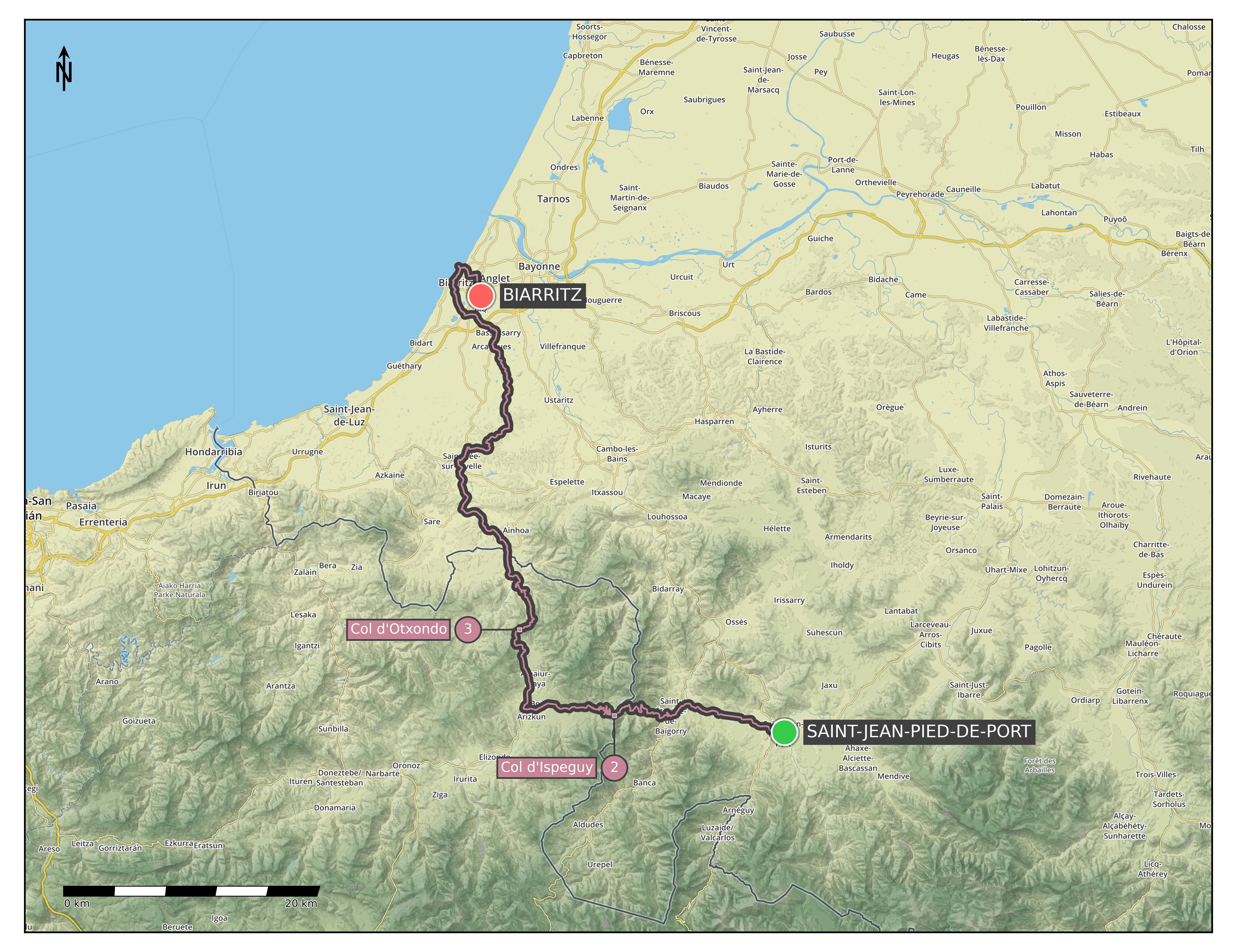
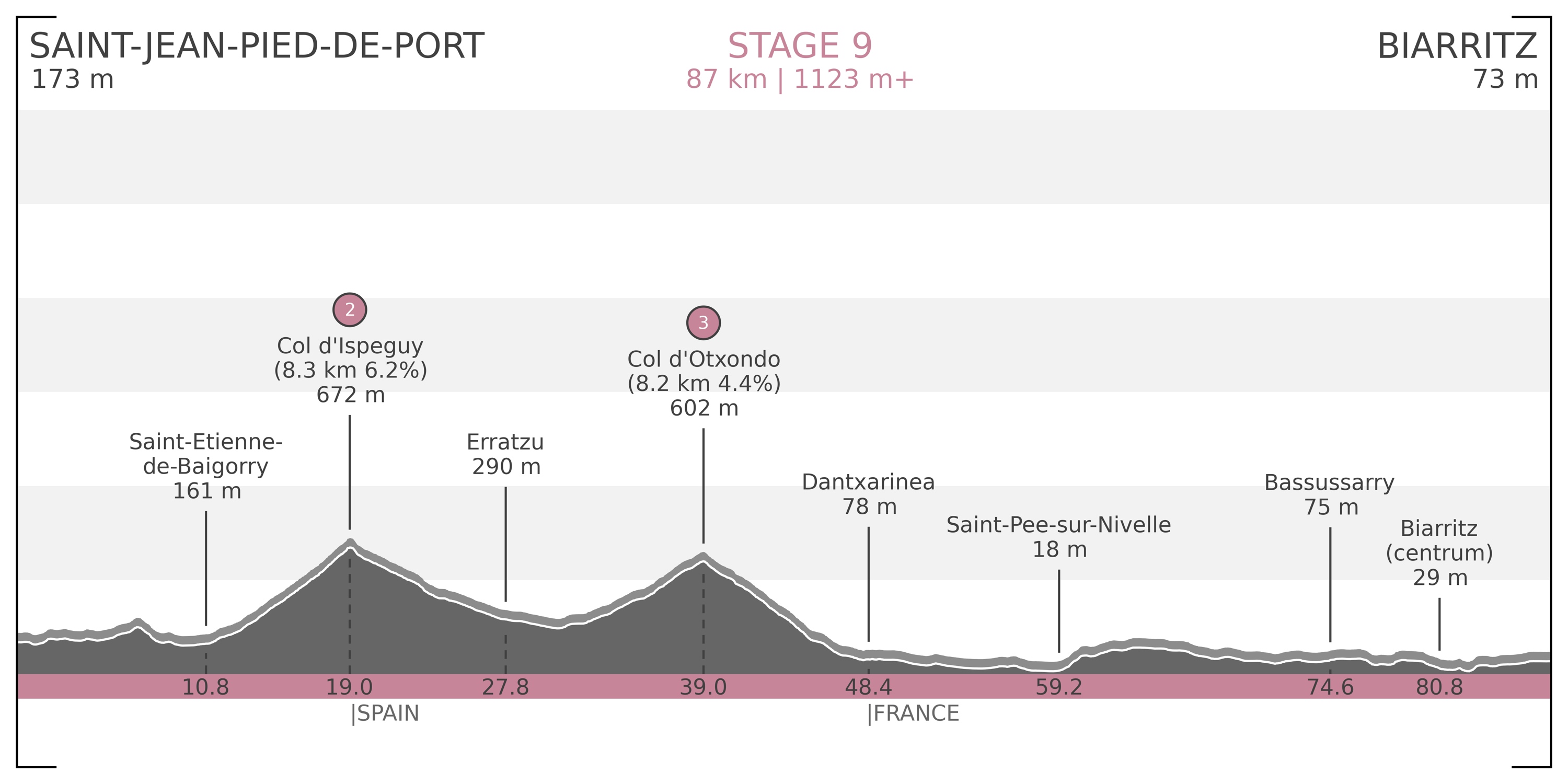
Stage 9) Saint-Jean-Pied-de-Port – Biarritz: 87 km | 1123 m+ (Map / Profile)
– Col d’Ispeguy [672 m] Cat 2
– Col d’Otxondo [602 m] Cat 3
After the ride, we drive with a rental car to Toulouse, then bike or walk to the hotel where we left our car (as the drop-off for the rental car will be at the airport too), and drive to another hotel for the night. - June 13: Driving home from Toulouse.
That is it for now. In the next post I will go over the gear we are taking with us, with a detailed description of each piece we will/might need on the road.
Really inspirational ride. Have to do it when back in Europe!
Hey.
I’m thinking of doing this in reverse this summer. I wondered whether you’d be willing to send me the gpx files you used.
This would be really appreciated.
Many thanks,
Peter
Sure, no problem, just send me an email to papics [at] gmail [dot] com.
Thanks so much for the super info. We’re off the follow you footsteps soon and have learned a lot from you.
Can you please let me know:
How long were you in the saddle each day?
What capacity was your saddle back? They seem to have two sizes, not sure which “standard” is.
Hi Nick, so sorry for the late reply (it might be too late now), my spam filter went haywire… We usually had an average around 20 km/h (give or take), so we were biking for 4-6 hours most of the time (not including photo and food stops). I think our bag was the normal size, and not the largest one, but not 100% sure… I hope you will have a great time out there!