I do not even know where to start… You might remember, that I crashed this year already two times on the racing bike (first almost breaking a newly purchased aero front wheel, then breaking a helmet and a special GPS mount) before we went to the USA. Soon after we came back, I participated in a very nice organised ride (accompanied by police motorcycles, so we did not have to stop at red lights, etc.), which ended abruptly after 100 kilometres, when my rear tire exploded. But it was not just a flat. The outer tire fell off the rim, so I had to brake scratching the edge of the rim, and when I came to a full stop I had to realise that the inner tube is stuck in and around – in truly unimaginable ways – the cassette and that the aforementioned outer tire has a 15 cm long opening in the middle… It did not take much time to realised that the situation was hopeless (since no person carries a spare outer tire with him), so I was already about to call Clio and ask her to come and pick me up, when a random Flandrien came to me from over the other side of the street. He told me, mostly in Dutch, that he has a tire, and I can take it. Then – while I was still in disbelief – he invited me inside, and it turned out that he had a fully equipped garage with all the possible bike parts and even a proper bike stand, just like the one I have. He gave me everything I needed to repair my wheel (a file to smoothen the horribly scratched, sharp edges of my rim, and the exact same brand and type of tire I just destroyed), which still took more than a half hour to accomplish. Since I had no cash on me, I asked him to give me the number of his bank account and reimbursed him for all the things he gave me.
But my misfortune was not over. Two weeks later while Clio was in Antwerp meeting up with a girlfriend for shopping, I went for a nice and easy afternoon ride. Just a day earlier, I did a big maintenance on the bike: cleaned it, rewired some brakes, changed the bottom bracket (for the first time in my life), installed new bar tape, trued my aero wheels (and even removed the decal stickers to make them look even slicker), etc. So there I was the next day, enjoying the silent (except for the sweet sound of the aero wheels slicing through the air) and smooth ride of my reborn bike the next day, when out of nowhere, I got a flat. Since recently I had gotten quite some experience in changing tubes, even before I came to a full stop I was already thinking: “ok, a 5 min break and we will back on track, no biggie”… But then when I started inspecting the front wheel to check if the flat did some damage to the outer tire too, I immediately noticed, that something was not right. And the shocking recognition came almost instantaneously: one side of the edge of the rim (which holds the outer tire in place normally) was completely broken, as if some previously hidden internal pressure or stress would have torn it away from the main body of the rim. It was probably some invisible damage from the crash earlier this year. It was unrepairable. Also, since Clio was not at home, I could not call her to come and pick me up, so accepting the situation, I started walking towards Leuven. I was in the middle of nowhere, with no buses or trains nearby, so there was not really another option. I was more or less 3 hours of walking from home… Luckily it was sunny, and relatively warm (for late September), so I did not have to worry about that, but it was still a long walk, especially in cycling shoes… After two hours, while I was already walking along the small channel which ends at the northern gates of Leuven, a guy picked me up and drove me home, saving me another hour of the cyclists’ walk of shame.
You might think this was the end of bad things, and now I will write about the nice rides I have been doing afterwards. But nope. On the next weekend, I was on my usual Sunday morning group ride, and everything went fine until the last 500 metres, where I managed to not concentrate enough for two seconds on a downhill (I took my eyes off the road for a jiffy), which was just enough to miss noticing a car coming to a full stop 50 metres in front of me… I guess it is needless to say, that I crashed into the rear of the car (travelling with around 30 km/h). Luckily (or because I had gathered quite some experience in crashing too recently) I managed to fall along the right hand side of the car while my bike bounced to the side, and land in a way that I got nothing worse than a few scratches… My bike was a bit less lucky: I immediately noticed that the replacement mount I had just installed a week ago broke into pieces, and that my front wheel got a bit untrue (this was the front wheel of the wheel-set from which the rear wheel got damaged in the “tire explosion incident” you might still remember from a few lines earlier).
Since I lost my trust in this wheel-set and I needed something trustworthy in a very short notice as I was about to leave to La Palma two days later, I decided to put on the wheels from Clio’s bike. But of course for that I had to change the cassette, the tires, and then fine tune the position of the brake pads again… Then I noticed that my nice carbon pedals also broke, so I had to put back the old (but still pretty good) ones. Now bear with me, we are on Monday afternoon, just two hours before I had to leave for my Dutch course, when I finally thought everything was ok, and I was about to start packing my suitcases. This is the point when shit happened again. And not the small kind of shit, but the big one. While doing a really last check on the bike, I found out that the chainrings (on the front) were seriously out of true (meaning: bent). I did not notice it while riding home after the accident because while riding using gears where the chain is near the middle of the cassette at the back, it did not result in anything noticeable. But as soon as you shifted towards the largest or smallest cogs, the chain started rubbing against the front derailleur. Since climbing on the Canary Islands means using the easiest gear, this was a huge problem, not to mention that riding a bent chainring will only bend it further… So, I guess I do not really need to stress that at this point I was on the edge of mental breakdown. A quick phone call with Clio made me feel a tiny bit better, but I was really about to just leave the bike as it was, and fly the next day without it (especially that I knew that the part I needed to replace is basically the most expensive part on the bike after the frame). But since this would have left me with nothing to do on La Palma for a week, I looked for a solution. I knew that there is only one bike shop near Leuven which is open on Mondays – of course the one which is furthest from us -, so I rode there. Unluckily the shop was just under renovation, but luckily the owners were there doing the works themselves, so at the end, they managed to get the crankset I needed from some other storage unit in the very back… After this, I still had to go to my Dutch course, which was really good for my nerves to calm down a bit. Then I arrived home at 10 on the evening, and after having something to eat (pizza!!!), I still had to pack all my stuff, then to make things even better, install the new crankset. It is not the easiest thing to do on a bike, and I had to set up my bike stand for it, so to cut it short, by the time I was done with everything it was 2 on the morning. And my taxi came at 3:30, so I had nothing more than an hour to sleep…
Surprisingly enough, I managed to get out of bed in time (although I remember vaguely Clio saying something about not try to sleep again after I killed the alarm), and everything went fine at the airport too. The flight was uneventful (and I managed to sleep another 2 hour pushing the total up to 3! – nope, not factorial tree, unluckily), and I also got to my hotel very quickly. My original plan was already a bigger ride for the afternoon, but thanks to the low amount of sleep I managed to accumulate, I had to opt for a quick and short training (after lunch in my favourite pizzeria). Even though I went for the most flat route possible, I had to overcome 750 metres of elevation gain over the course of only 42 kilometres. And finally it seemed like everything was working fine on my bike…
This miraculous state lasted till the next morning. I was in the middle of preparing for the first proper, long, epic ride, had my breakfast, put together all the energy bars and gels, started filling my bottles, etc. As one of the last action items, since I remembered from the previous day that my seat felt a bit too low, I wanted to raise the seat post a bit. While tightening back the seat post clamp, the threading broke in the clamp. I really could not believe this was happening… Probably all the fine-tuning of my seat height during the past years was too much for the thread, and it decided to finally give up… I really thought this was the end. I am always travelling with all the spare parts, spokes, tires, tubes, brakes, wires, everything, but who has a spare seat post clamp with him? But then again, I really had nothing to do, so I started sending around emails to all the bike shops I managed to find online, and also to the staff of the Mercator telescope asking if they could help me somehow (in driving me around, or in trying to ask around in Spanish)… After a few hours, I had a couple replies from shops on the other side of the island (so I already started looking up the bus schedules while preparing myself for another adventure), but also one of our engineers told that he could take me to a more nearby shop on the afternoon. At the end, this turned out to be the solution, and I managed to get a new seat post clamp for 3.5 (!) euros. Compared to the crankset which costed me 220 euros a few days earlier, it was really nothing, but no matter how inexpensive this part was, I still could not go cycling without it. At the end, the new seat post clamp did fit my bike, and this incident was – finally – really the last mishappening…
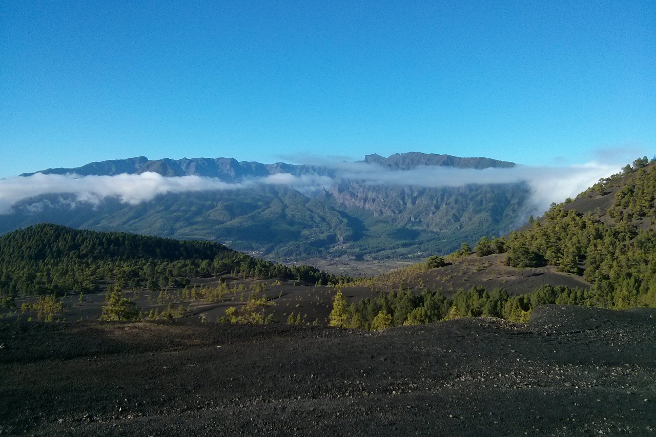
Of course with this half the day was lost again, so I could not do anything but go for a short ride similar to the day before. Although it was almost the same route, I had some excitement when a dog started to chase me while I was going up on a slight climb… Luckily, I was still faster uphills ;) Then things really turned around, and on Thursday and Saturday, I managed to do two really nice, hard and epic rides. On Thursday I did a circle through the northeast of the island, climbed the Roque de los Muchachos from the North, and finished the day after 121.8 kilometres and 3621 metres of elevation gain. It was great.
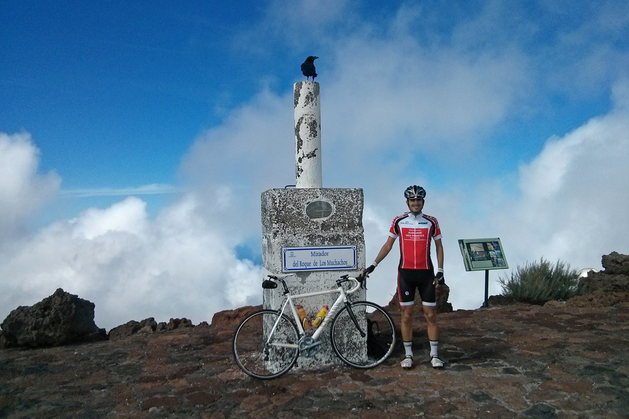
Then two days later I did a circle into the heart of the island, climbing the Roque de los Muchachos from the East, and on the end of the day, the second highest pass of the island from the West too (which I have never fully done before, especially not in good weather). This was my second hardest ride ever: 147.9 km and 4363 m of elevation gain, and even though I was a bit on the slow side, I am proud of the accomplishment.
And with this ride, this year’s cycling season is more or less over (and it was my best season so far), I will probably join a few more Sunday group rides if there are any left before winter kicks in, but then I will take some time off the bike, and do some running just like I did the previous winter. Hopefully without any misfortune happening to me, since I think I had enough of that recently :)


