Tag Archives: road trip

Road trip Iceland: Day 8 (Transfer to Mývatn)

With a very tiring (but awesome) day behind our backs, we were happy to take the morning easy, and enjoy the breakfast in our hotel for a bit longer than usual. Since we already visited the puffins the previous evening, we had quite some extra time on our hands.

We left around 10, first driving back to Egilsstaðir, then turning left onto the ring road, heading North. The weather was sunny, but still very cold, and the road condition reports indicated occasional patches of melting snow for later. It took quite some climbing to leave the Lagarfljót behind, before turning Westwards, descending into the valley of Jökulsá á Brú or Jökla – a river that we would follow upstream for a while.

There was basically no traffic (even less than before), and the landscape was also very bleak (long, straight, wide valley with nothing but yellow grass) compared to the wild vistas of the Eastfjords, so to break the monotony of the drive I stopped at an unscheduled parking, below the Rjúkandi waterfall. But the stop was more for snacks than for actual sightseeing, since we had already seen quite a lot of waterfalls on Iceland during the previous days, and we were heading towards two larger ones anyway. As the ring road continued climbing higher, we left the rivers behind, and entered into a more rocky, barren region. At one point the road had to navigate around and across a row of smaller and larger volcanic cones, and overall it felt like driving on another planet. Soon after – as we left the ridge behind – we had to cross a relatively larger river (Jökulsá á Fjöllum, which flows from the Vatnajökull glacier) on a single lane suspension bridge.

The two waterfalls that we were heading towards are both located approximately twenty kilometres downstream this river. To get there we had to leave the ring road for a while by taking a right turn onto road 862 a few kilometres further. The new-looking asphalt ribbon cut through old lava flows as it headed towards the North with us. There was a lot of fresh and melting snow around (some on the road, but not too bad), clearly dumped on the landscape by the snow storms that had passed there during the previous couple of days. Everything was reflecting sunshine, so I had to squint my eyes quite a lot in order to see something of the road ahead.

It was not too difficult to find the spot where we had to make the final right turn off road 862 towards the parking, as the main road was not cleared from the snow beyond that point. There was also still a lot of snow (albeit melting) in the parking, and over the whole landscape around us. It was around one on the afternoon when we arrived here. First we walked to the Dettifoss, which is one of Europe’s most powerful waterfalls.

There were plenty of good lookout points along the trail where we could enjoy the views and take pictures, and luckily it was impossible to walk down to the waterfall itself, so people could not get into (and ruin) the view ;) While the weather was quickly deteriorating as more and more clouds arrived, we still managed to catch a rainbow before the sunshine disappeared completely.

From here we walked to the Selfoss – a few hundred metres more upstream -, where water falls below in a U-shaped area, lined by basalt columns. It is a much smaller drop, but still worth a visit. We passed by the Dettifoss once more on the way back to the parking, just to see if I could get some pictures in better light conditions. (I could not really…)

We left the parking around 14:30, and drove straight to our hotel, where we would spend the next two nights – the Fosshotel Mývatn. It was still an almost one hour long drive, and it took us past some of the geothermal spots (which were planned for the following day) just outside of Reykjahlíð. After we arrived to the hotel and checked in, I took a short nap, while Clio went to the sauna. Since the weather forecast did not look very good for the next morning (for the first time during our stay, rain was imminent), we decided that after dinner we would still visit some of the things that were originally scheduled for the next day.

So after some fish and chips, or burgers (I can not remember the details anymore, only that we ate in Gamli Bærinn, and that the food was not very special), we headed to the Krafla area. The small road leading there passed by a geothermal power plant, and an outdoor shower installation (with hot water of course, although the art aspect was more important than the hygienic one). We made a short detour to the crater lake of Víti first (freezing cold wind, barely managed to take a picture), before arriving to the parking of the Leirhnjukur geothermal area.

We did a short walk here around the “Mud Peak”, passing by numerous warm and smelly fumaroles, a small lake that was somewhere between grey and blue (and it was difficult to decide if it was filled with water or mud), and some black lava fields (here and there covered by green moss). The active nature of the area was evident from the hot spots that were not covered by snow, where we could also literally feel the warmth of the ground.

From the peak you could see several snow-topped table mountains or tuyas – volcanoes that were born under a thick glacier (that has melted away by now, leaving these steep-sided mountains behind). The wind was strong and very cold, so we were really happy to be back in the car afterwards.

By the time we made it to the hotel it was already past eight, so there was not much left but posting some pictures to Instagram, and sleep…

Road trip Iceland: Day 7 (Winter in the East)

Given that this was going to be one of our longest days (especially with the possibility of moving something from the next day to this evening, bot no spoilers), we had to get up very early. I was already taking pictures on the sunny (but barely above freezing) deck of the hotel at 8:30.

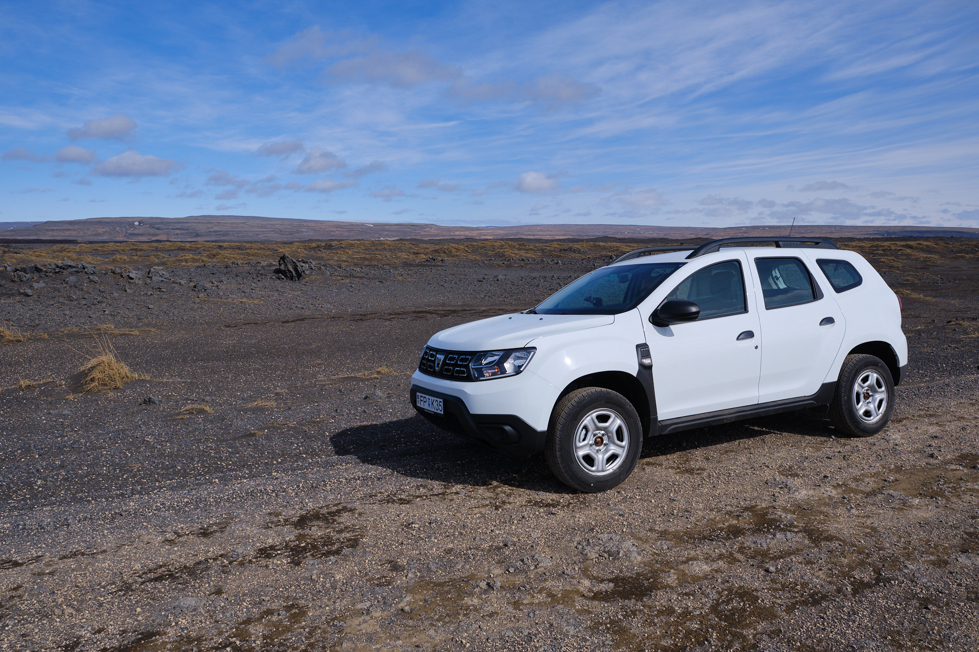
We had no breakfast booked here, so we just drove to the next village to get something from the bakery. (We were happy to see that after resetting it the previous evening, the tire pressure warning was not showing up on the dashboard anymore, and the tires were perfectly fine.)

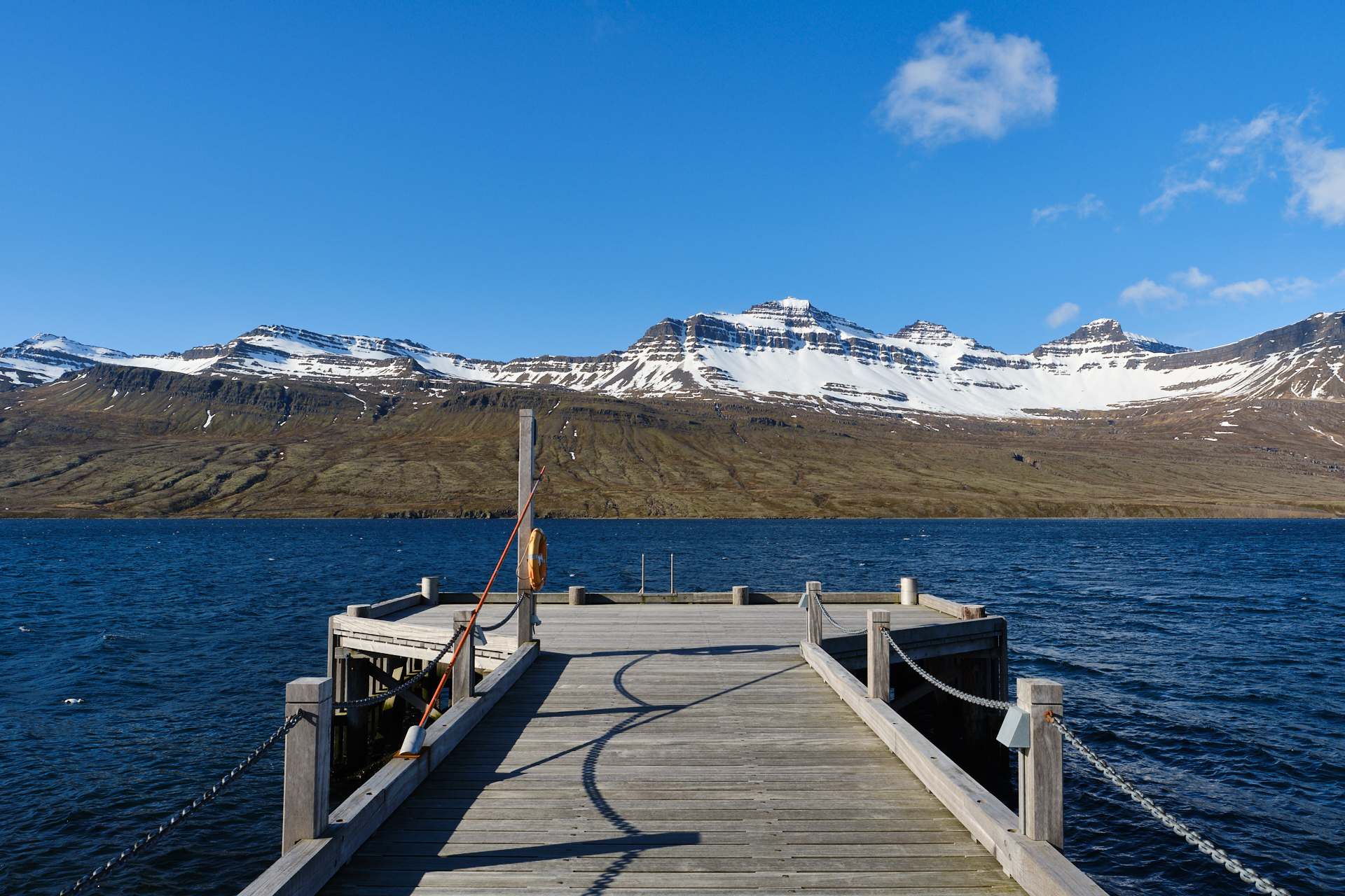
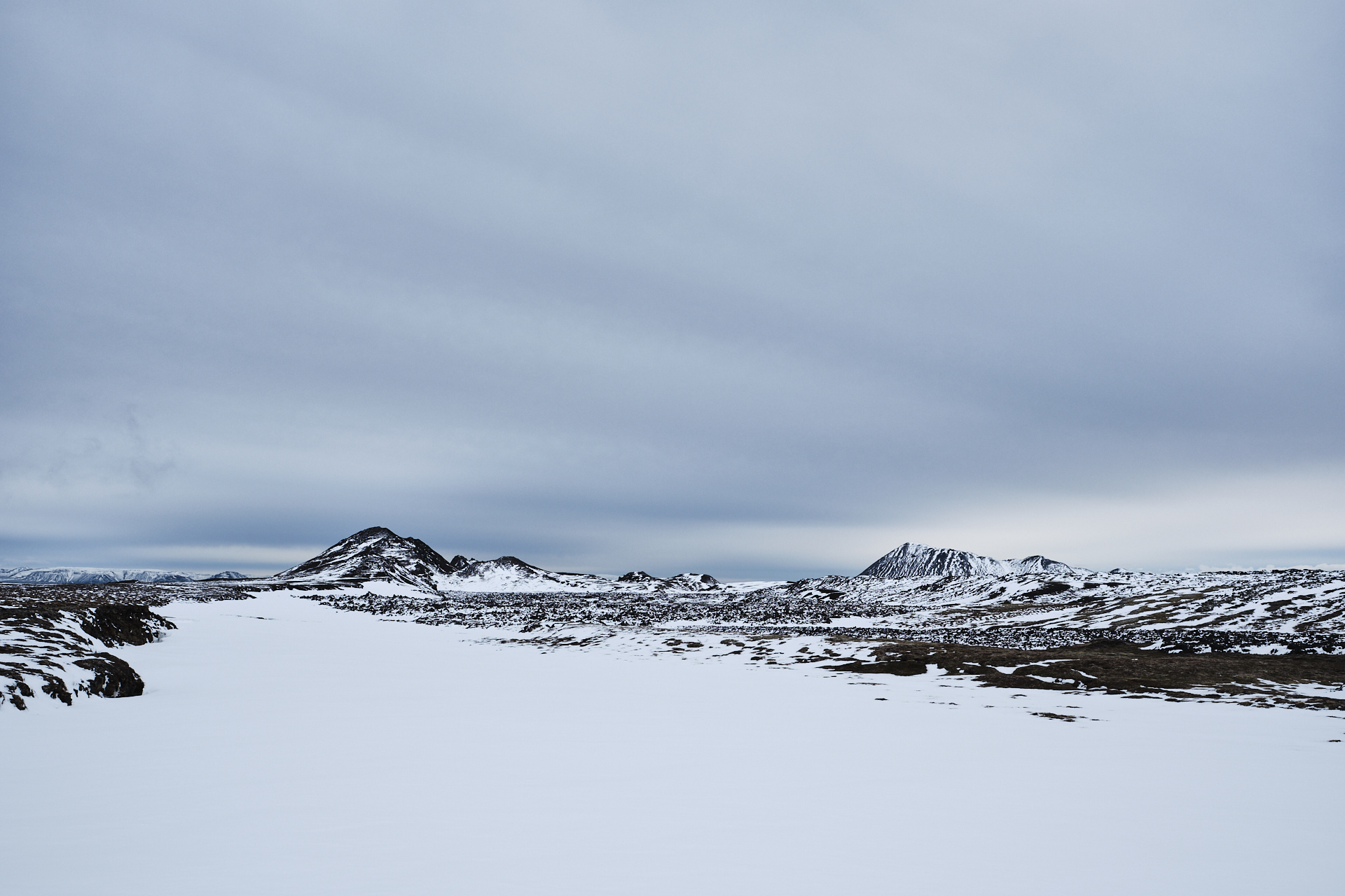
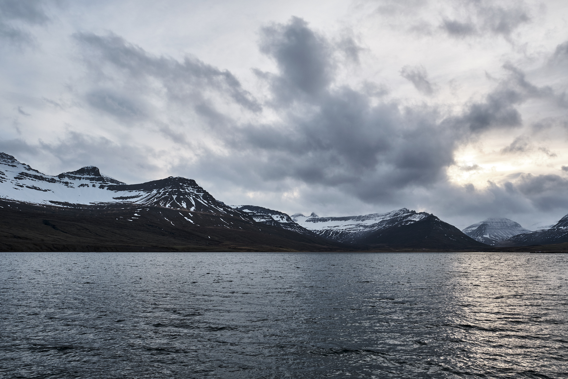
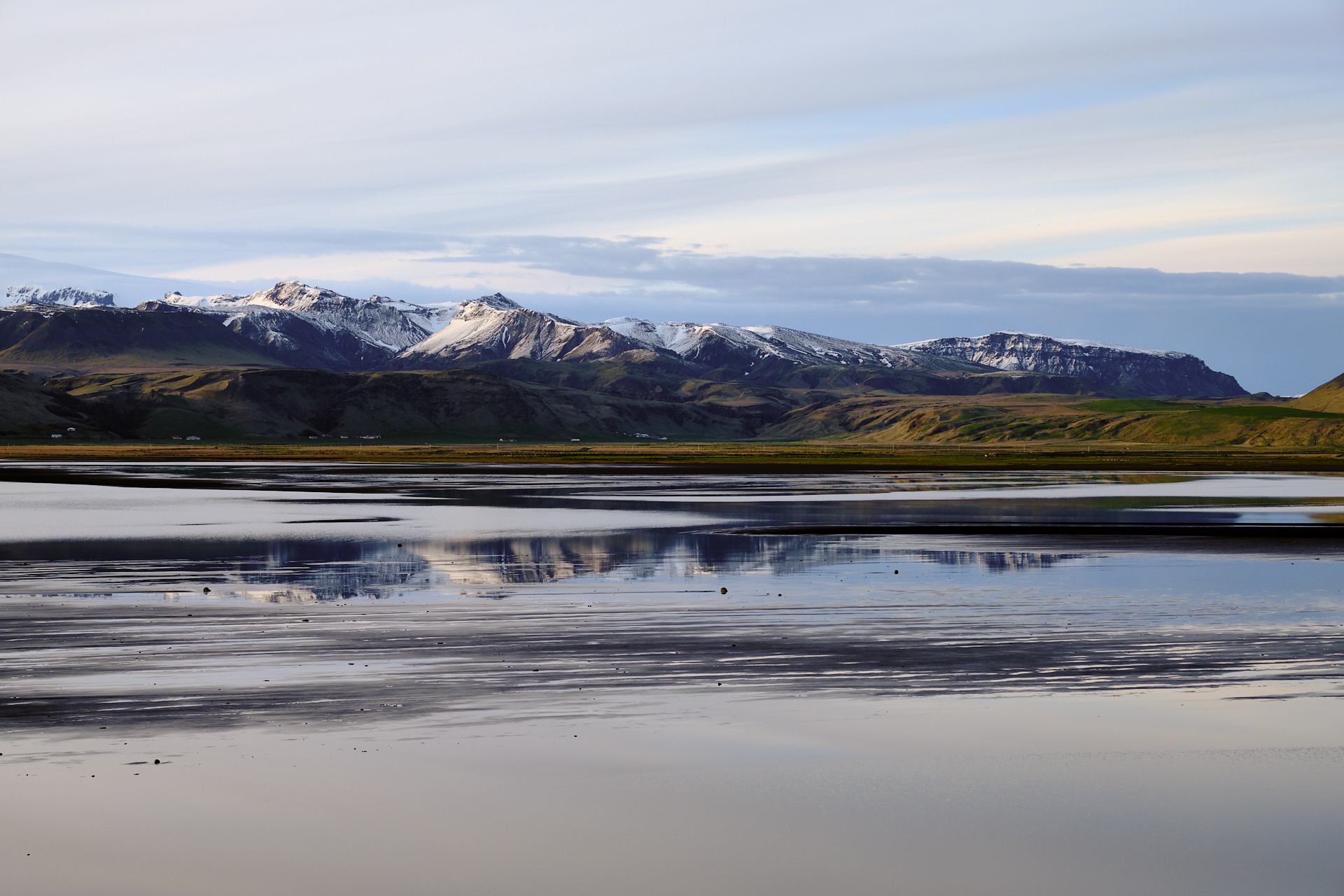
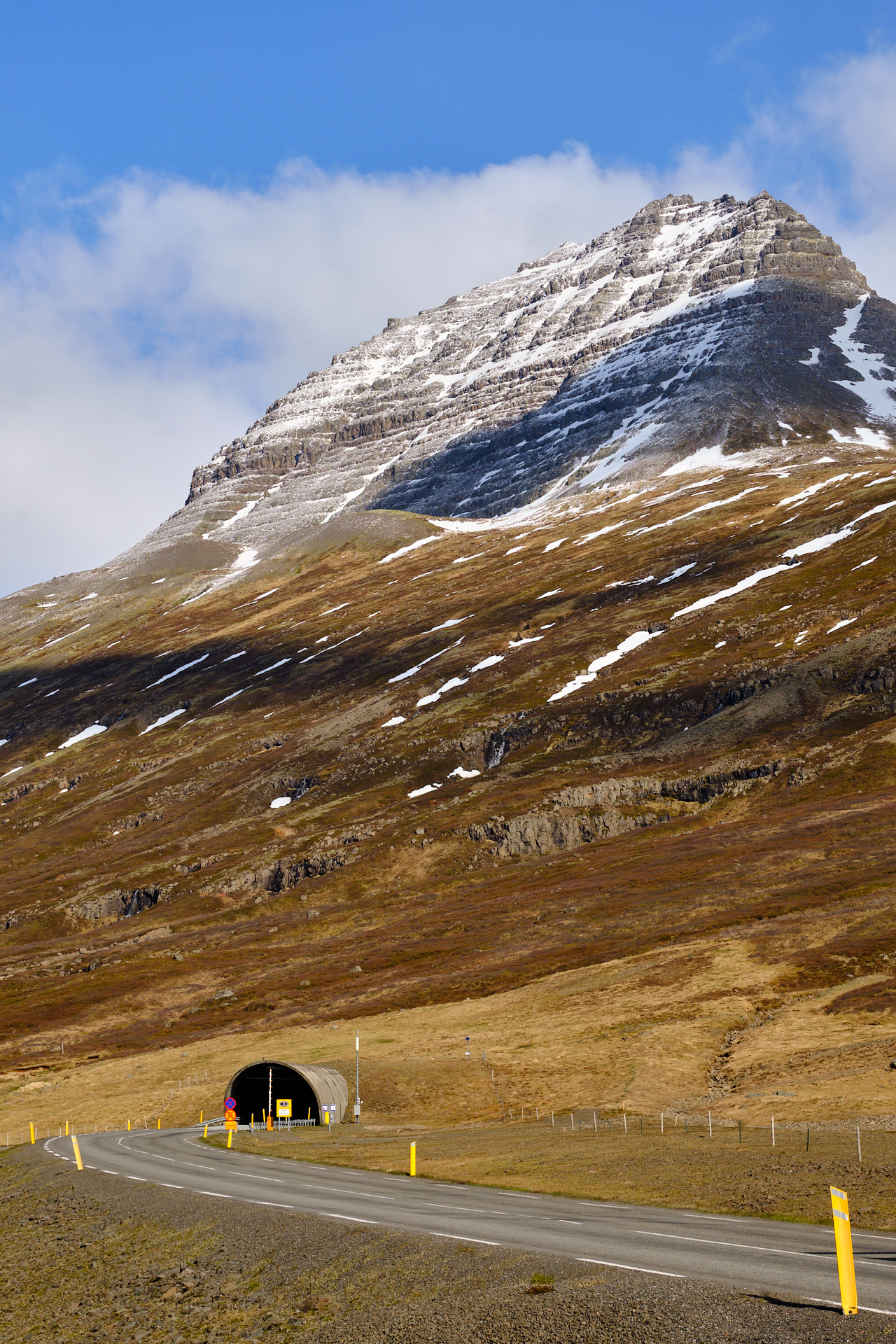
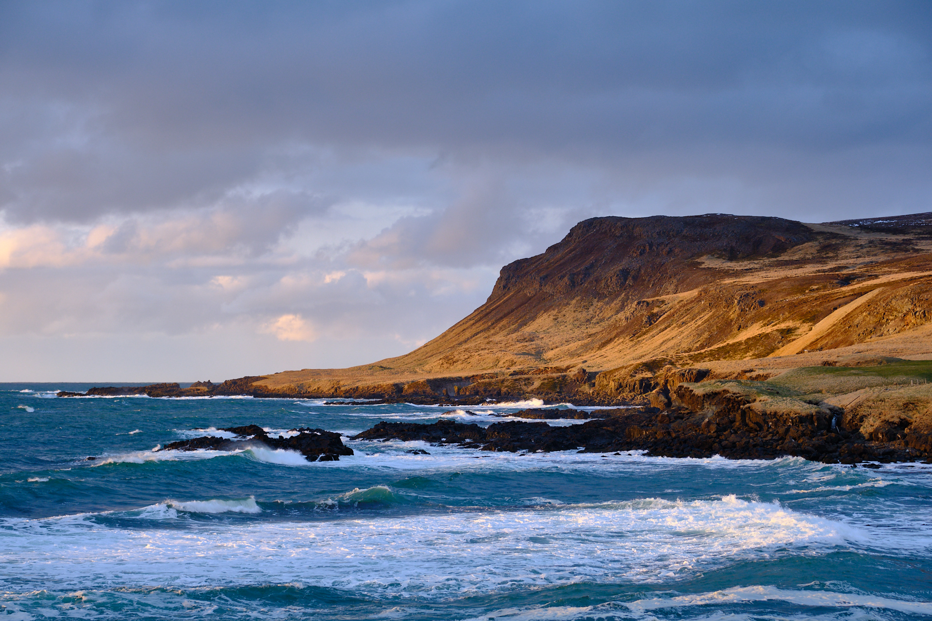
Hungry for not only a pastry, but pictures of snow topped mountains and blue skies, I stopped along the road at least twice even before reaching the tunnel that takes the ring road from Fáskrúðsfjörður towards Reyðarfjörður, under one of the towering ridges of the Eastjords.

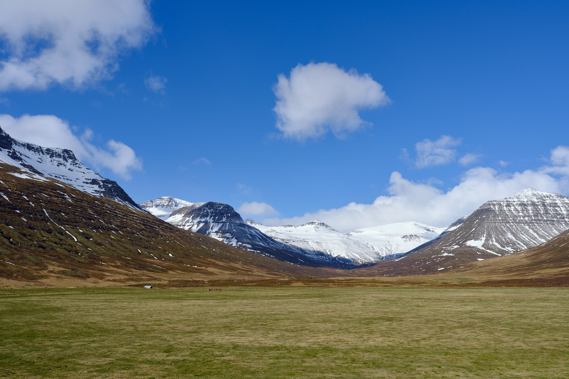
The only reason why we did not have to get up even earlier is that on a Saturday, the bakery (Sesam brauðhús) only opens at 9. We arrived not much later than that, so we still had to pick our orders from the loaded racks that were just being rolled out from the kitchen area. I cannot recommend this place enough, they had huge pastries, and everything we tasted was delicious. (While we were eating a snow shower passed outside). After breakfast we drove further North, climbing up a long, straight valley flanked by steep slopes, covered by a thin blanket of fresh snow. The road was most likely cleaned during the night (or the morning), but everything else around us was white, and the outside temperature displayed on our dashboard was just below zero.

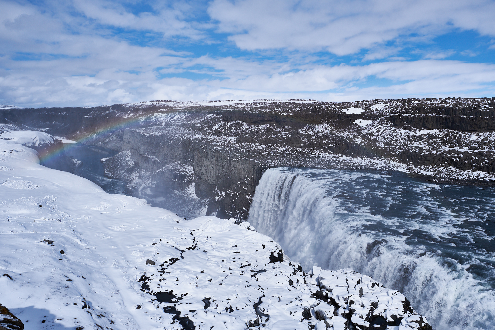
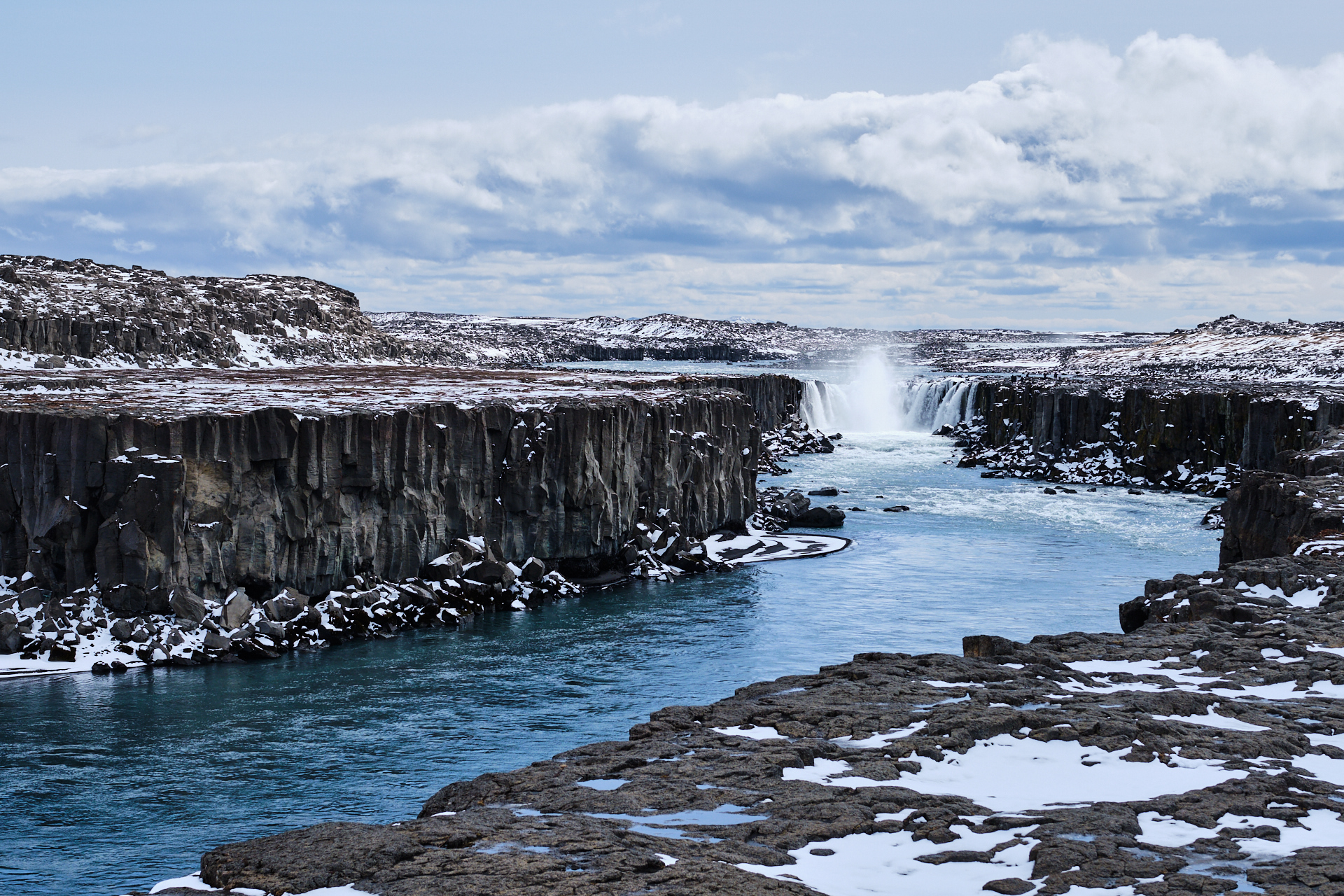
The snow melted in the sunshine as we got lower again, heading towards, and into the largest village (city?) of the region, Egilsstaðir. We drove through the city during the day several times, and during one of our passages we stopped at the Bonus to recharge our cookie and snack reserves, but I don’t remember when exactly :) Anyway, here we turned Southwest on road 95, soon (after passing a few reindeers – this time crossing the road at a safe distance from us) followed by route 931, that bends around the lake of Lagarfljót. Along the South coast of the lake is one of the only regions in Iceland with an actual forest. We originally planned to stop for a short walk at the camping of Atlavik, but driving through the relatively lush landscape was satisfying enough, so we kept going further. Not much longer though, because a few minutes later we arrived to the parking of the first main attraction of the day.

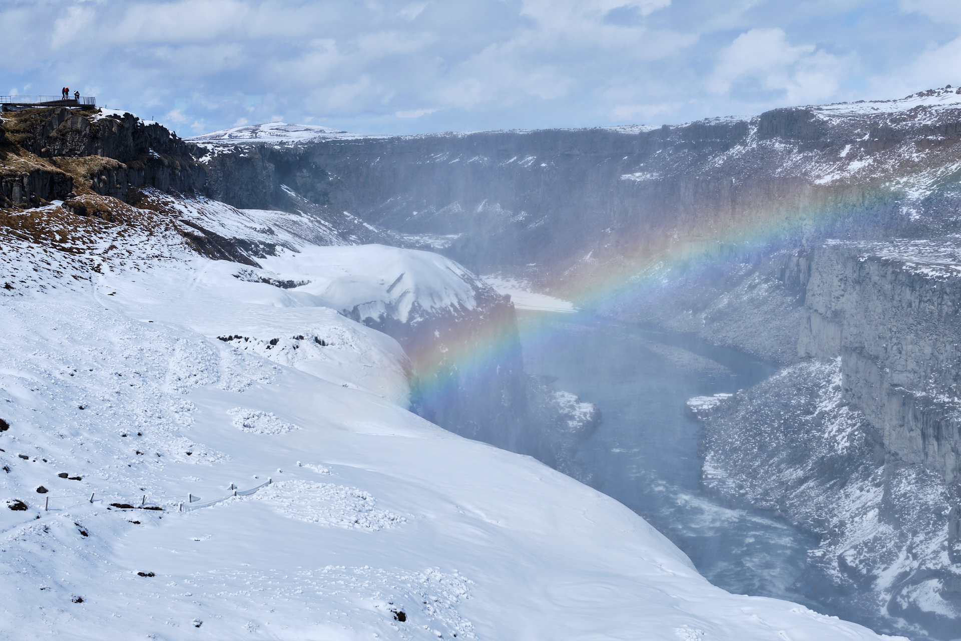
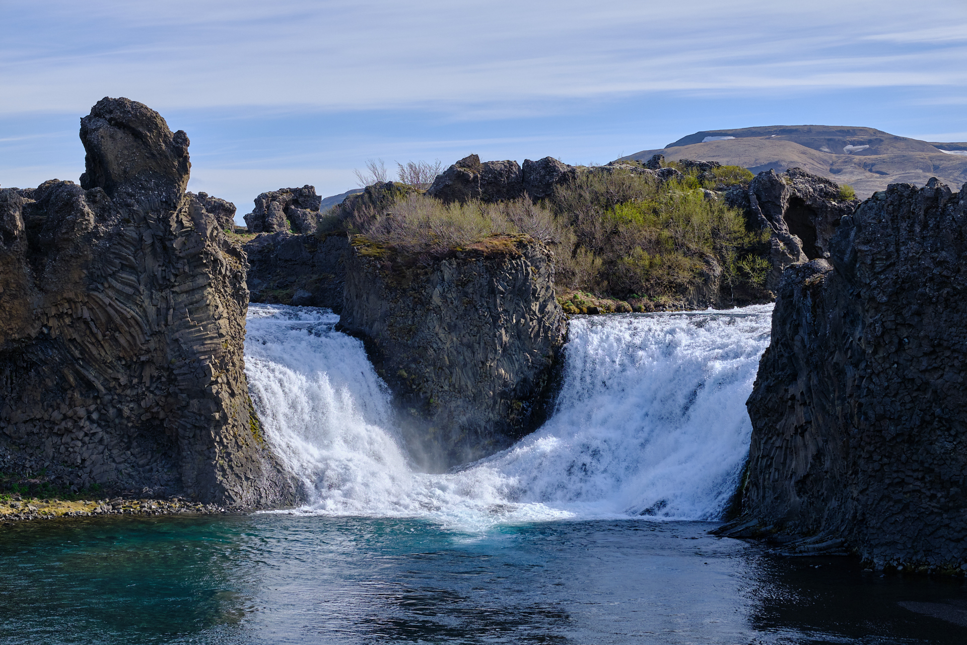
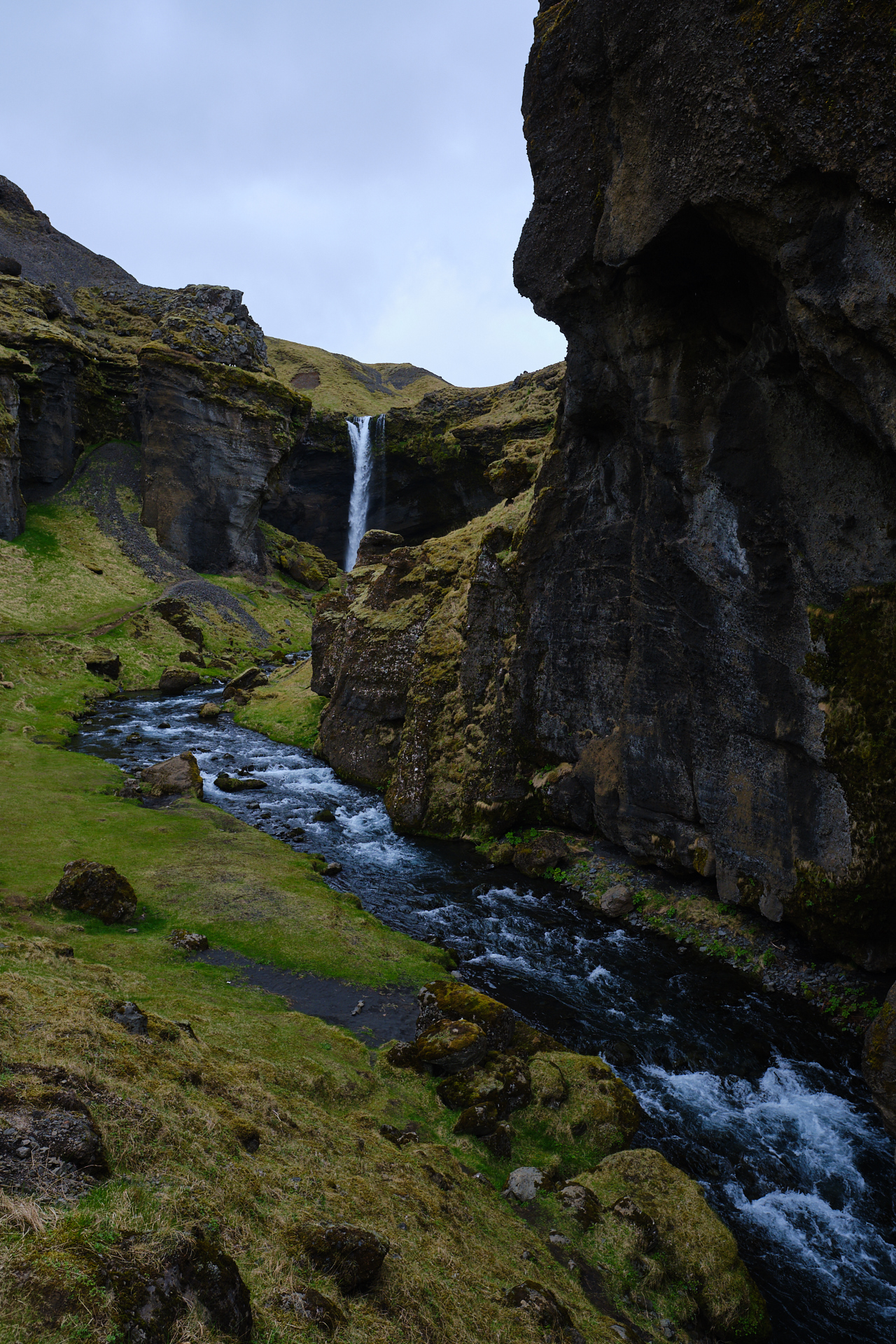
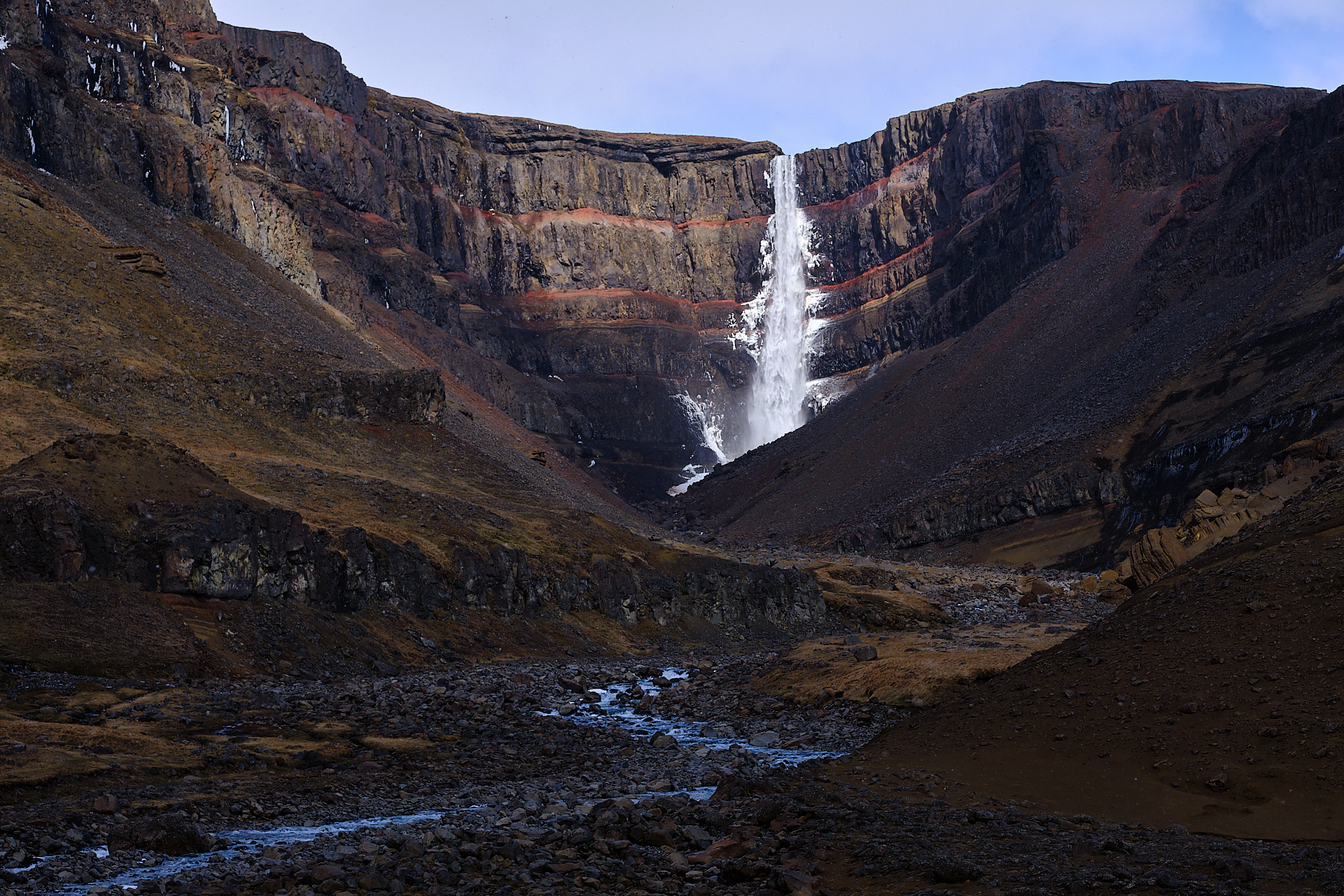
From the parking a well marked and maintained trail climbs to the Litlanesfoss and Hengifoss waterfalls, that are wedged in a narrow and steep canyon, cutting into the Northwestern flanks of the valley. This was a really nice hike, with magnificent views into and along the valley below us, and to the snow topped mountains on the opposite side. What made it even better was the numerous, dense snow showers that kept coming and going every five minutes, constantly changing the view, the lights, and the colours around us. Perfect conditions for a photographer!

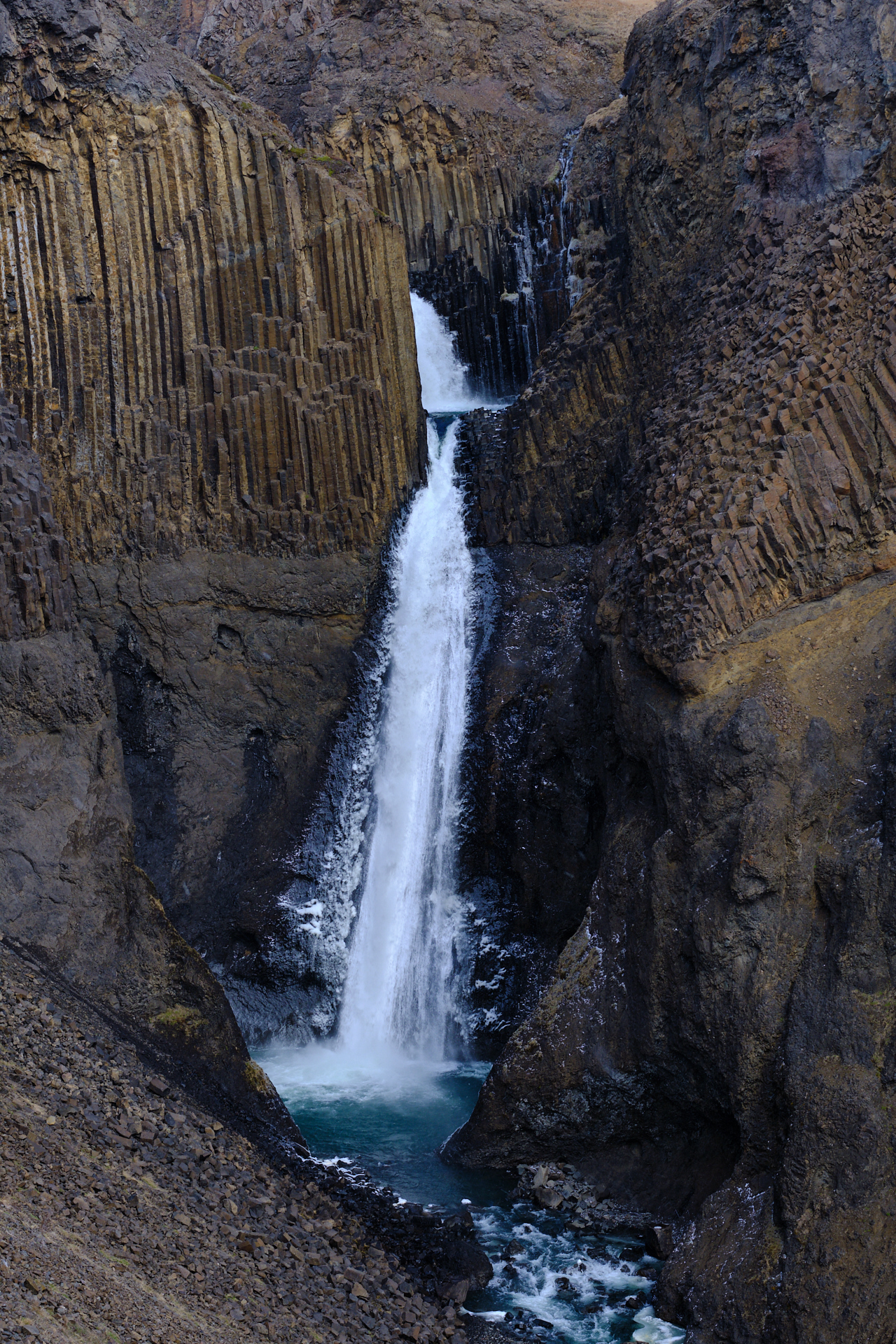
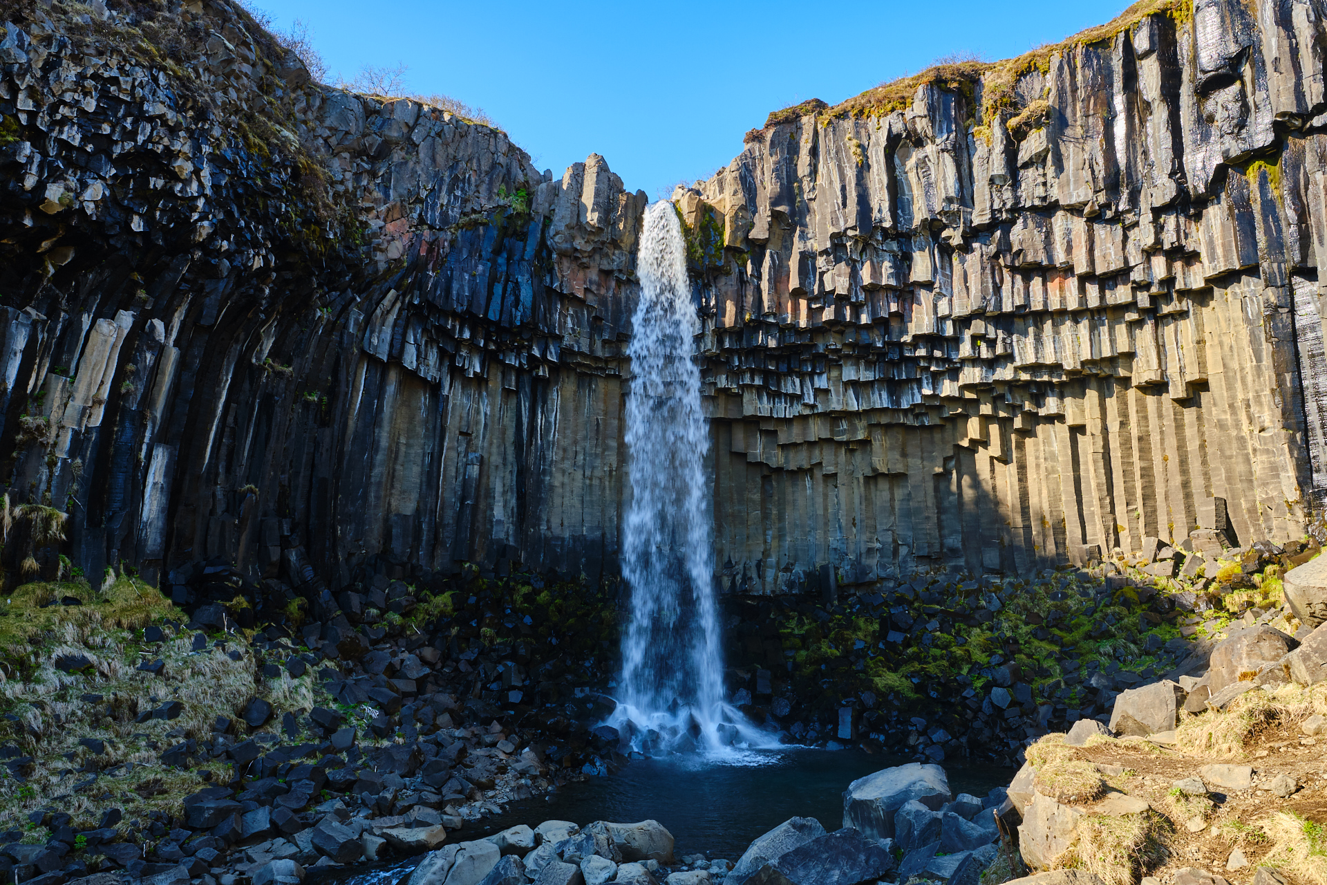
The Litlanesfoss is framed by beautiful, tall basalt columns, while the Hengifoss falls from the top of a wider rock face that consists of multiple horizontal layers of red, orange, and brown bedrock. At this time of the year the trail was only open until just 250 meters past the top of the Litlanesfoss, but from there there was already a very nice view to the second waterfall, so we did not mind turning back.

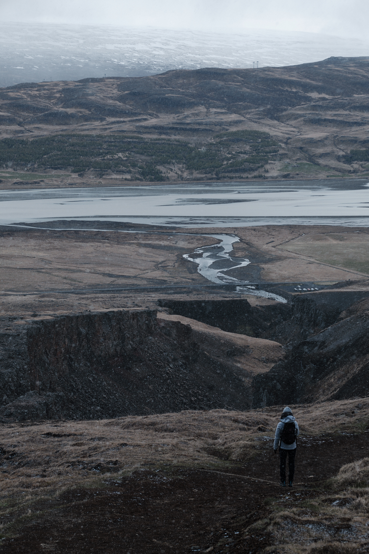
The walk down was even prettier (since we did not have to turn around to enjoy the views anymore), but I have the feeling (from the pressure on my arm) that Clio had enough of the snow showers by then (admittedly it was freezing, and wind was blowing snow in our face, but to me it was so cool), so I tried to not stop every 10 meters for another picture.

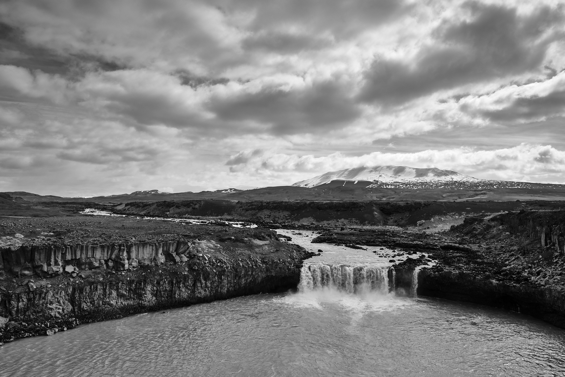
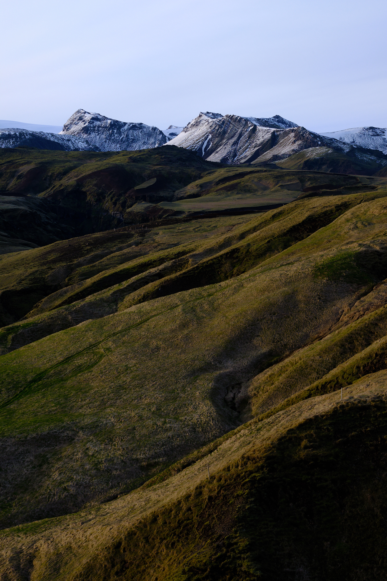
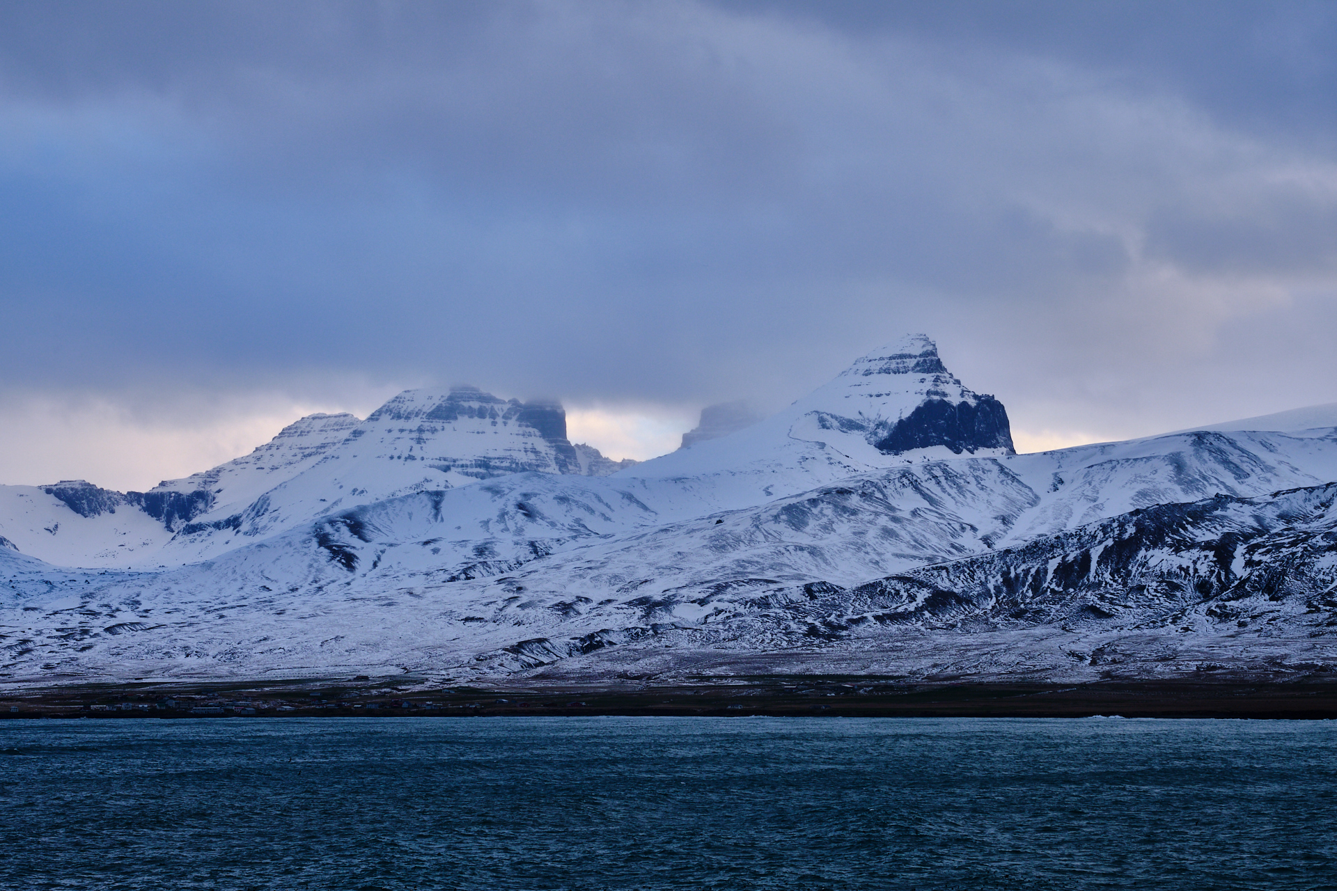
By the time we arrived back to the parking it was almost noon. From here we had to drive back to Egilsstaðir, but now we took the road over the Northern side of the lake. There were no forests here, but the yellow grass was glowing in the warm (looking) sunshine. A long section of the road was gravel here, and just as we were about to forget the problems with the tire pressure from the previous day, the indicator lamp lit up again on the dashboard. Since there was still quite some driving (and possibly snow and gravel) on the menu, we decided it was best to have a better look at the issue, so we drove to the local tire shop. Here they checked the pressure in no time and concluded that there was nothing wrong, and we should not worry about the indicator, it would likely still come on when driving on gravel. Feeling a bit relieved, we  could continue along the original plan, and drive to one of the small villages of the fjords. Given the weather conditions, we picked the asphalted road to Seydisfjordur, skipping the gravel pass towards Mjóifjörður. Still, even the surfaced road was not an easy drive, there was still quite some snow and ice around the top of the pass (just over 600 meters above sea level, in -4°C, with a windchill below -20°C). The drive down from the pass is occasionally very steep, but again the typical horizontal layering of the Eastfjords appears on both sides of the glacier carved valley, and we even pass another waterfall on our way.

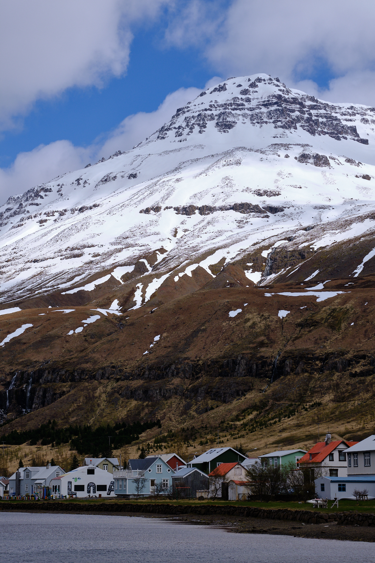
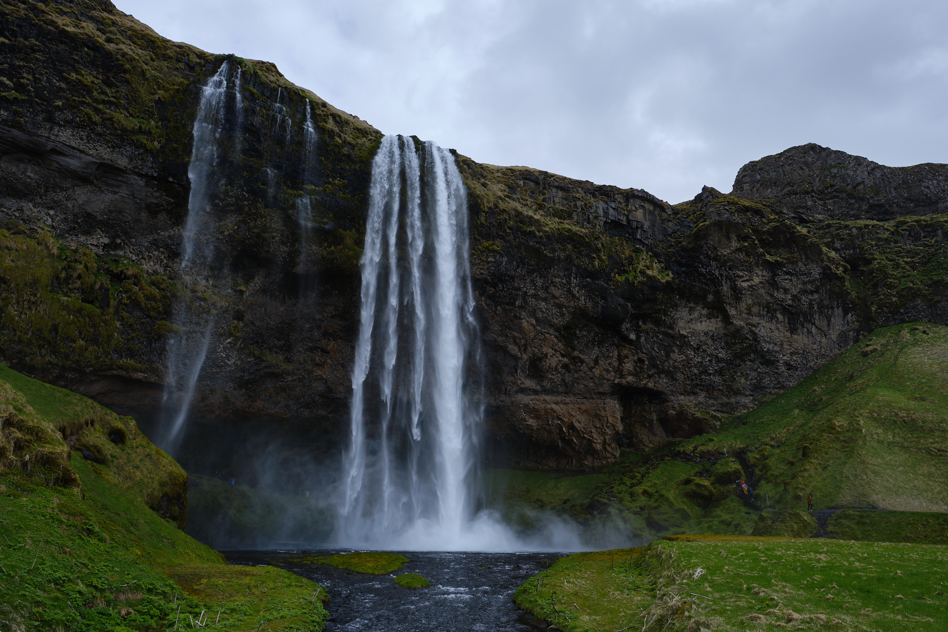
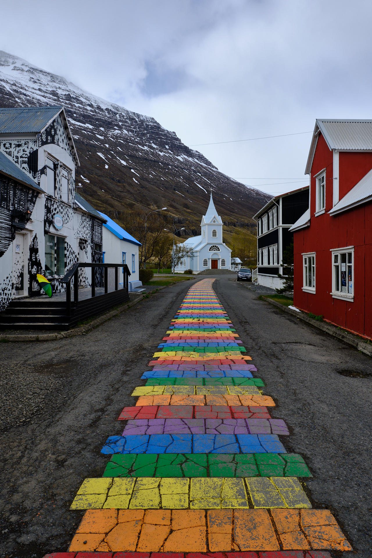
Seydisfjordur is a quite and cozy fishing village, but even here there are a few restaurants catering for the tourists that make it this far. (We also had lunch here, just a burger and a salad, nothing special.) There is a small church, some colourful houses, and an Instagram-famous rainbow-painted street all within a 100 meters. And of course there are the snowy mountains towering over the village on both sides.

It was almost three on the afternoon when we left the fjord, taking the one and only road back out of the valley. This time I decided to fight the elements and get out of the car on the top of the pass for a few pictures, but the windchill was horrible, so I did not spend a long time outside. The view was really nice (albeit very difficult to capture), as you could see the snow shovers passing over the landscape in the distance, leaving a white trail behind them.

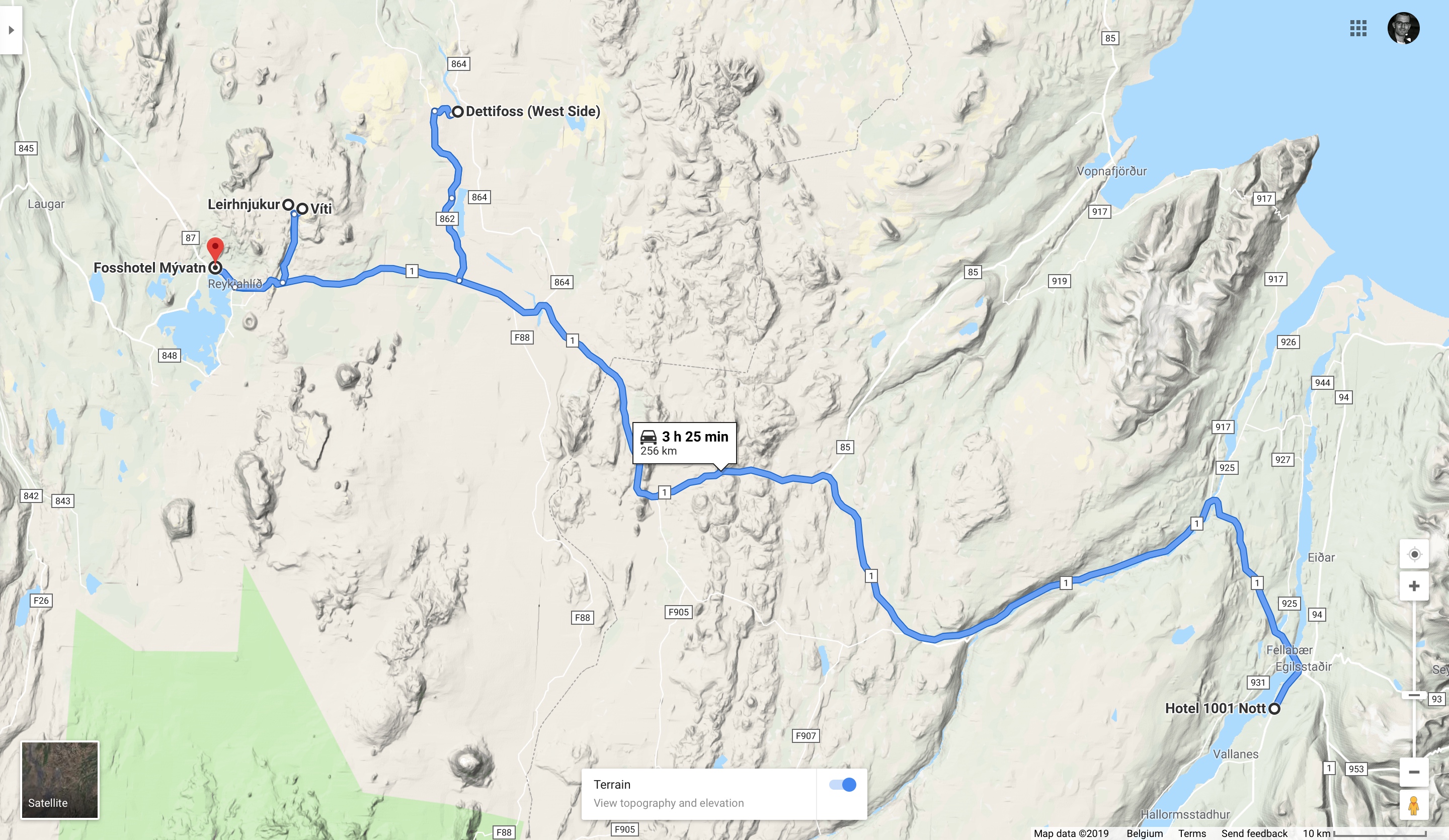
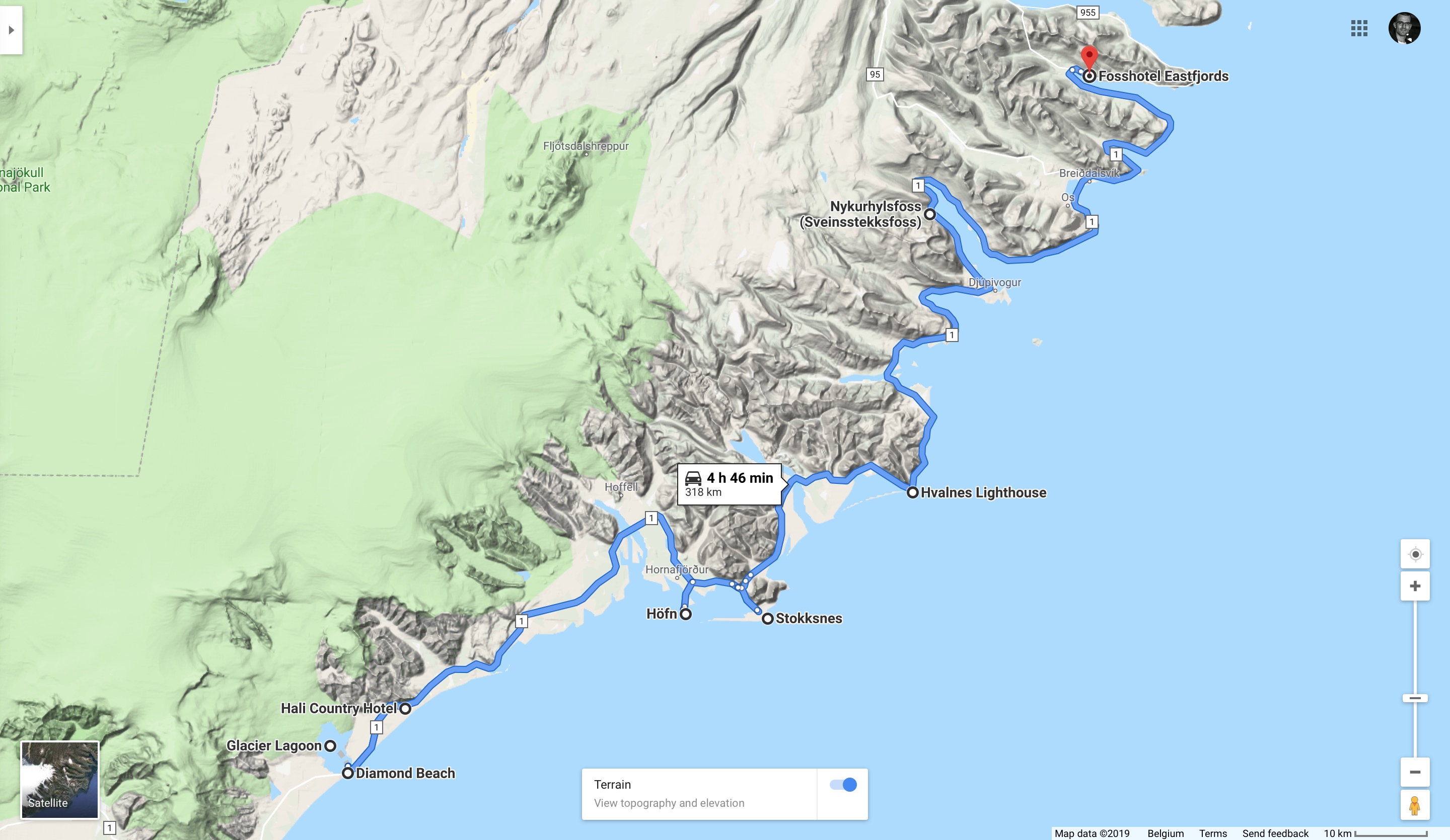
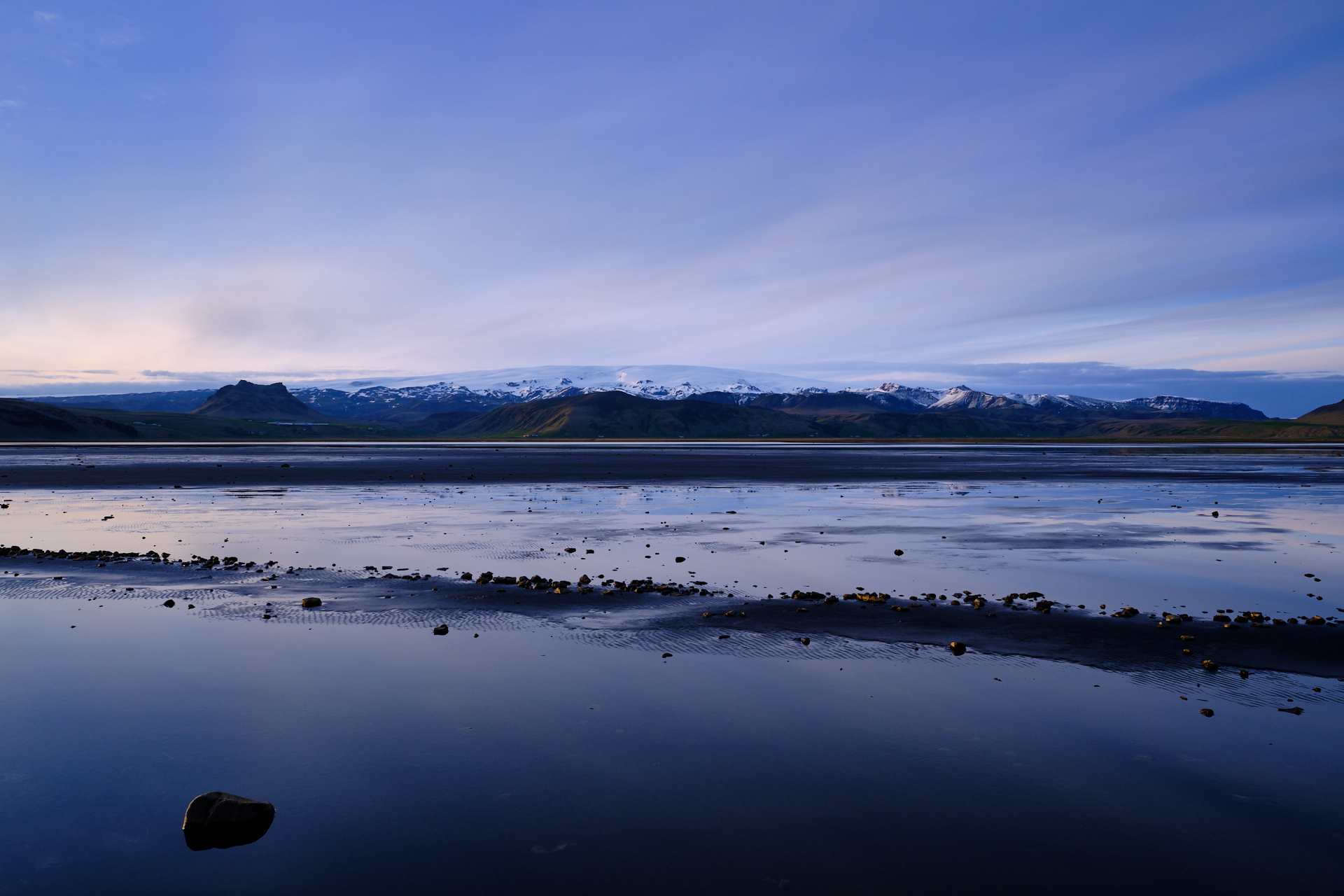
Next we drove to our hotel (Hotel 1001 Nott – the hotel of the 1001 nights) to check in and relax a bit. There was floor heating in our room, and a beautiful view to the lake, so we both found it just perfect. While Clio enjoyed a cup of hot coffee, I was planning the rest of the day by repeatedly checking the road conditions, the weather (current and the forecast), and the webcams online for the region of Borgarfjörður. Just beyond this village there is a small harbour where puffins nest (in large numbers), and I wanted to go there either on the evening, or the next morning. While the weather was looking better for the morning, I knew that there was a much better chance of us seeing puffins on the evening, because they usually leave their nests after sunrise and come back just before sunset, but sunrise was so early (already in May) that there was no way that we could catch them then. Also, there was no winter service planned for Sunday on the gravel pass of road 94, so had the conditions deteriorated during the coming night, there was no way we could have gotten there on the next morning… I was a bit concerned about the conditions on the gravel pass though, because the webcam showed that there was definitely some snow being blown across the road (even though it was just powder and the surface was well visible below), and the traffic those days was extremely low with around 100 vehicles per day, so no constant stream of cars to keep the road clean. Still, after some thinking and a short consultation with the personnel at the reception we decided to give it a go, with the option of turning back in case the conditions would not turn out to be safe.

As I wanted to be there between 20:00 and 21:00 (and not much later so we could still come back before it gets “completely dark”), we still had plenty of time, so we packed up all our warm clothes (I am pretty sure I had an extra layer of long underpants), then drove to Egilsstaðir for dinner first. I was really excited by the possibility of seeing puffins in the wild for the first time in my life, and I was also afraid at the same time that we might not make it there because of the same weather that made the landscape so photogenic during the rest of the day. It took me quite some effort to not finish my pizza (at the Salt Café & Bistro) in two seconds, but there was really no point in leaving too early.

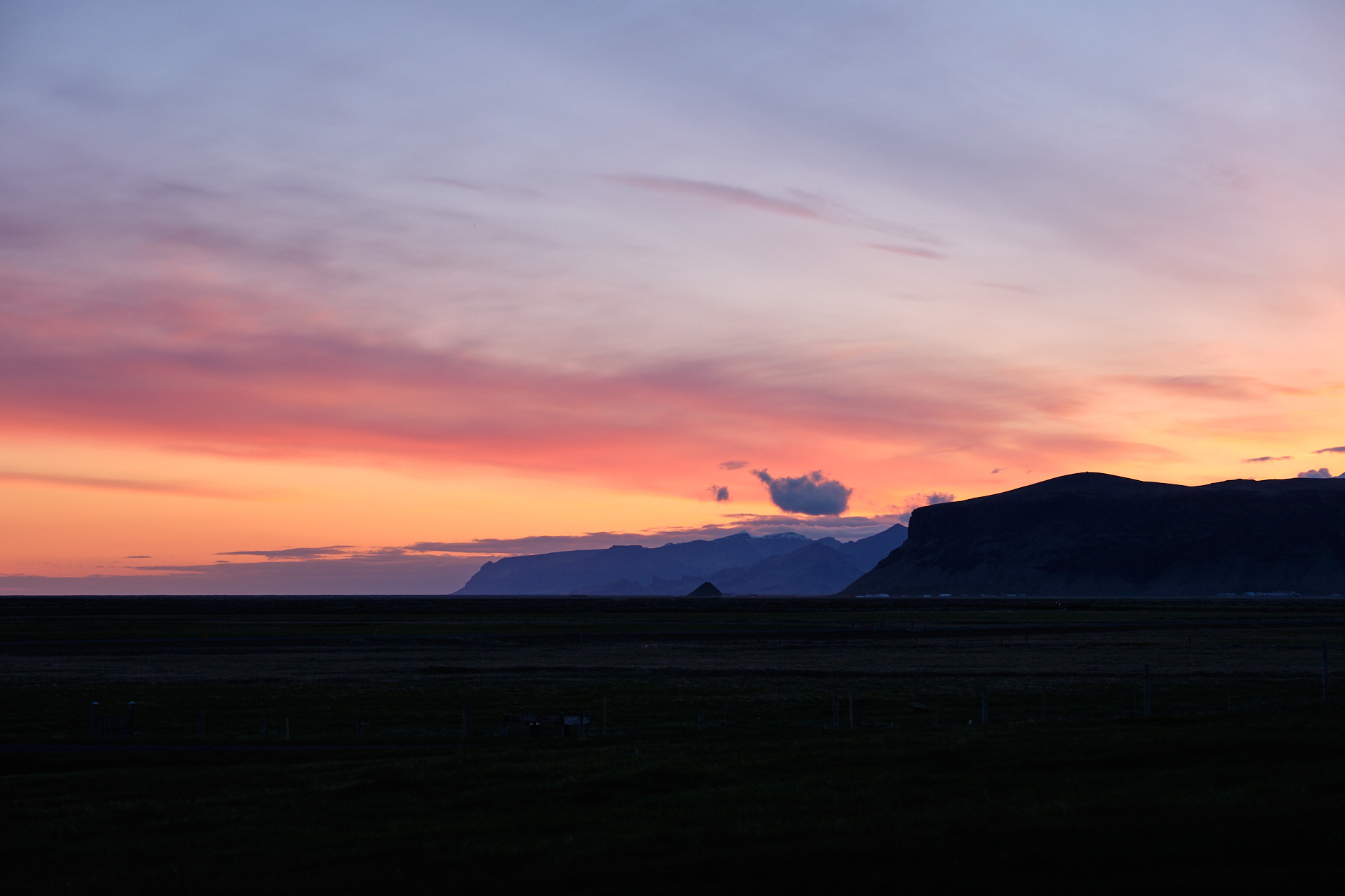
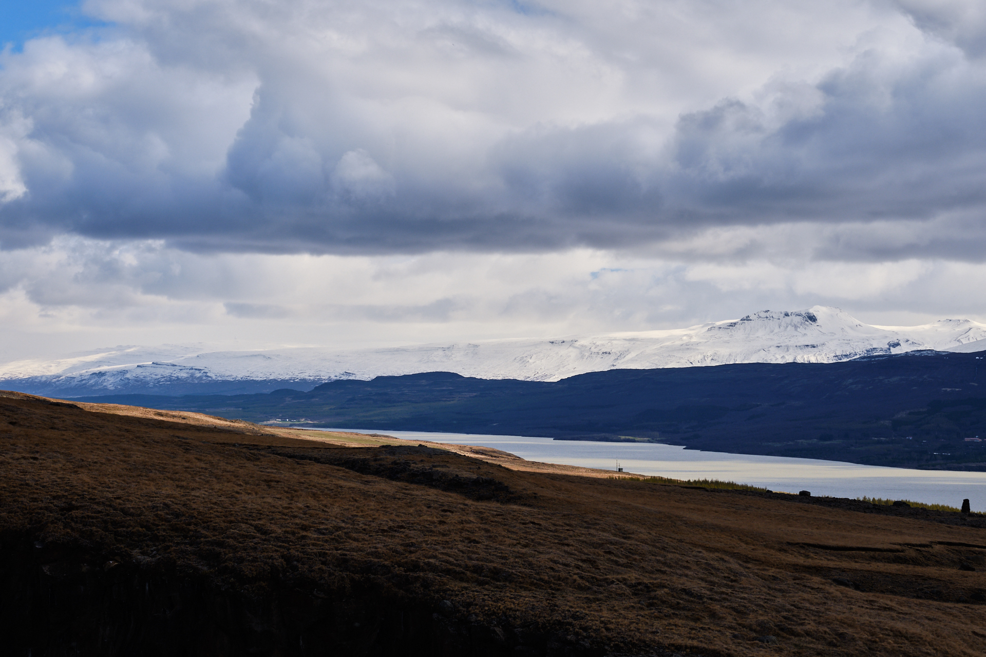
When we finally left the weather looked quite nice – while it was cold, the sky was mostly clear, with the low sun already turning orange, and there were only a few snow showers visible in the distance. We drove North on route 94 – asphalted in the first ten kilometres, but then turning gravel for the next twenty. The surface was still good, and the road mostly straight, so we could easily drive 60 km/h. To our left we had constant views to the Northern extension of the Lagarfljót (difficult to decide if it is a lake here or just a very wide outflow), with occasional snow shower curtains blocking the low-hanging sun behind it, while to the right we could see the snow covered mountain range standing between us and our destination. We did not really see anybody else around, there were only a few farms/guest houses along the road, and a small self-service booth (snacks and drinks from a vending machine). A few kilometres from the sea the gravel section ended and soon after the road turned sharply to the right, directly towards the mountains. I am really sad that I could not stop here somehow to take a picture, because the scenery in front of us was magnificent: the road was running straight at the mountains, cutting through the grassy marshlands that were glowing from the orange sunlight, in great contrast with the dark brown mountains, the snowy triangular peaks, and the deep purple sky above. Even though I don’t have a photograph, I will never forget that view.

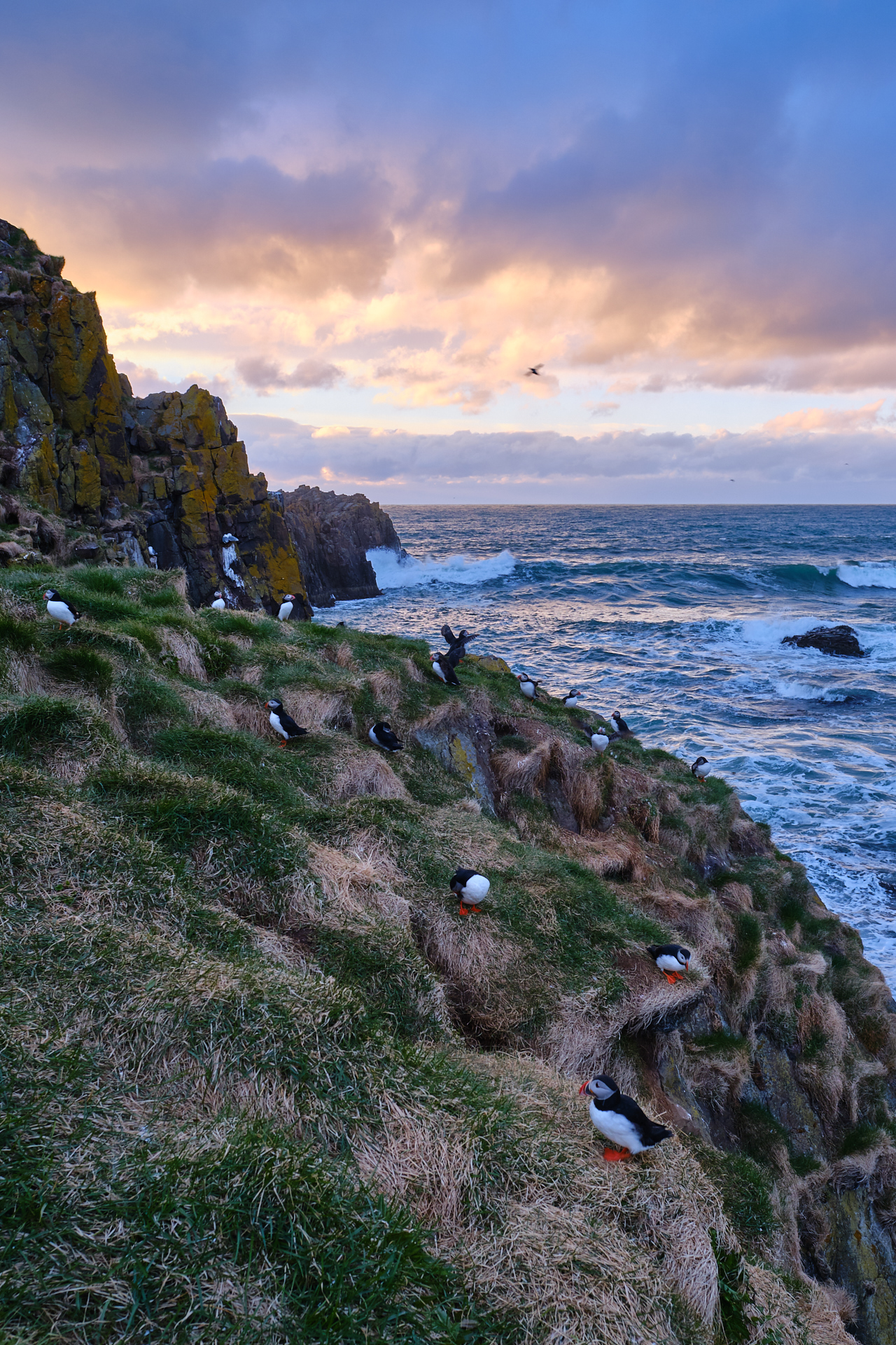
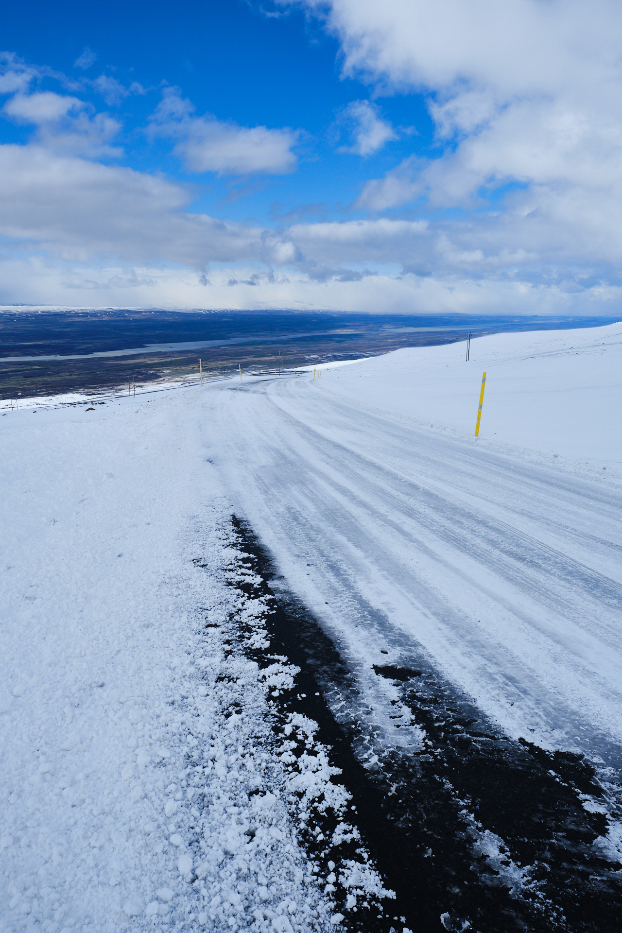
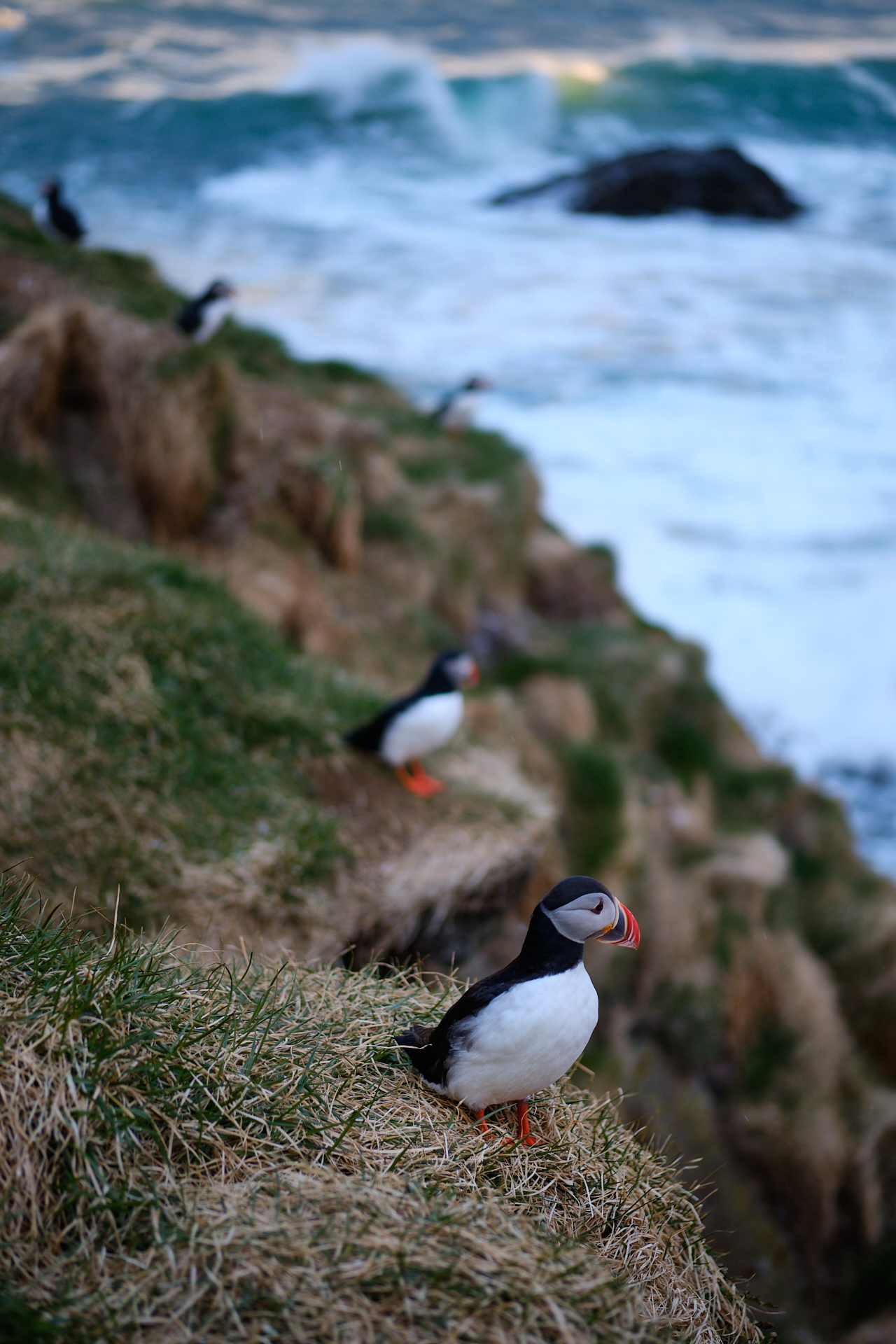
Then the gravel pass started. The road got pretty steep and quite narrow very quickly, so I was driving very carefully. Maybe after only 50 meters of climbing there was already snow around us, and the higher we went the more of it. Near the top of the pass – at around 400 metres above the sea level – powder snow was being blown across the road, and the wind was building small snow dunes across the surface, which was slightly worrying, but we kept driving (but without a 4×4 we would not have done so). The descent went easier than the climb, not only because gravity was on our side, but mainly because the visibility of the road was better. From the bottom of the descent there was still a long stretch of quite bad gravel to be done (scattered with large holes), but based on the encountered road works this section might get a layer of asphalt in the not so distant future. Then finally as the road turned into the wide valley of Borgarfjörður Eystri, and we were back on smooth, hard surface. The small port of the puffins (Borgarfjarðarhöfn) was another five kilometres further beyond the village. We arrived to the relatively new parking area overlooking the small harbour around just a bit after eight. The harbour itself connects the mainland with a tiny island (or a larger rock), and that is where the puffins nest. There is a short but steep path (with stairs) that leads up to a couple of view points, and even a small house with a row of windows for photographers to hide with their large tele objectives (from not only the puffins but the elements too). Even without puffins, the panorama from this spot was great.

But luckily, there were puffins too! At first only a few, and they kept their distance, but as the evening progressed, more and more of them flew back from the sea, and since the space was limited, they had to land closer and closer to us to get to their nests. I was extremely happy to finally see puffins in the wild, and at the end it was not at all difficult to take some nice pictures of them either (even without a huge lens). I think the closest ones were not further than 3-5 meters from us. In the meantime light snow started to fall again, and it was getting late (while we were still one hour from sunset, the sun itself was already only 4 degrees above the horizon to the Northwest), so a few minutes after nine we decided that it was time to leave.

The drive back through the pass was a bit more difficult compared to two hours earlier, as there were a few deeper snow-dunes across the road, but we always had at least two wheels on gravel, so at the end it was not too bad. The rest of the remaining drive was easy, and we arrived back to our hotel around 22:15-22:30, just after sunset. Clio immediately fell asleep, but I only followed around midnight, as I was still too pumped from all the amazing experiences of the day, and I also wanted to put some picture online first. It was really nice, sitting in front of our floor to ceiling windows, in the quiet, looking at the clear sky above the lake, as the post-sunset colours ran from yellow to indigo above the horizon. This was definitely my favourite day in Iceland.

Road trip Iceland: Day 6 (Further along the South coast towards the Eastfjords)

The easiest way to get behind your schedule on a road trip is thinking that you have plenty of time on a less busy day, and we did not want to make this mistake. While we did not have that many sights planned for the day, there was still a lot of driving to be done, so we did not spend too long in the warm, sunlit dining area of our hotel before hitting the road. The weather was pretty cold, but by this point we had gotten quite used to the Icelandic climate.

We started the day by driving back to the Glacier Lagoon and the Diamond Beach, to experience these places under different light conditions too. Due to the very early sunrise, by the time we set foot on the beach the lights were not really warm morning lights anymore, but it was still worth walking around one more time. I spent some time trying to get some original pictures, but it is very difficult on a location like this, especially after spending hours watching YouTube videos about photography on Iceland…

Thanks to Clio’s eagle eyes, we even spotted two smaller whales (besides the much easier, nearby seals), slowly swimming by the coast around a hundred meters off shore, coming up to the surface from time to time for a sip of fresh air. We finished our visit here by driving five hundred metres further back on the main road to stop at a parking spot along the Southern shores of the lagoon, where after a few minutes of walking we could get a nice panorama over the whole area from a bit higher than at other places. (We still spent almost 1.5 hours here in total.)

From here we continued our journey towards the East. The ring road cuts through grass covered flatlands (still shades of brown and yellow at this time of the year), but there are constant views to the never ending series of glaciers and mountain ridges to the left. At one point we have to cross the complex branch-structures of a meltwater river, over a long single lane bridge (looking quite worn). These outwash plains are quite frequently seen here to the South, we also had to cross several others the day before. After the bridge the road turned South towards Höfn, where we were planning on getting something for lunch. Unluckily just when we arrived to the harbour and stepped into the diner of Hafnarbuðin, a large group of school children flooded the place and started ordering food before we could do so… I was way too hungry to wait and also did not really want to listen to loud children the whole time, so we decided to just go and grab something at the N1 petrol station. Over there is was quiet and – as usual – they had a really nice hot dog for me and some fish and chips for Clio.

Our next stop for the day was the Stokksnes, only a short drive further along the ring road. It is a small headland stretching Southeast from the feet of the scenic Vestrahorn mountains, wedged between black sand beaches, and covered with small grass-topped sand dunes. You have to pay to enter the area – probably due to it becoming one of the most well known photo-spots of the island -, but it is definitely a nice place to walk around a bit. Unluckily the wether turned a bit grey after the sunny morning hours, but I still enjoyed playing around with my photo equipment, trying to find a scenic spot between the larger than expected wind-blown dunes.

Another hour (and another single-lane river-bed passage) later we had a short stop at the Hvalnes Lighthouse, but it was so cold and windy here, that it was really just a hop out of the car. At this point the road turns more towards the North-Northeast, and the glaciers and glacial outflows are replaced by deeper and deeper fjords of the Eastfjords. Reaching the almost 20 km long Berufjörður the mountains start to display those typical, nearly horizontal rock layers that are mostly known from images of the Faroe Islands. There is still quite some snow on the top of the ridges, which helps pronouncing these formations even better. After almost running over a few reindeers who though that chilling out in the middle of the road just after a sharp curve was the best idea we made a small detour to the Nykurhylsfoss, but after all the amazing waterfalls of the previous days we did not find this one particularly impressive. I personally found the view itself from the tiny parking spot to the mountains over the other side of the fjord much nicer, especially since the sun came out again for a few minutes.

The views along the road were really beautiful (if you like barren mountains like I do), but we only stopped for food after here, because we were getting a bit behind our schedule. In any case the food itself deserves special mention. We had a burger in a tiny place just outside Breiðdalshreppur, the Hamar, Hótel – Kaffihús. We were the only ones there, and they served us the best burger we had in a very long time (and some good and desperately needed coffee). It was perfect, moist, had a well flavoured sauce, and the fries and onion rings were also delicious. I really do not write reviews often, but here I really wanted to (and did).

Our hotel was only one and a half fjords further, but we still had to deal with a bit of a scare on the way there thanks to the tire pressure warning light turning on, but we did not see or feel anything wrong with the tires, so at the end we just drove on. (Later on it turned out that driving on gravel, and/combined with stronger accelerations can also make these sensors think that something is not OK, but until we realised this it was quite annoying to think about. But having such simple sensors on a 4×4 is a bit stupid, isn’t it!?!)

At the end it was almost half past seven when we arrived to the Fosshotel Eastfjords in Fáskrúðsfjörður, and just as we checked in (after still taking a few reference pictures of the tires just to be sure) a dense snow shower descended down the fjord from the Northwest. I still went outside to the wooden pier of the hotel take a few pictures, but my hands were getting frozen in the cold wind pretty quickly, so it was not a long expedition. Luckily I had not too many pictures to put online that day, and I could go to sleep in time (knowing that the next day would likely be very long with much many more sights to cover).

Road trip Iceland: Day 5 (The Southern Vatnajökull National Park)

This was finally going to be a good (or easy) day for photography, with clean air, sunshine, and beautiful vistas. We also did not really have to hurry with our breakfast, since the originally planned drive to the camping and hiking site of Þakgil (hidden in a nice canyon at the end of a gravel road) was not yet doable even with a 4WD (for current road conditions, always check the website of the Icelandic road network).

We left our lodge around 9 and drove immediately up to the Dyrhólaey rocks. The last few hundred meters of the ‘road’ climbs over a steep and narrow series of gravel switchbacks before reaching the small parking on the top. I though this section was super fun, Clio was less enthusiastic about it :D The view from the top of the rocks was very nice; standing over the edge of the cliffs and looking over the black sand beaches towards the West below really gave the feeling of flying over the landscape.

To the North we could see tall, ice covered mountain tops, and to the South – after a short walk past the lighthouse with a small red lantern room  – a massive stone arch bending over the sea. We also stopped at the other parking over the Eastern side of this small peninsula, which gave a better view towards the black sand beaches and rock pillars towards Vík.

This was also the Southernmost point of our road trip. From here we drove to the church of Vík (over the same – still pretty – pass that we had already taken twice the previous day), which by itself is not so special, but it provides another nice lookout point over the region. The next bigger stop on our list was the Fjaðrárgljúfur Canyon, so we had a longer drive in front of us. On the way there we stopped at a place where you could walk around a bit in a huge field of green (moss covered) lava.

Unluckily the road leading to the canyon (and the canyon itself) was not accessible, and not only because of thawing, but also because the canyon became so popular in the past years (partly due to a music video clip being shot there by Justin Bieber…) that the Environmental Agency of Iceland has decided to close it to allow the trails and vegetation to recover a bit. I was pretty sad (maybe even devastated) about this, because I was really looking forward to taking some nice pictures here. Luckily I was prepared and had some backup sights just in case, so this meant no real disturbance for our schedule. (Not that a bit of extra time to chill and relax would not have been welcome :D)

Just a small drive further we stopped at Kirkjugólf, the “church floor”, where the typical hexagonal basalt pattern forms a flat floor surface that you can walk over. It is such a hidden sight, but I really liked how special it was. Then just a bit further from the ring road we also visited the Stjórnarfoss waterfall.

The drive further towards the Vatnajökull National Park was very scenic, we passed by and stopped at various waterfalls (thin and tall, or wide and long) and river beds cutting through the ever changing colourful landscape.

Then just before reaching the National Park, as the views suddenly open up towards the steep, glacier-carved mountains, it is impossible to not stop for a short break, trying to take in the panorama. There is actually a nice designated view-and-information-point (Skeiðará Bridge Monument) just a bit further down the road from where I stopped. As the weather was super nice (and I definitely wanted to take pictures in those exact conditions at the glacier), I decided to first drive to the Svinafellsjokulsvegur. (Normally if you just follow the ring road you encounter the two following locations in the other way around.) The little bit longer than a kilometre long gravel road leading almost to the very end of the glacier was the worst road we have taken on Iceland; it was very broad, but irregularly scattered with deep potholes almost along the full length (and width) of it.

It was not an issue for our car, but I had to drive very slow and carefully find a way around the deepest obstacles. From the parking it is not more than a five minute walk along a narrow trail to reach a few nice panorama points. The cracks and crevasses give the ice-flow its characteristic look, wedged between the tall, snow-capped mountains, and the brown meltwater below.

From here – after carefully making it back across the gravel “superhighway” – it was not more than a few minutes to make it to the parking of the Svartifoss. To reach the waterfall itself we had to make a small hike, following a 2.1 km long trail (and then the same back) and climbing almost 200 metres along the way. The route itself was also very nice, with great views to both the taller peaks to the right, and towards the flat, wide riverbeds over our shoulders in the opposite direction. The waterfall itself is not especially tall or wide, but its water flows from the top of a wall of textbook basalt columns. It is definitely worth the hike.

By the time we arrived back to the car it was already around half past five, and according to the original plan our next destination would have already been our hotel for the night, but the weather was so beautiful that we decided to still sop by the Jökulsárlón Glacier Lagoon and the Diamond Beach (even though we were also getting quite hungry since – for the first time – we only had snacks and no real food during the day). The Glacier Lagoon had a real arctic feeling to it, everything was blue or white, there were seals swimming between the icebergs, and the low sun gave no warmth at all. This was really one of the most magical places on Iceland.

As crystal clear meltwater and icebergs flow out via a narrow channel (under the small suspension bridge of the ring road) from the lagoon (looks like a lake, I would call it a lake) to the sea, waves and currents distribute varying amounts and sizes of ice over the black beaches, creating what is known as the Diamond Beach. Much of the (relatively) smaller (but still easily dog-sized) pieces of ice lying (and very slowly melting – especially in the 3°C we had there) on the shore are completely clear and transparent, which makes them shine like diamonds in most lighting conditions.

I knew I wanted to come back here around sunset, so I did not spend much time taking pictures here, instead we drove to the Hali Country Hotel to check in and have dinner in their restaurant.  The views along these few kilometres were amazing: we just entered the early minutes of the golden hour(s), driving along a straight section of the road surrounded by bright yellow grass fields scattered by mirrors of small lakes, head-on towards the mountains that were just barely lit from the side (therefore creating high contrast regions between rock faces in sunlight and their dark shadows), under a sky that was somewhere between deep blue and purple with a few well defined clouds here and there above the ridges… I was (and still am) so sad that there was no place to stop safely anywhere to take a picture. After dinner Clio stayed at the hotel (and went to sleep at one point), and I drove back to the lagoon and the beach with all my warm clothing and photography equipment.

I headed to the lagoon first to watch the sunset over the glacier in the distance (this was around 21:15). There was a huge amount of birds flying over the icebergs, and they made quite some noise! When the sun dipped below the mountains I drove over to the beach and also took my tripod and filters with me to scout for a good location amongst all the ice.

I wanted to make a long exposure image composing a stationary transparent piece of ice within curtains created by waves coming ashore, but actually executing this was not an easy task. First, I had to find a suitable piece of ice: nice and clear, at a good location (that other ice bergs create a pleasant composition with it), not too far from the sea (so the waves can still reach it), but also not too close (so I don’t get drenched in freezing water and the tripod is not washed away in the process). This was the most difficult part. Every time I thought I found a good spot, either the waves did not come far enough, or I had to run away (picking up the tripod in the process) to stay dry. At the end I still had some water over my shoes, but luckily my boots survived those few shallow waves without letting anything through. Even though I was not yet 100% satisfied, at 22:10 I decided that it was getting way too late so I had to stop.

I still had a quick look on the other side at the lagoon before heading back, but there was not much to photograph anymore. It was 22:40 by the time I started driving back to the hotel, and dark enough that using my floodlights did not seem excessive anymore. I even saw a reindeer along the road. It did not take long to fall asleep that night.

And a quick reminder that on Flickr there are more photos in my Iceland album ;)

Road trip Iceland: Day 4 (Waterfalls towards the South)

The breakfast at the Lambastadir Guesthouse was simple but delicious. The morning was sunny but cold, with temperatures just above freezing, and there was still some dew on the grass from the rain that fell during the night. We started the day by driving off the ring road towards the Northeast, in search of waterfalls in a deserted landscape.

We reached our first stop, the Hjalparfoss after a good 45 minute drive (including a short bumpy gravel road that took us to the parking itself). There was a strong cold wind blowing outside, but the waterfall was quite pretty, coming down in two branches framed by typical twisting basalt columns.

In better weather this might be a good place for a picnic (the river under the waterfall broadens immediately into a calm, almost beach-like body of water), but for us it was time to get back into the car and drive further before my hands would freeze to my camera. Our next stop would have been the Haifoss, but to my (large) disappointment (and Clio’s slight relief), the 7.5 km long bumpy gravel road (332) leading up to it was closed due to unstable (thawing) conditions. It is a pity because this would have been definitely one of the nicest waterfalls, but on the other hand we got quite some unexpected extra time for the rest of the day, so I could spend a bit more time taking pictures at the remaining locations.

From here we had to still drive a bit further inland to cross the big river (that we have been following upstream before), then turn back Southwest onto a long gravel road (26 – see photo above of our car on the side of it). This straight and (at least then) pretty deserted stretch led us across a large lava field providing perfect views towards the snowy volcano of Hekla, and the occasional dust devils that appeared and disappeared along the “road”. The road turns back to smooth asphalt upon reaching the Búrfell mountain (to the right), and soon after there are (at least) two more waterfalls to visit. The first one is the Tröllkonuhlaup which is just a bit off the main road (but you need to look at the satellite imagery of Google Maps to be able to find the unmarked gravel trail leading to it), but when we were there it was almost completely dried out, so we did not stay there for long.

To reach the second one (Þjófafoss) you need to make a slightly larger detour from the main road, but this gravel road is well marked. This is again a quite impressive waterfall, with nice views down to the bend of the river (bordered by plenty of tall basalt columns), and to the Búrfell and Hekla above. I used my graduated ND filter here to get a few nice pictures.

From here it was a longer (more than an hour) drive first back to the ring road, and then further onwards to the East. For lunch we just stopped at a petrol station (N1 in Hvolsvöllur) for some fish and chips (these were always a good option). Then around half past two we arrived to the waterfalls of Seljalandsfoss and Gljúfrabúi amidst some intermittent snow showers. (Here you have to pay for parking at one of the machines.)

These are two very different waterfalls, the Seljalandsfoss is out in the open, and you can even walk behind it (get ready to be at least a bit wet though), while the Gljúfrabúi is a small walk further away, half hidden inside a small canyon. You can also walk close to the falling water here, but getting drenched is totally inevitable.

Less then a half hour (and some good views to the snow covered Eyjafjallajökull volcano) further is Iceland’s most photographed waterfall, the Skógafoss. Its wide water curtain is unquestionably an impressive sight, but if you want to take a picture without tourists, be prepared to wait for a while even in the pre-season… There are also a lot of birds (seagulls) nesting on the cliffs around the waterfall. You can also walk up and have a look from above, but we skipped that and did something more off the beaten path instead.

So there is another more hidden waterfall just around the corner, the Kvernufoss. To get here it is the easiest to drive to the parking of the Skogar Museum, and then follow the walking path to the East. In less then one kilometre you will be at the end of a deep green valley, facing a tall, narrow waterfall. You can also get behind this one (although we did not). It is a very nice walk, with likely nobody else around (we met one other couple on the trail).

From here we had only a short drive left (with nice views to the mountains and wide river beds to the left) to reach our accommodation for the night, the Farmhouse Lodge, but we were not yet done for the day. After checking in we got back to the car and drove to Vik (over a small but very picturesque pass) to have dinner in The Soup Company (not only good soups, but great cakes too).

Then we drove back over the pass (see view above) to Reynisfjara beach, which is famous for its basalt columns (definitely the most photographed ones in Iceland) and black sand/pebbles. It was a bit too busy here to get the picture I originally wanted (as some guys were chilling on the basalt columns with their beers…), but it was very nice nevertheless.

Finally we wanted to close the day by driving to the Dyrhólaey rocks, but unluckily you can not do that after 19:00 at this time of the year because the area is closed to protect the nesting birds. Still, we got to enjoy some nice views from the beginning of the small peninsula before driving back to our Lodge.

The sunset was very pretty behind the mountains, and the forecast for the next day was nothing short of (ok, except for maybe a few degrees Celsius for Clio) perfect weather…