Stage 4: 124.7 km | 2611 m+
The morning of the fourth day (7th of June, Tuesday) started grey and misty, but I quickly calmed Willem’s nerves by showing him the satellite picture and explaining that what we see is just local low-level fog, which would dissolve by the time we leave after breakfast. There were a lot of athletes staying in our hotel preparing for the canoe slalom world cup that was held on the following weekend, so while we were carrying our bikes down they were tackling the same narrow turns through the staircase (or the elevator) with their paddles. This was the first time that we had breakfast in the hotel, but we would stick to that from then on, simply because it took less effort than looking for food on the morning.
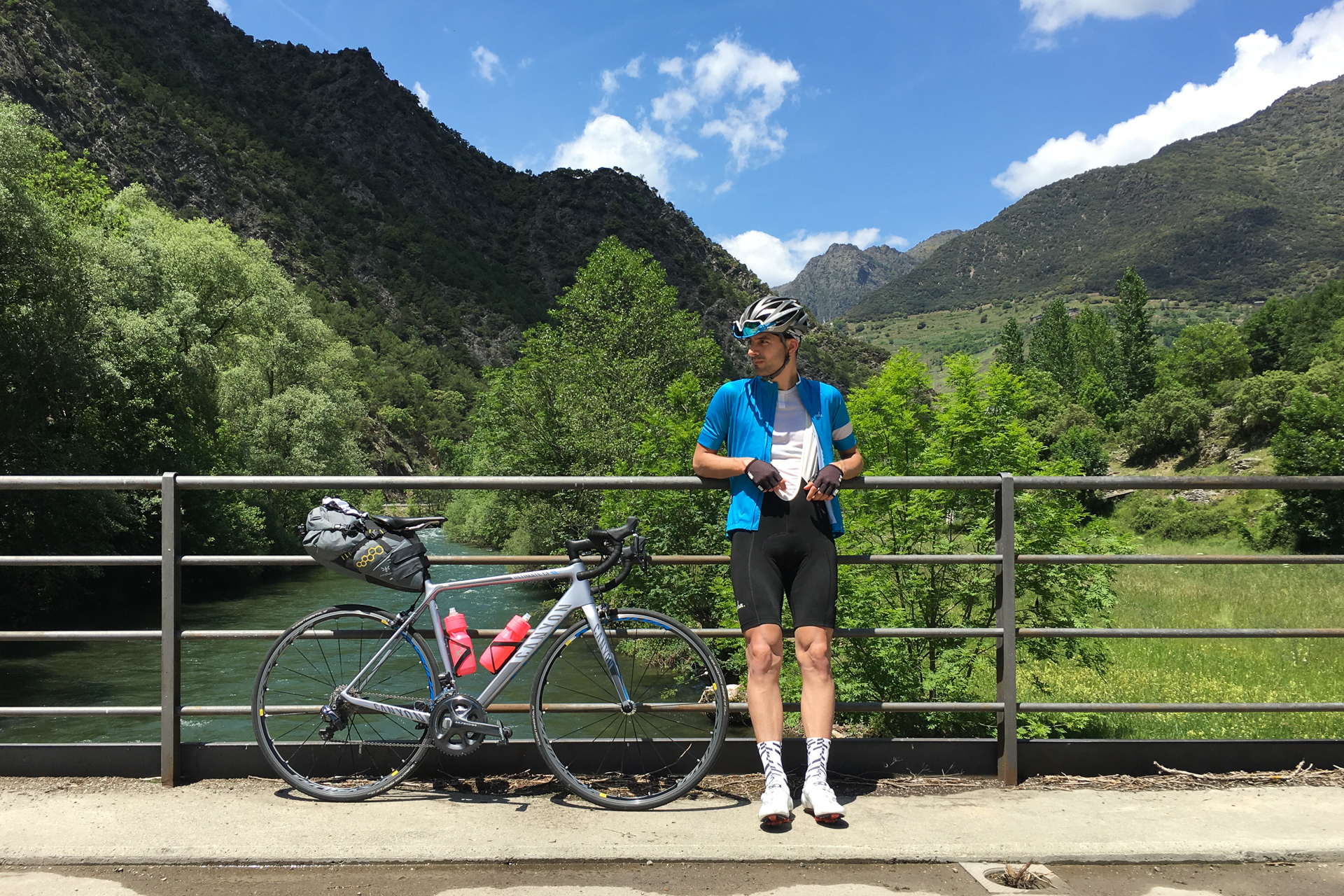
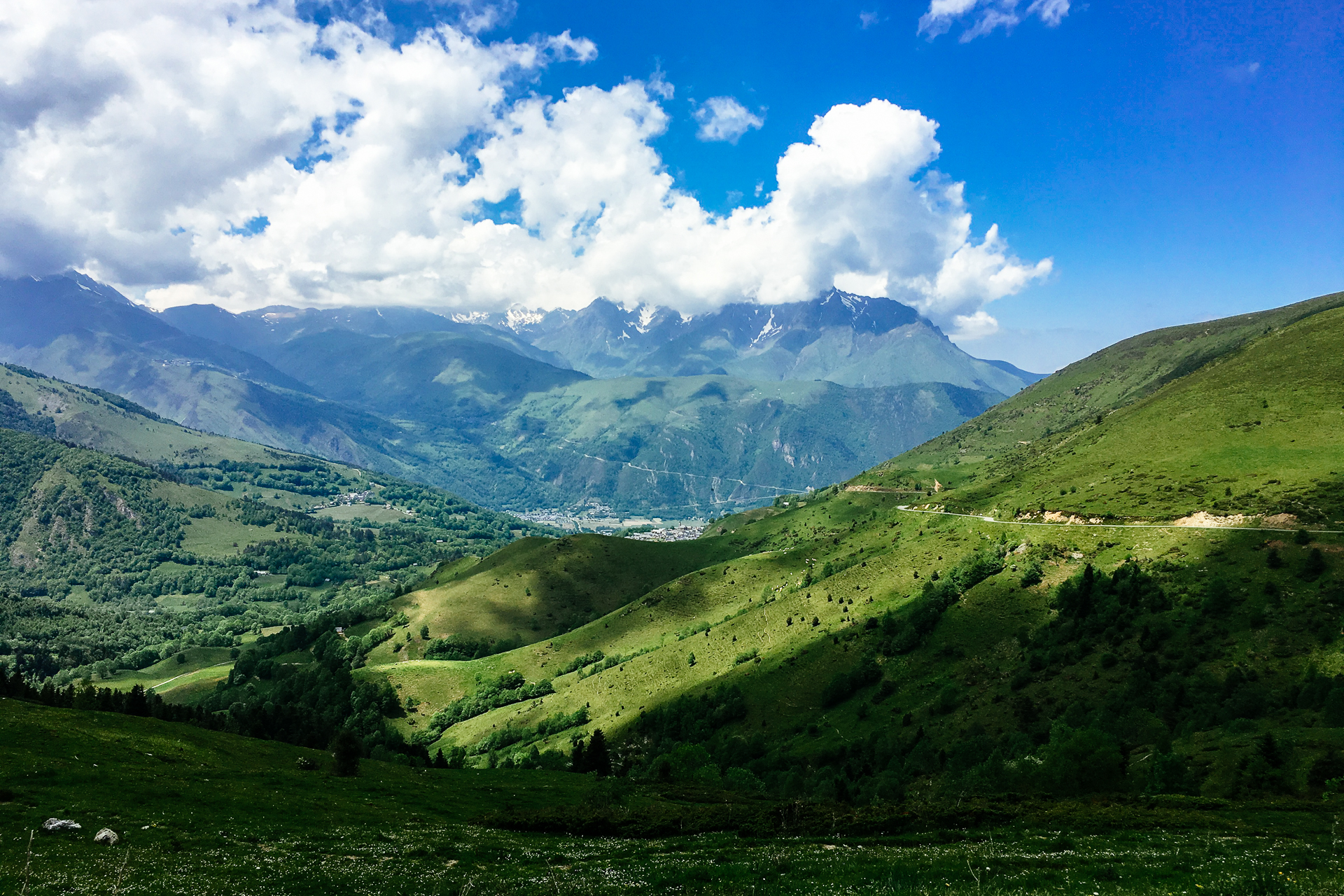
By the time we left the last patches of fog gave way for the sun, but it was still only a chilly 12 degrees when we rolled out of La Seu d’Urgell. The air was fresh, and extremely clean, thus the sky appeared deep blue above us. During the first nine kilometres we followed a narrow car-free path along the el Segre river, and we could watch from the bottom of the walley as the clouds that were born from the morning mist were climbing higher and higher up the surrounding slopes, before they dried up and disappeared at a given altitude. Then we had to go and try to catch up with them. After a short section on the shoulder of a busier road, we turned right to the Northwest, and started the 1st category climb towards the pass of el Canto, that was waiting for us at a distance of more-or-less 25 kilometres.
The slope started with a brutal suddenness, the first six kilometres had an average of a bit above 8%, but this included sustained sections over 10% too. Even though the air temperature stayed almost constant around 15 degrees, I was feeling extremely hot even with an open jersey, and drops of sweat were pouring down my arms and legs. This was the first time that I started thinking “how are we going to survive this, we are not even halfway through and I am dying here…”, and then I quickly decided that I will just take the remaining days “one climb at a time”. That seemed to be a good mental setting, which worked pretty well from then on. I felt a bit sad first that Willem was doing quite a lot better than me, but then I reminded myself that this is not a race and we are here to enjoy the journey.
Speaking about that, the view was pretty amazing looking back towards the valley and the mountains behind that we had conquered already the day before. The scenery to the front was not so special, the mountains were not tall or young enough to be rocky, all the slopes and ridges were still covered with pine forests, with some occasional bushes that were blooming with yellow flowers in between. We had to stop once for road works (as the Tour de France was passing there a few weeks later the surface had to be fixed here and there), but besides that, the climb was pretty uneventful. After the first steep section ended there was an 8 kilometre long stretch that was barely going uphill (with even two short descents to piss me off by loosing some hard-earned metres from our altitude), which provided some time to recharge both the mental and physical batteries, so by the time the next really ascending section arrived, I was feeling much better.
It was 3.5 km at an average of 7%, monotonously climbing higher and higher through the pine forest, and as the air thickened, the rays of the Sun became more powerful, which was very noticeable on the roads that were shaded from the wind by the surrounding trees. This was followed by a long, nearly straight and almost flat stretch of road (at 1%, it felt basically downhill), before the last uphill section arrived that still averaged 4.5% for 2.5 km while it took us to the top to an altitude of 1720 metres. Willem – as usual – was already sunbathing at one of the picnic tables by the time I have arrived. I was feeling pretty good here, the bad thoughts of the firt steep section were long left behind. I almost managed to throw my banana peels into a garbage bin from 50 metres, but at the end I missed by a few centimetres, which meant that a had to do the silly walk (because when bikers walk in their cycling shoes that is everything but elegant) through the grass to the bin and back… That was a fun break.
Soon enough we started our 20 kilometre-long descent towards Sort. We could see patches of snow to the Northwest again, while leaving the pines behind quickly as we dipped deep into the zone of deciduous vegetation. This was also the place where I started suspecting that my GoPro camera is interfering with my Garmin GPS, because as soon as I started a recording, my GPS suddenly lost the ability to track the sudden changes in direction fast enough (which is definitely a bad thing on a serpentine), but it went back to normal immediately as soon as I stopped the GoPro. So from there on I tried to avoid making extended clips on long winding descents. It is stupid, but 100% real, I even found videos on YouTube about this issue afterwards.
When we finally arrived to Sort, we decided to take a proper lunch-break. I had a burger and some of Willem’s patatas bravas. Since we still had 70 km to go and another 1st category peak (that was almost categorised as HC) to climb, we did not waste too much time, so we payed and got back on our bikes pretty quickly. The following 30 kilometers were hot; a 28 degree-warm tail wind helped us pedalling Northwards in the valley of the Noguera Pallaresa river. The smooth road curved up and down, wedged in between the surrounding, rocky walls, that were too steep to support trees, therefore only bushes managed to climb their faces. While on average we were ascending at an average of 1%, it was much more a succession of short climbs and shorter descents, crossing the river a few times in the meantime. Halfway through the heatwave of the valley we stopped for a few minutes on a small bridge just off the main road to cool down in the shade (and enjoying the cold air coming from the water below) and take a few scenic pictures with the wild river in the background.
Maybe as a side-effect of the heat, but this section felt much longer than expected, and I was really looking forward to the cool air of the next col. But first we still had to pass a larger lake, then as the valley broadened towards Esterri d’Àneu we were welcomed by great views towards the taller, snowy peaks once again.
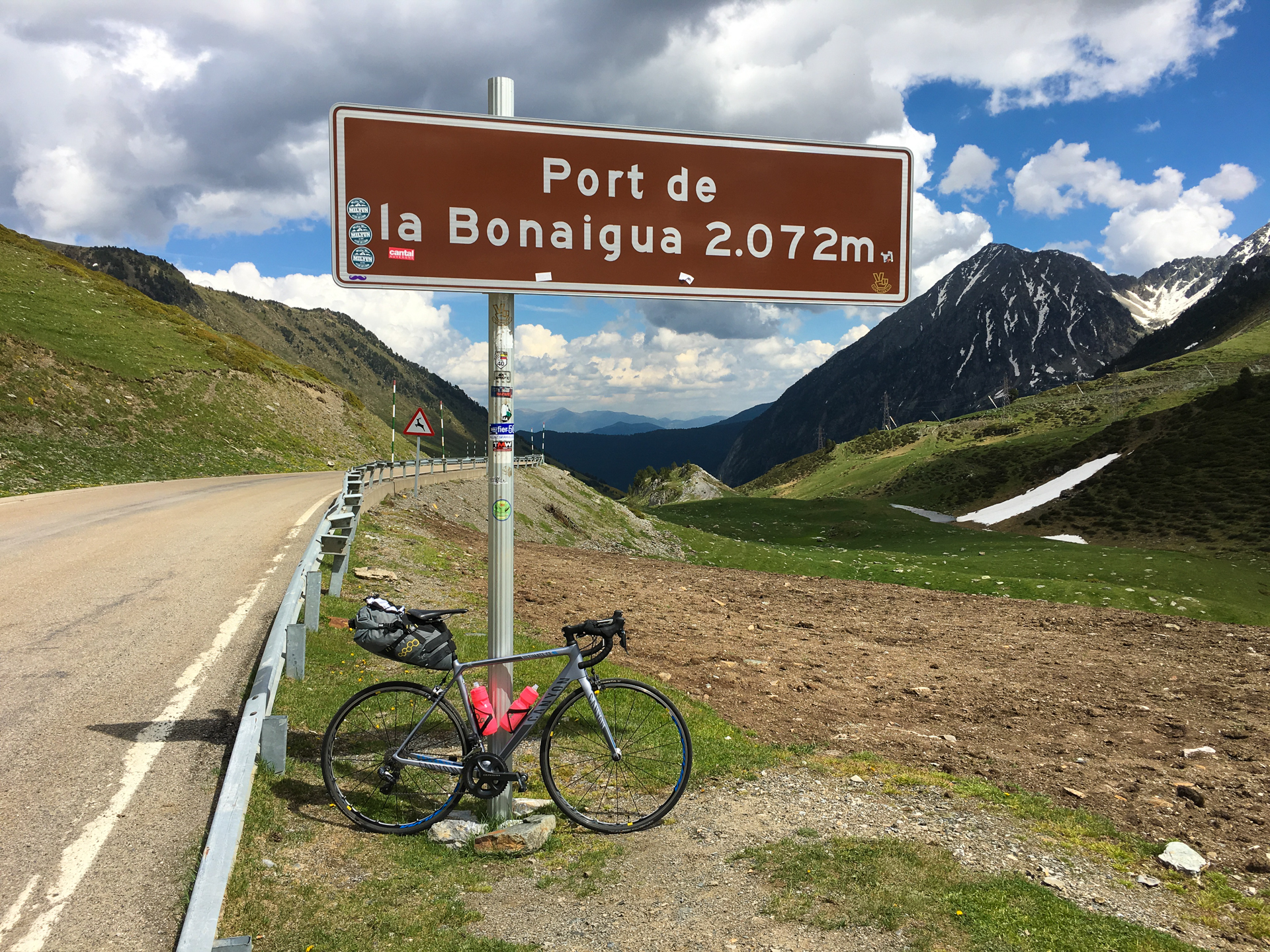
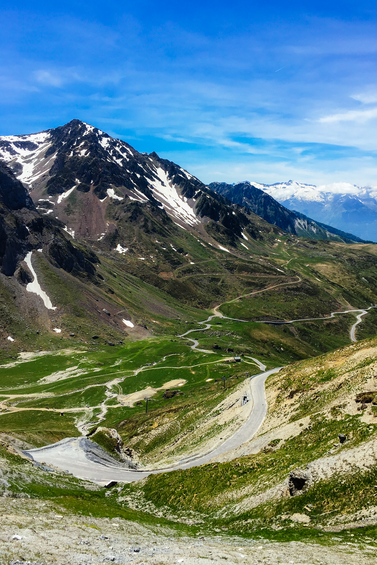
The 18 km long climb started there, hugging the left side of the valley, with painfully steep gradients around 8% over the first 3 kilometres, well beyond the foreseen average of 6%. That section was pretty painful, but the view got better and better as we climbed. For a short time the road narrowed to a single lane to make it through a narrower passage, and the steepness also became more pleasant for a while. Soon green-white coloured snow poles appeared along the side of the road (helping the snow plowers find their way in deep snow, as this road is kept open during winter to give access to a busy ski-area that is situated on top), and the surrounding forest was gradually left behind as we made it to the altitude of flowering yellow bushes, grassy fields, and barren stone-covered slopes. At the beginning of this area there were a lot of annoying flies (and our limited speed meant that we would not just fly past them), but luckily the air was too thin or too cold for them to follow us higher.
The second half of the climb was at a relatively steady 6%, passing more than twenty hairpins (most of which very broad and relaxed, Willem even complained that they were excessive and uncalled for), before reaching the last stretch of straight road that lead to the col signs placed at an altitude of 2072 metres. The panorama was truly magnificent during the last half of the climb; thanks to the winding road we had plenty of opportunities to enjoy the view to every possible direction. It was the first really high mountain pass of our trip, where there was no more vegetation left around us, only grass, rock and patches of snow. It was still 16 degrees Celsius on the top, which was not so surprising since we started the climb in 30 degrees at a 1000 metres lower altitude. I arrived to the top exhausted, I did not eat or drink enough during the last hour, so I was very happy that Willem still had a half banana for me.
As soon as I managed to pump enough calories in and started to feel better, we took off for the descent. Even though it was warm, the first few kilometres felt very cold, but again, the views were amazing, especially back towards the snowy ranges to the South. The road down on this side of the col was almost perfectly straight, except for six hairpins, so the rest of the day was quite straightforward. Literally. After 22 kilometres of doing nothing, we arrived to the outskirts of Vielha, where a more-or-less empty, huge, ski-resort hotel was waiting for us.
The funny thing is that if you look up this place in Google Street View (and make sure you are looking at the July 2012 imagery), then the team bus of Garmin-Sharp (a cycling team) is visible just in front of the entrance, so I knew we would not be the first people staying there with bikes. And still, this was the first night when we were not allowed to take our bikes with us to our room. I was pretty pissed about that, and now I feel a bit bad about all the complaints and demands I was throwing at the receptionist lady, but you need to understand that I was very tired, and I could not get the stories I had read about bikes that were stolen from storage rooms in hotels during large cycling events out of my head. Moreover, this was the very first time that I was not allowed to take my bike to my room ever. So at the end, we had to put our bikes to an empty ski-storage room (displaying a sign saying that the hotel is not responsible for any valuables left in there…), but I was so tired that after 15 minutes I could not care less anymore, and I just wanted to get a shower and go for food.
After our usual post-ride ritual, we first had a look at the menu of the hotel itself, but that was not at all compatible with Willem’s dietary restrictions, so we headed down to the centre of the village. It did not take much walking around before we settled on a terrace overlooking the old square just below the church, where the choice seemed to be plentiful and the prices were – as everywhere in Spain – ridiculously low. I took a bruschetta with tomatoes as a starter which was not so amazing, but then I ordered the special burger of the chef. Now that was mind-blowing.
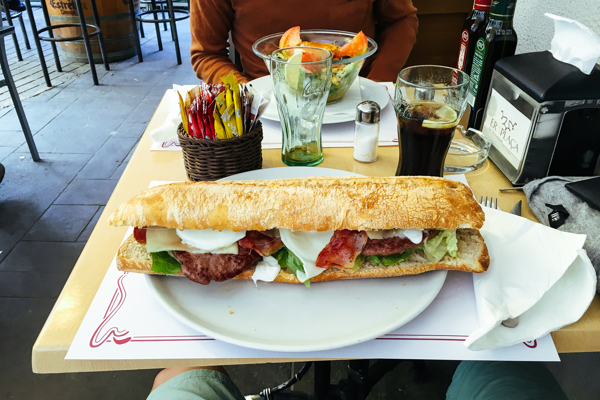
It was a double burger in a ciabatta bread, which means that it was basically two full burgers next to each other (the plate underneath was not wide enough to hold it), and it had the two pieces of burger meat, two full sunny side up eggs, bacon, onions, cheese slices, and some salad inside. It was so enormous that when I ordered the waiter specifically warned me that it is going to be really big, but non of us expected it to be that big. Anyway, when he brought it out everybody around us started to ask for the same. It was so well hidden on a menu consisting of more than hundred options, that nobody knew this actually existed before I started eating it. Long story short, I almost managed to finish it, but with around a quarter or fifth left I had to give up. Maybe without that lacklustre bruschetta I would have been able to eat it all, but we will never know. I don’t really remember anything else from the rest of the evening, but I know that walking back to the hotel (and up the stairs) was not an easy task anymore.
Stage 5: 82.4 km | 2143 m+
Thanks to a good night’s sleep and the calorie-bomb burger the evening before, I woke up feeling pretty good on Wednesday morning (8th of June), especially sine I knew that the next three days would be relatively shorter compared to the previous three longer stages. The weather was still perfect, with no cloud on the sky, 17 degrees, and the first 16 km of the day waiting for us with a pleasant 2% downhill. After breakfast we filled up our bottles with the usual sports drink that we bought at the local supermarket, then not much after 10 we were already on our way. The asphalt was smooth, we did not have to do much pedalling, so we were just enjoying the fresh cool air as we rolled towards Bossost.
Just before entering the village we had to exit to the west to start our first climb of the day. As we passed the sign signalling that the col was open, I told Willem that as usual we would see each other on top, then switched gears all the way down, and started spinning my legs around in a comfortable pace. As comfortable as it can be going up a 7% slope. For more than 8 kilometres… But hey, that’s what we came for! The first part of the ascent climbed up the mountain following a serpentine through the forest, where the hairpins provided great views to the South, and where each of these 180 degree turns had a small statue with the name of a cyclist who reached the top first during previous editions of the Tour de France. We went slightly slower than those guys. But that simply means that we got to enjoy the views longer.
The second half (following a nasty 11% intermezzo) climbed into and up a small valley ending up in a mixed, not too dense forest. The Col du Portillon sat on the top of this 2nd category climb at an altitude of 1293 metres, still below the tree-line, thus providing zero panorama to the surrounding area. It got also hot very fast, by the time we reached the peak, it was already 27 degrees, so as usual, I was sweating like a pig. After a small bite, we crossed the border and started a fast descent to France.
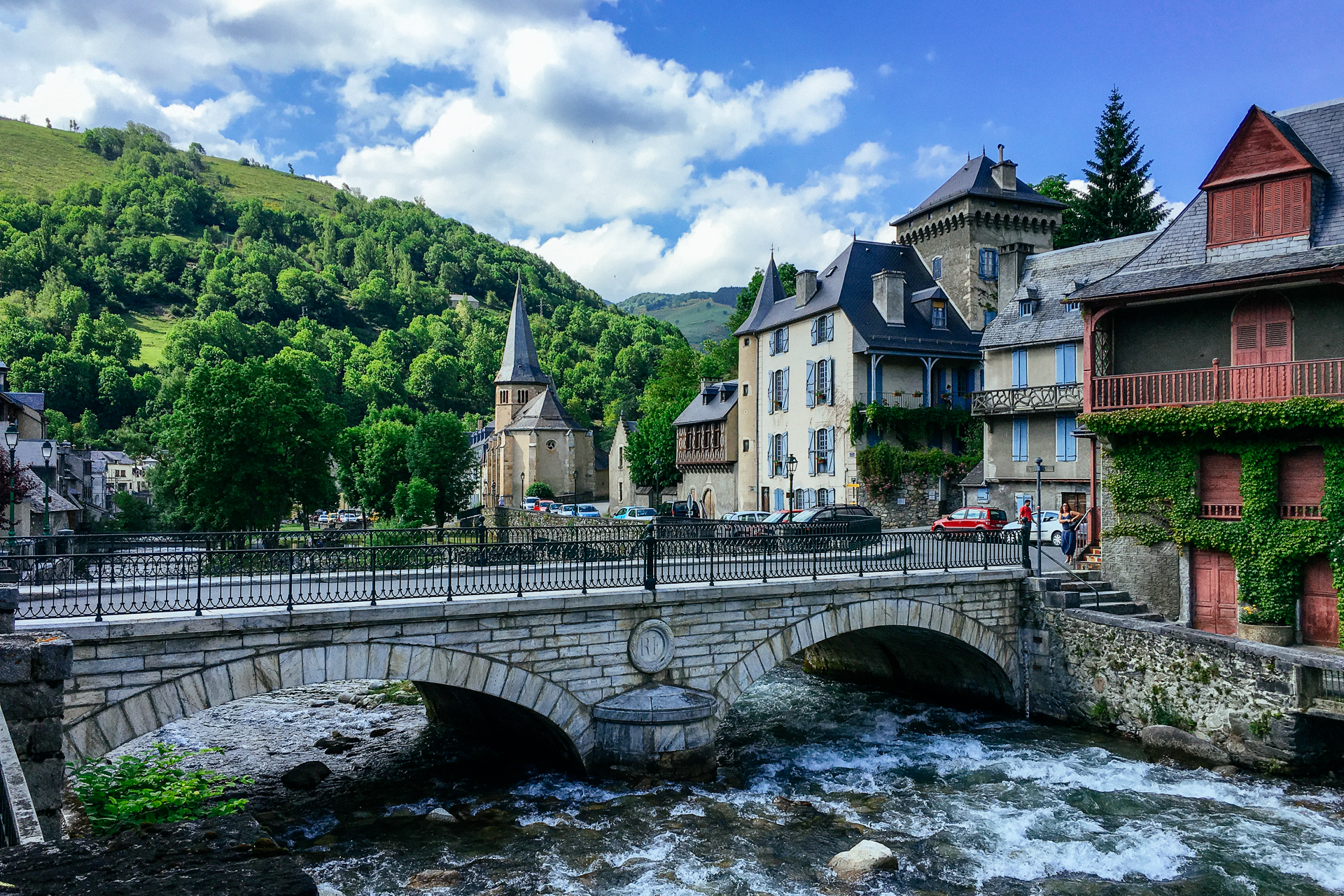
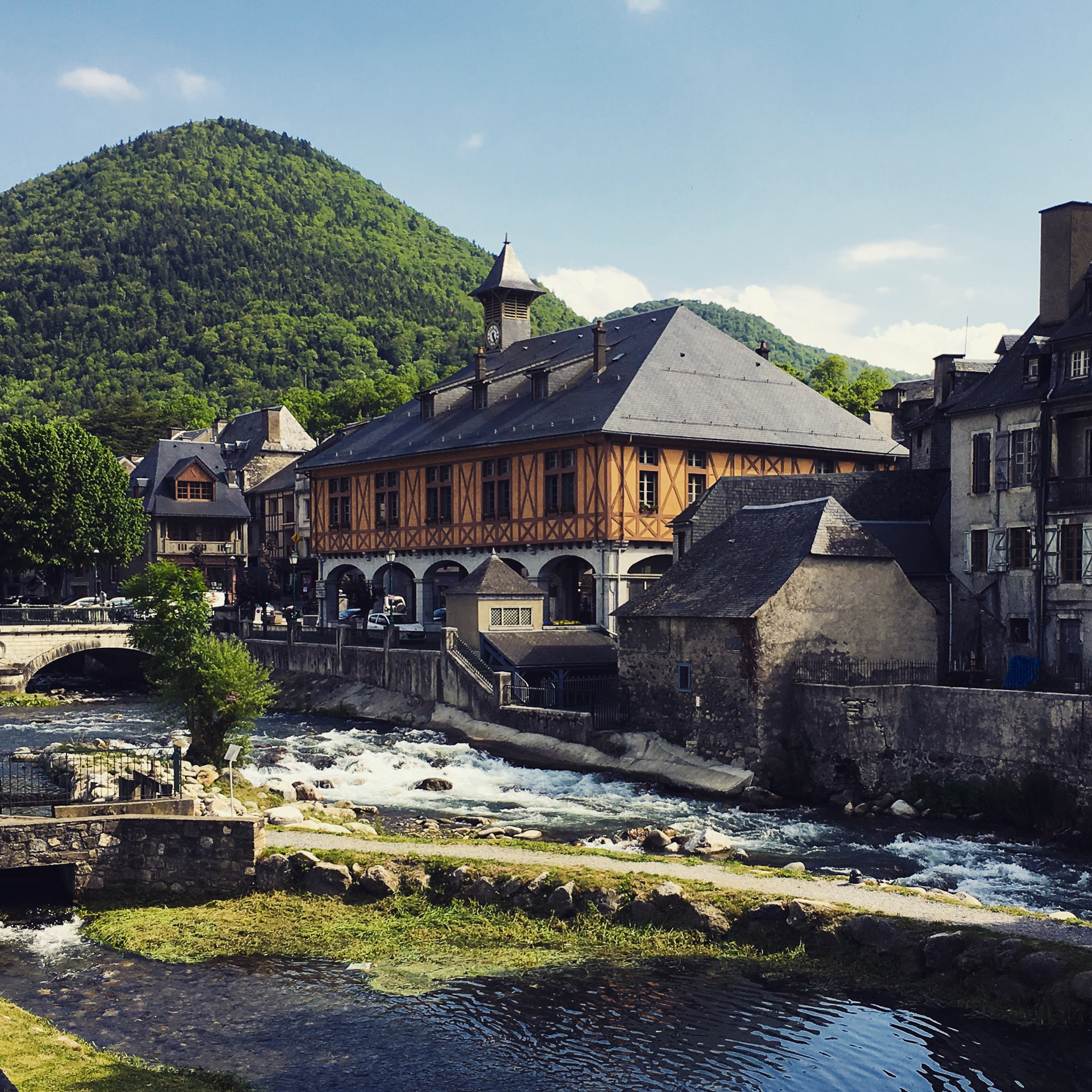
That side of the mountain was definitely a bit steeper, so it did not take much time before we rolled into Bagnères-de-Luchon. Now this place is the prototypical spa town of the Belle Époque, with its baths, villas, and casinos scattered around a central avenue that is planted with lime trees. It is so chic that it is cliché. We even got a bit lost since we could not keep our eyes on the map and the view of the streets at the same time, and maybe partly because I planned a route crossing the village on small streets instead of just taking the big roads… Anyway, we found our way out pretty soon, and started our next ascent towards the West.
This was the first 1st category climb of the day, with the top waiting for us 13 kilometres further. We had an almost constant, strong, warm tailwind blowing up along the road, which definitely made the average 7% gradient feel at least one percent less. From here on we were encouraged by signs placed at one kilometre intervals from each other leading up to the top of the next col, telling us how high we were, how far we still had to go, and how steep the next section would be. These signs were mostly welcome, but should they display an unexpectedly high gradient, they would occasionally be sworn at.
As we climbed higher, the forest surrounding the road got thinner, and between 850 and 1200 metres in altitude the trees disappeared almost fully, leaving behind green grasslands that dominated the scenery, even on the top of the mountains surrounding us. The views once again were magnificent, especially looking back towards the lower sections of the road below us from the last three-harpin serpentine before reaching the Col de Peyresourde at an altitude of 1569 metres. Here an old stone signals that the pass is on the border of the department of Haute-Garonne and Hautes-Pyrénées; which also meant that we reached the halfway point of our Trans Pyrenees ride there.
We could already see the next col waiting for us on the opposite side of the valley (and snow-capped mountains behind it), and we did not want to keep it waiting for too long. There was a small building just below the top where they were selling lots of pancakes for very little money; I did regret it pretty quickly that we did not stop there for lunch. We should have totally done that. It was like 12 pancakes for 5 euros!
The descent towards Genos was hot and it required much more concentration than it should have. The otherwise straight and high-speed-craving surface was very recently patched up here-and-there with fresh batches of asphalt, and these quadrilateral patches were covered with a thin layer of fine rocks that were supposed to be pushed into the underlying surface by the passing cars. The problem with this was that the rocks were still loose, and they kept sticking to our tires, from where the centrifugal forces kept throwing them agains our frame. Since both of us take very good care of our bikes, we really did not want to end up with numerous scratches on the matte finish, so we tried to slalom around these patches as much as possible, which resulted in a significant drop of our average speed. To sum it up, the view was awesome, the road was annoying.
Down in Génos we stopped for a few minutes in the 30 degrees at a public restroom to refill our bidons. Actually we also wanted to eat something, but we did not find anything that was open at that hour (see, we should have really gotten some of those pancakes earlier). Since there was no other option, we decided that we would just do this last climb, and look for food after crossing the finish line. But the last climb was a tough – 1st category – one; 14 steep hairpins had to be tackled over a bit more than 6 kilometres at an average gradient of 9% before reaching the Col de Val Louron-Azet at an altitude of 1580 metres.
The first 3 km twisting through the forest hit us with an average 10%, which was so steep, that even Willem was struggling trying to leave me behind; every time he would pull a bit away in the straights, I would catch up with him by pushing up through the steeper but shorter inside of the hairpin turns. Then as the gradient got shallower (yeah baby, only 8% for the second half!), I decided that it might not be the best idea to kill myself while trying to keep up with Willem, so I dropped back a bit. As soon as the forest gave way to the pastures, we got nice views back towards the previous climb (and the crazy, uphill landing strip of Peyresourde Balestas to the right of it) and the snowy peaks to the South, which we shared with the cows lying along the road, and with a few paragliders who had just taken off a few minutes before we passed there, and who were now circling above us searching for a good upwards draft.
There were quite a lot of people on the top, a few cyclists, but mostly hikers or tourists travelling with a caravan, probably enjoying the 19 degree-cool wind. Strangely enough, there were no motor-bikers, although we had days when we saw much more of those than cars.
The downhill from here was one of the nicest ones we had; the first part down to Azet was quite narrow, but with great visibility and with close to zero cars, so we could finally let the brakes go. The passage through the village was also great, with the road continuously turning left and right, and Willem wondering how I managed to not take a wrong turn in the maze of narrow streets while navigating towards our destination. Soon after this we got almost jumped by two shepherd dogs who probably just wanted to have a bit of afternoon fun, and maybe thanks to that surge of adrenaline, I finally managed to miss a right turn, so we had to do an extra few metres of climbing back up. Then I told Willem that he needs to stop complimenting my routing, because as soon as he starts, we get lost.
During the last 9 kilometres we slowly reached the La Neste d’Aure river following a quite secondary (or tertiary) road down the Eastern side of the valley, turning into a more-or-less flat, cool-down spin for the last three kilometres before arriving to our hotel in Cadeac. This place was the only one where we were not really satisfied, mostly because we had to kill tens of flies that flew into the room through the windows that we left open while we went for dinner (and we really had to do that because we did not want to suffocate and melt at the same time). It was definitely a strange team-building activity, but we came out on top as winners at the end. Speaking of dinner, we had to walk to the next – otherwise cute – village (Arreau) to get some, since unluckily there was really nothing on site.
Willem actually suggested that we could just take the bikes, but I really did not want to do that, because my ass really can not take my saddle without proper bib short, and I did not want to risk getting any saddle sore with still 4 days to go. At the end we survived walking 4 kilometres, even laughed quite a lot, and got a nice pizza after waiting an hour for the only restaurant to open. The fact that all the other restaurants were having their summer holidays or renovations, and the only remaining one was not open before seven on the evening was so typical, that we were not even surprised anymore. After dealing with the fly-infestation upon our return, we managed to fall asleep quite early to get some extra rest for the next day.
Stage 6: 81.8 km | 2086 m+
Thursday morning was still sunny, but a thin layer of high-altitude cirrus clouds were slowly moving in from the West, covering parts of the blue sky with a white filament-pattern. I did not take much from the breakfast table, because I was not in the best mood and I just wanted to leave the crappy hotel with its flies behind as fast as possible. But as soon as we got on our bikes and started the day by pedalling effortlessly along the trajectory of the dinner-quest from the previous evening, I was feeling good again.
That day we had to tacke a 1st category climb as a warm-up before ascending the Eastern side of the Tourmalet, the most famous pass of the Pyrenees. It was going to be a ‘fast’ stage though; we only had to make it to the 45 kilometre mark, then everything would be downhill from there. But when your warm-up is already a 1st category climb, then you know no matter how short the day is on paper, in practice it will feel long… As usual, as soon as we turned on to the climb after passing Arreau, I settled into my comfortable pace, and slowly dropped behind Willem who was still going strong.
The whole ascent is a bit less than 12 kilometres at an average of 6.5%, but the first 2 km is only 4% while the road climbs out of the forest, and gets over to the opposite side of the small side-valley that reaches towards the peak above. The remaining 9.5 km settles at a more-or-less constant 7%, and except for four hairpin curves, it takes a relatively straight trajectory up towards the Col d’Aspin. This part – aside from a few hundred metres before the finish – scales the mountain’s grassy side, offering unobscured views both towards the col, and the highest, snowy peaks of the Pyrenees to the Southwest, standing tall over the valley where we started an hour earlier.
Looking up I could still see Willem sometimes in the distance striving to catch up with a triatlete guy whom we already met during the previous day. I was trying to push even a bit easier than usual to save some energy for the Tourmalet, while enjoying the panorama. It was very busy on the top (in 20°C, at an altitude of 1489 metres): besides the cyclists constantly arriving from both sides, there were also a lot of other tourists (hikers, and people with cars and buses), and a herd of cows lying in the sunshine. A few of them attempted to lick the salt off some unsuspecting cyclists, so in order to move slightly further away from the group, we rolled over to the Western edge of the col. From there we could see the still snowy massif of the Pic du Midi de Bigorre, dominating above the region, and acting as a guide-post for the coming kilometres.
After producing another batch of compulsory Instagram-content, we started the descent. The first 5 km down to Payolle was the same type of narrow road as the ascent, and it went by fast (but we had to pay attention around a few patches of freshly resurfaced road similar to the descent of the Peyresourde the day before, although the top layer was not as loose anymore as it was back there). The view – needless to say – was magnificent. While I accepted early on that Willem is a better climber, I kept telling myself that his faster descending is simply a result of me being more cautious (and he being a fatty several kilograms heavier :D). At the plateau of Payolle, the road broadened into two proper lanes, and after leaving a small almost flat section behind, we tucked down into an aerodynamic position, and plunged into the valley of the L’Adour.
We had to turn our pedals only occasionally to keep our speed during a few slightly more moderate downhill sections, and to push through the small ridge while crossing over to the neighbouring valley before arriving down to Sainte-Marie de-Campan. Here we stopped at the main square, just around the corner that marks the start of the ascent towards the Col du Tourmalet. We sat down at a table on the terrace of the local cafe, facing the Church of Notre-Dame-de-l’Assomption, and held a 50 minute-long lunch break. It was nice to rest in the shade a bit, and I enjoyed every bite of my pâté-filled baguette (with pickles) – what a horror for my vegetarian friend. After the food settled down a bit in our stomach, we started our first hors catégorie (HC) climb.
The road leading up to the col is 17 km at 7.5%, but as usual, the average gradient does not tell the full story. The first 4.5 km crosses the initially wide, but gradually narrowing, grass-covered bottom of the valley, passing a few lonely houses before reaching the point where the two steep walls close in on the pastures, where the real action starts. After the warm-up provided by the pleasant 4% gradient, the sudden switch to 9% was painful, especially knowing that it would stay like that for the remaining ~12 km of the climb… In the meantime clouds had converged above the lower section of the valley, so we stayed protected from the strong sunshine until the grey blanket started to dissolve when we passed the elevation of 1450 metres.
Soon after the Sun broke through, we reached the section where the road passes under the protection of a few ‘tunnels’ (that are basically just covers above the road supported by the mountain on one side, and pillars on the other). This is where the pines disappear, leaving only rocks and grass around us. Also, the last kilometre before entering the village of La Mongie was maybe the worst one, constantly being over 10%. Then as we passed the last hotels, the panorama opened up to the towering, stone and snow covered walls culminating in a chain of sharp peaks to the left, and from a bit further, towards the remaining kilometres of the road, twisting towards the col, cutting through the grass covered slopes, and passing under several ski lifts.
As the air got thinner, the rays of the Sun got stronger, and the temperature fluctuated between 25 and 29°C – depending on how protected we were from the cold wind. Two kilometres from the top the road takes a 180 degree turn (the first of the three up there), resulting in views towards the East for the first time. From there on we still passed the last remaining snow patches from last winter, names of Tour participants painted on the road, a photographer who just started packing up before I pedalled through the corner where she stood, and a few less famous Dutch cyclists, before finally reaching the finish-line painted across the road at an altitude of 2115 metres, overlooked by the metallic figure of Octave Lapize gasping for air on his bike above the Northern wall of the col.
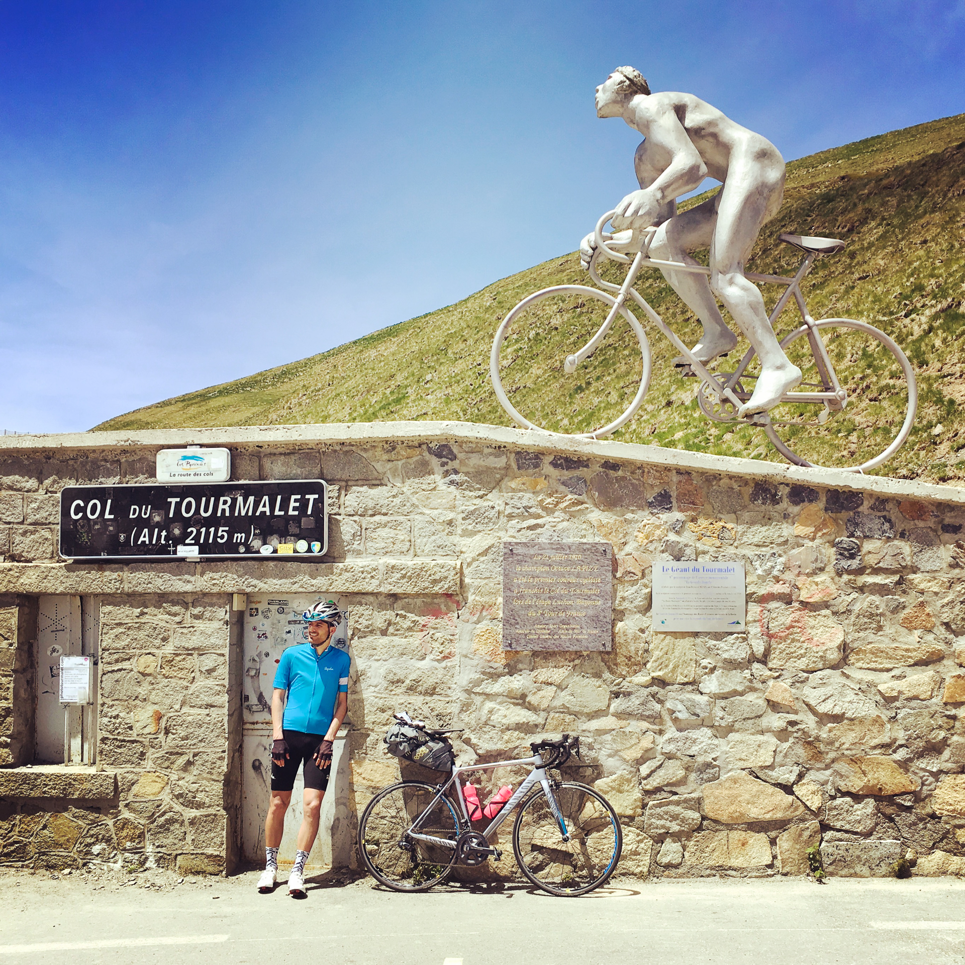
I am not sure how Willem felt on the top, but I was pretty exhausted, even though I arrived 7 minutes after him. (Thinking about it now, that is not so bad.) Even though we were there on a weekday before the start of the real holiday season, the cyclist-traffic through the col was pretty high, and we met people from many different nations. Like everyone else, we also took a few pictures with the col sign (I stand there equally proud and tired), and of the view towards the road ahead to the West.
Then after a quick cola, we started the long descent into the valley. As long as a car was holding up Willem, I could keep up with him, but as soon as we managed to take over, he disappeared into the distance. We had fun leaning into the curves following each other in succession, staring at the magnificent, snowy peaks towering above both sides of the valley. As we left the last ski-station behind (where Willem waited for me), the road stretched out and continued straight down towards Barèges, reaching the tree-line just before the village. This was the perfect high-speed section of the day; we reached 70 km/h without even taking up a special aerodynamic position.
As our altitude dropped below 1200 metres, the temperature started rising again, and when we turned to the North in Luz-Saint-Sauveur it was already 28°C, but the layer of high-altitude clouds started thickening again. From there the downhill became more gradual. The 19 kilometres leading down from the Tourmalet had an average of -7%, but the remaining 19 km was about to follow at only -1.5%. We still had to pass through a narrow gorge where both of us had problems with the GPS reception, before breaking out from the grip of the mountains into the broad, boiling hot basin of Argelès-Gazost.
As soon as we entered the city we stopped at a bike shop to buy a pair of new cleats for Willem, and pump an extra bar into our tires to make sure that the pressure would be optimal for the remaining days, before rolling a few hundred metres furter to our hotel. We again had to lock our bikes away in a separate garage, but there were plenty of other cyclists doing the same there, so even though that had nothing to do with the safety of the storage space, it made me feel better about the whole thing. The room was OK, and after running through our post-ride check-list, we went for food.
Following an hour of chilling on a terrace drinking Coke while waiting for the restaurants to open, we found a nice Italian place for dinner, and if I remember correctly this time I even had space for a dessert after my pizza. Yeah, definitely, I had a huge bowl of something ice-cream based, and I recall some chocolate sauce and whipped cream too. Then on the evening Willem threw his old cleats at me while he installed the new ones, probably because I told him that the next day we would definitely get some rain. Yeah, our morale was definitely very good! We went to sleep earlier than normal, because we wanted to start an hour before the usual time on the next morning. This was deemed necessary because after the next day’s stage, the queen etape was waiting for us, and we wanted to have a bit of extra time to rest before that.
To be continued…