There are iconic climbs in road cycling, and probably the most known ones are the Col de Tourmalet, the curvy road of Alpe d’Huez, and the vindy ascent of the Mont Ventoux. These are not the most difficult climbs (like the north side of the Roque on La Palma is way more difficult – steeper and longer -, and you can find the almost exact copy – in terms of steepness and length – of Alpe d’Huez also on the island) of the World, but these are usually decisive places on the Tour de France. The yellow jersey is won on these slopes. They have a long and exciting history.
As I already mentioned in the last post, I got invited by Valery (who is now a PhD student in Gent, but who finished her Master in Astronomy during the first year of my PhD in Leuven) to join them (her boyfriend and some family members) for five days in France, where one of the days would be a climb to the Mont Ventoux. How on Earth could someone say no to such a thing? :D
We left from Limburg around six on Monday morning, and I spent most of the ride sleeping, so the almost 1000 km to our residence near Grospierres went by relatively quickly. The apartment was a bit smaller than we expected, but we had no plans to spend a lot of time inside, so we did not make a big fuzz about it. On two of the evenings, we had the buffet dinner of the resort, which was really delicious, and usually made me almost unable to move ;) There were also several pools, so the children and the non-cyclist adults also had fun on the spot.
As the weather was not the best on the first days, but the weather forecast was really promising for Thursday and Friday, we scheduled the ascent of the Mont Ventoux for the second part of our stay. (Side note to myself: make a lot of money – or love, as a sub side note -, and forget this economy class flying, because it starts to be a bit annoying… We are somewhere between Madrid and La Palma while I am writing these, and there is absolutely no leg-space on this plane… But back to the story…) So after the first night, I decided that it was time to try out my knee, to see what I might still free from the accident I had on Saturday. I had a 47 km ride alone into the nearby gorge (which was really amazing, as at one point, the river flows below a magnificent arch of rock which connects the two sides of the valley), with an average speed of 33.4 km/h and basically no pain in my knee, so I was quite convinced that I won’t have any problems with it later that week (as such average would have been really good even on my flat Leuven – Mechelen – Leuven training route). Almost immediately after arriving back to the apartment, I went for another ride with Jurgen. It was a much more calm ride of 74 km to a relatively nearby bike store, where he could get the specific bike parts he needed, and I could buy a new rain (and wind) jacket, as my old one was torn in the accident (and that was not even windproof). Speaking of the jacket I made a very good purchase, because it was not only relatively cheep, but I made use of it immediately, as on the return leg we got quite some rain starting at the exact moment when we left the store ;) 10 km from home we caught Jurgen’s father, who was riding all the way from Belgium! On Wednesday Jurgen wanted to rest, so I went on a ride with his father. It was 68 km with an elevation gain of a bit more than 1000 meters (through a beautiful pine forest, with rocks and flowers on the ground level), but with low intensity climbing, as neither of us wanted to use too much energy before the big day. The roads (even the smalles ones) in this part of France are generally very good quality and quiet (especially the small mountain roads have very low amounts of traffic), so we enjoyed the ride very much despite the rain we got here and there. I hope I will be in the same shape as Jurgen’s father when I turn 67… On the descent I had the feeling that he took too much risk, as at a very curvy section I got dropped, but I preferred to take it slower especially because of the wet road (and because one accident per week is already more than enough). From the point where the road got straighter, I went back in front to lead the group (of the two of us). For the next day, we set the alarm clocks to 6:30 AM, as we wanted to do the climb before it gets too windy and hot on the afternoon.
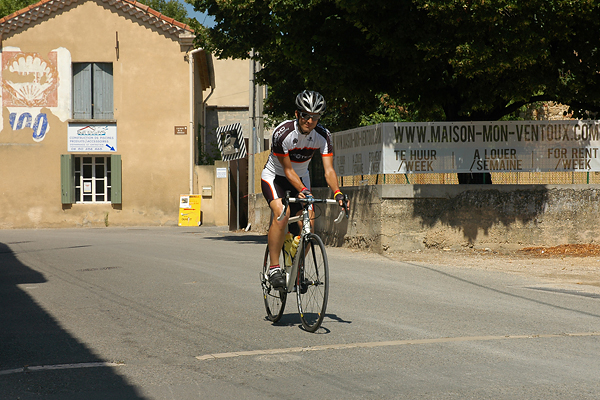
As the holiday resort is situated a bit more than a 100 km from Bédoin (the village where the most difficult of the three ascents of the Mont Ventoux starts), we still had to spend two hours in the car before we could start the ride. After one hour the Mont Ventoux started to became visible, as a huge pyramid standing high above the vast plains between the Alps and the Massif Central. It was a majestic sight. We hopped on the bikes 20 km from Bédoin to have a proper warm-up before the hardcore part of the day. One hour later (and already ~250 meters higher) we arrived to the start line, which is literally an old line made out of stones across the road – the 0 km mark of this legendary climb (some people start 400 meters further out at the Bédoin road sign, that’s why the official distance from the Tour de France in 2009 is ‘only’ 21.1 km). We had enough time to think about the climb (at least that’s what I did) during this warm-up section, as the rocky, deserted peak stood high in front of us all the time, getting higher and higher as we approached the start… Here we discussed the strategy for the support car (as Valery and Jurgen’s mother was our support car staff for the climb, which was pretty nice), filled our bottles, prepared our replacement bottles, energy bars, and everything we might have needed later on. Then around noon, we started the climb (see photo of me crossing the start line, while starting the recording of the climb on my Garmin cycling computer – precision is very important). The data of the ascent is here, while the descent is here.
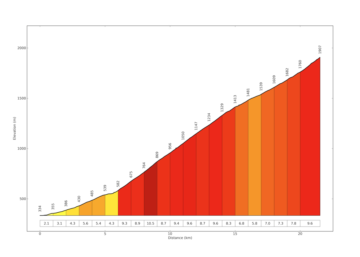
My plan was 1 hour and 40 minutes, as this was the time Tijl had when he did the climb before his PhD defense. Of course I wanted to be faster ;) He was not in his best shape back then, but now I was less then one week from a quite serious accident. I did not want to look at the time (that’s frustrating), so I had not have it displayed on the GPS, but I just wanted to give the maximum effort I could, and see the resulting time only on the top. So the only thing I had to concentrate on was to keep my heart rate around 180 BPM. That’s the maximum I can keep for such a long time, above that I start producing too much lactic acid in my muscles, which makes you tired and slow pretty quickly. As you can see it on the elevation profile (click for larger version) the ascent consists of 4 main sections.
The first 5.5-6 km is very easy, so the plan here was to go as fast as possible (ok, basically this was the plan on all sections, but still, people tend to not pedal really hard before the climb gets really serious). Then from the first switchback (and the first checkpoint with the support car – where they did not expect me that early, so they were not yet standing on the side of the road when I arrived there…) to Chalet Reynard, kilometer 7-15 through the forest is really difficult with an average gradient of 9.2% for 9 kilometers, and with kilometer 9 being 10.5%, this stretch of the route is really something to survive.
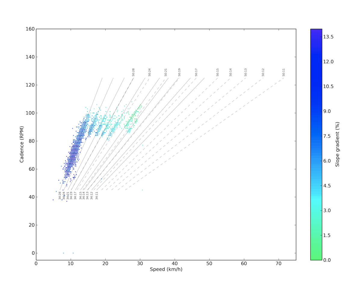
You can see it on the plot below that on such steep climbs I can not keep up my cadence in the optimal ~90 RPM zone, so on the easiest gear I have much lower cadences too. In the first section I could just keep my optimal cadence and shift gears according to the gradient, that’s why you see the nice compact distributions along the different gears other than the easiest, where the distribution is elongated towards the lower values. (My earlier posts about these plots can be found here.)
We had the second checkpoint in the middle of this section, and the last at the Chalet Reynard, where I also put my jacket in my pocket, as I knew that because the support car has to wait for the last one of use, they will not be on the peak when I arrive there (and you don’t want to stand there in the cold wind without a jacket). The good thing was that I kept passing others and no cyclist passed me, though there was a guy with whom I went together for quite a while, and we really played the game of he dropping me and me catching him for kilometers (then on the last section he bonked, and I flew past him).
The third section comes after Chalet Reynard and lasts till the last 1.5 km, with gradients below 8%, and with a kilometer of only 5.8% around 1500 meters above sea level. Here it started to be a bit colder and the wind got stronger because at this point the road leaves the forests and continues through the rocky deserted yellowish grey landscape of the Ventoux. Also, the tower on the top stays visible till the end of the climb from this point. These kilometers – especially after the steep road of the forest – seemed to be really easy, so I had the feeling of going pretty well. Then the last 1.5 kilometer is again 9.6% and the steepest 100 meter section comes also here with a shocking 14.0%…
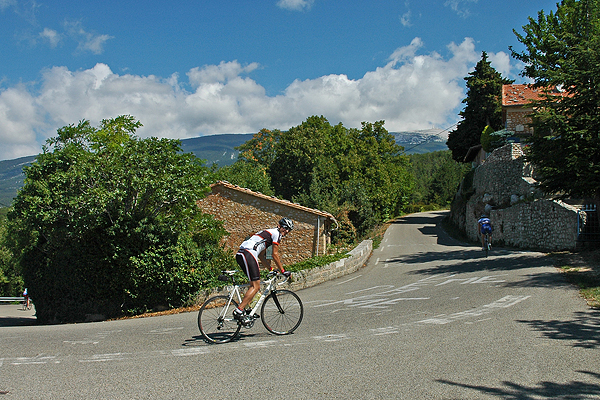
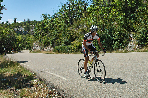
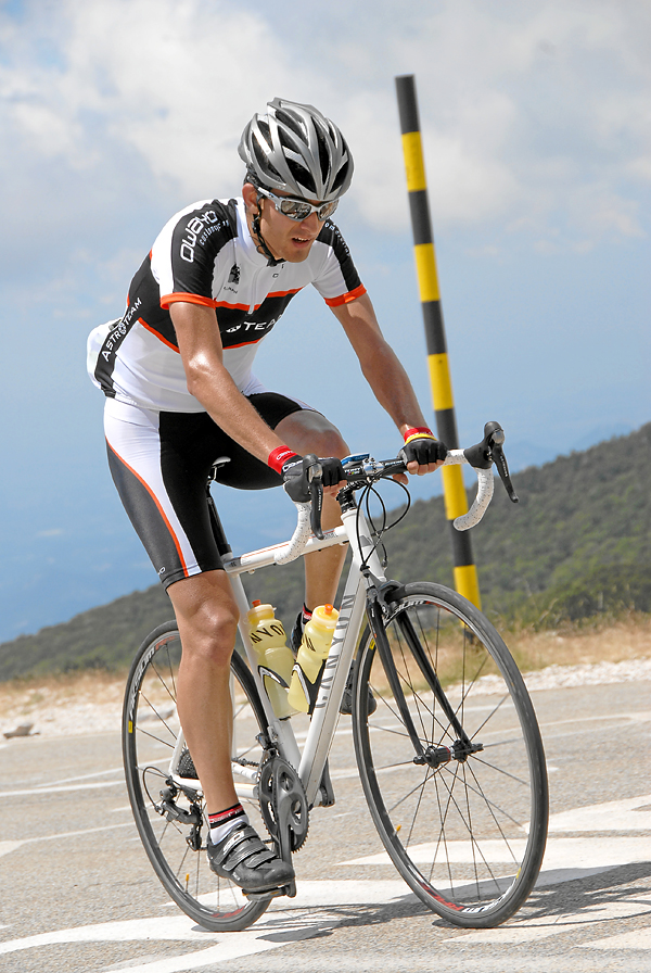
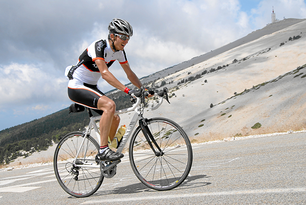
There were three points where photographers took pictures of basically every cyclists, and then gave you their business cards (with the time and date, or even a specific ID number printed on), so later it was possible to find the pictures, and purchase them online for a lot of money. Really, a lot. But they made really cool pictures, so I had to buy the ones above and below. (And thanks to Valery for the other pictures and the support!)
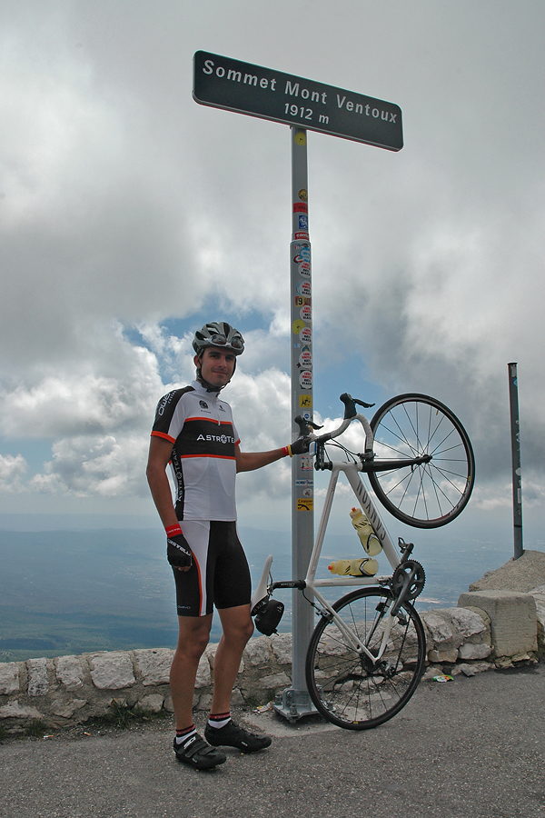
The last curve is very steep again, but then after 21.5 kilometers of climbing at an average of 7.3% (HC climb beyond any question), you arrive at the top of Provance. Which is extremely crowded… It’s like Mecca but for cyclists. I arrived on the top completely exhausted, and stopped the timer on 1:38:41, which was a bit more than 1 minute faster than the plan, so I was extremely happy. And tired. This was my fastest HC category climb till now.
On the peak it was very windy and cold, so I put on my new jacket and stood next to the building where the conditions were less harsh… At a point a guy asked if I was from Leuven, as it turned out he was the one I rode along with for a very long time on the Brabantse Pijl earlier this year. The World is a tiny little place, isn’t it!?! Then at the point where I really started to be cold the support team finally arrived (the others had a time around two and a half hours), so I could put on all my warm clothes (arm and knee warmers, etc.), before we started the descent. Now that was fun! I had an average speed of 50 km/h to Bédoin, following a Dutch car (but not in its slipstream). Then we rode back to where we started that morning. None of us had problems with sleeping that night ;)
On the last day we went for a shorter and only slightly hilly ride of 48 km. There was very strong (~40 km/h base with gusts up to who knows what) headwind for the last kilometers, but with my last energy reserves, I led the three of us home with ~30 km/h, which was quite well apreciated by Jurgen’s father. Then on Saturday we drove home, and luckily all the traffic jams were in the other direction, towards Marseille and the sea. With all this biking, July became my best month with 1256 km on the racing bike (so the cruising around Antwerpen with Elise on a Dutch bike on the last Sunday is not included :D). It was almost 400 km more than the previous best, and it was third af all the road cycling I had last year. It was a very nice month :)
Fantastic! Super and Super+++++. Apu