Visualizing cycling workouts (a.k.a. I love plots!)

Fasten your seat belts, you are about to read one of my best posts ever. (Honestly, it is true.)

I am a bit of a nerd, there is no need to try to deny this fact. I love gadgets, I love technology, and especially, I love plots. I love if they have more than two dimensions, if there is also color or even symbol shapes or sizes used to represent a third or fourth dimension. Moreover, I love GPS devices. At the moment I have a hiking GPS (Garmin GPSMap 60 CSx), a smartphone with built in GPS, and a cycling GPS (Garmin Edge 500), and I had three other ones (two hiking GPS devices, and a bluetooth GPS receiver with my previous Nokia phone) before these… But I am not the nerd who just sits in front of the computer, because I also love sports. I mean, I love doing sports, and not just watching them on TV (which I also like, but this is not the point). If you are not completely new to my blog, then you know that these days I am especially into cycling – this is also the reason why I own a special cycling GPS (which I bought basically on the morning of my first ride with my – back then new – racing bike). With Garmin (and even with other brands), you have the option to upload your workouts to the Garmin Connect website, which gives you some nice overview plots, a calendar, reports, some statistics, and maybe most importantly the ability to share what you have done with the on-line community. The plots and statistics are nice and detailed enough if you are an average – or so called hobby – user. In that case, there is no problem. But if you are such a plot-fetishist as I am, or you need professional analysis, and you have a desire for more, than you will like what I am just about to show after the break. (If you have no food and drinks with you, go and grab something before clicking on continue…) Continue reading

New personal best to Mechelen and back

My standard training route is a perfectly flat, ~48 km long section of quite good quality asphalt along the channel (the Dijlekanaal) which connects the city of Leuven with Mechelen. I have ridden it 37 times since I bought my racing bike in February, 2010. It can be very windy, but riding this route is the best (as it is always consistent) and easiest (no cars, very few crossroads, good infrastructure, and starts very close to my place) way to see how trained I am. If I push as hard as I can, and there is not too much wind, then my average speed will reflect the level of my fitness. Basically this is my individual time trial course. My seasonal best (SB) for 2010 was set on the 7th of June, with an average speed of 33.95 km/h (this value differs a bit from what can be seen on Garmin Connect, but it is more precise, believe me – and you will see in the next post, how did I get it). Now this year I had a quite different training strategy, with additional low intensity rides and interval workouts, instead of the mostly strictly high intensity rides of last year, when I almost always tried to break my previous record. The reason for this is that 1) it is better to train like this, and 2) it got really stressing after some time that I never managed to break my record from June, so I realised that I should not try to always break my record if I do not want to demotivate myself. There is also no point of going for a record, if I do not feel perfectly fit, if the wind is stronger than 10 km/h, or if the temperature is too high/low, because now I have reached the point when it is not that easy to break a record, so I need perfect or near optimal conditions to try – if I also want to have chance for succeeding. So far this year I only tried once, but too early in the season, so I have failed miserably (I thought the aerodynamic wheels would do the job just by themselves, but this is not true at all – of course). But now after all the training I had on La Palma, I really felt strong, and as the weather forecast was perfect (temperature in the low twenties, and a wind of maximum 5-10 km/h), and I had a feeling that I had already recovered after the hard  rides of the Canaries, I had to try it. So on Wednesday after work I left with the goal of setting a new personal best on the Leuven – Mechelen – Leuven course. On the way towards Mechelen I had a slight tailwind, and I felt really good; my cadence was high, I had no ‘difficult’ breathing at a constant high heart rate of 180-183 BPM, and I could relatively easily concentrate on keeping the pace high without getting distracted by any doubtful thoughts (because sometimes that’s the worst, when you don’t feel perfect, and you start thinking about it, doubting that you will be able to hold this speed for long). This way I was riding with typically 37-39 km/h, and I have arrived to Mechelen with a personal best split time. My average speed was 36.5 km/h (because at crossroads I have to slow down to basically 0, and this have a huge impact on the average) when I turned back (after my usual short stop) towards Leuven. I knew that I had a very good first leg, but I was not sure if it was because of the slight help from the wind, or because my training on La Palma was really this useful. So I was very curious how will I perform against the wind (and a bit afraid what if it was just the wind – as it would have not been the first time in history). But it was relatively easy, I really do not remember if I have ever felt this comfortable (relatively speaking, as you never feel comfortable after keeping your heart rate above 180 BPM for an hour) while riding against the headwind. After the first kilometers it became clear that if I do not make a big mistake, then this will be a new record. As my speed was typically 35-37 km/h during this stage, I knew that the final average would be lower than what I saw at the turn-around point, but still much better, than my best time from 2010. And knowing that I can make it, and that the end result can be really good helped me a lot psychologically. Because there are moments when there is a stronger gust, and then you need to push against the wind with a much higher power to keep a steady speed, and it is very easy to loose the rhythm when this happens if your mind is not devoted or concentrated enough. In the last 15 km I just tried to keep my cadence at or near 100 RPM, and go without thinking about anything else (except for drinking frequently enough, because that’s very important). So at the end, I crossed the imaginary finish line completely exhausted, knowing that I really gave the maximum I could. Then I looked down to the screen of my Garmin Edge 500, and it displayed an average speed more than 1.5 km/h better, than what I had on the 7th of June in 2010. After a very easy (and extremely happy) ride home (from the end of the channel, where the imaginary finish line lies), I got to know my final, ‘official’ average speed, setting my new personal best (PB) at 35.70 km/h (individual TT on 48.06 km, not closed roads, no TT bike). An improvement of 1.75 km/h! For me this was a success as big as riding up twice to the Roque de los Muchachos on one day. In the second half of last year I tried so much to break the record without succeeding, that I really started to think that I had set it in such perfect conditions (it is true that the weather was even better than now), that I would never be able to break it again. And now, such an improvement, it is still almost unbelievable. I really am very happy about it! :)

Cycling on La Palma – Day 4

On Saturday I again took the day off, just watching the Giro d’Italia, and eating :) Somehow I could also enjoy these rest days, just by really not doing anything. Though these days were a little bit lonely… Anyway, for Sunday I planned an easier ride to finish nicely my cycling holidays on La Palma. Of course when I say easier it is very relative. Because indeed, easier than biking up twice to the Roque de los Muchachos, but compared to that, everything might seem easy. But keep reading, and you will see what I am talking about ;) After getting up at 9:30, I only managed to leave a bit before twelve – partly because it was raining, partly because it was so good to just lay down in the couch :D First, I had the same short climb as on Day 1:

6.59 km @ 5.6% with a maximum over 100 meters of 8.8% (3rd category)

Though I felt like making a good effort, I was a bit slower than on the first day. But I guess it is ok after such a week on the bike. Then after a short near flat section, the big climb (up to El Pilar on LP-203, though I think the road numbering is not the same in real life anymore) of the day started at km 10.41:

14.17 km @ 8.0% with a maximum over 100 meters of 12.9% (HC)

I was not avare of the fact that it will be this hard. I though it would be a 1st category climb, with a much less steep gradient, so I was a bit surprised when I had to face reality. But it was a world class ascent. The worst part was between km 7 and 12 with the following gradients (over 1 km): 9.5, 10.8, 9.3, 9.0 and 10.1 percent. And to make things worse, as I entered the cloud layer around the elevation of approximately 800 meters (so around the beginning of the really steep part), the visibility dropped to 100 meters, and the temperature to 11°C.

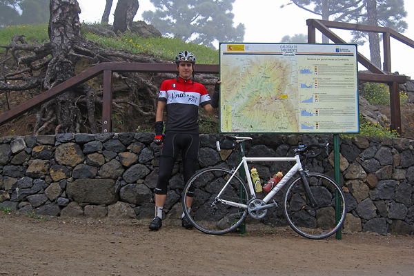
At the end of the steep section I have passed another cyclist (who was way older, so not because I would climb like Contador – at least I don’t feel the effect of the Spanish ham too much :D), with whom I had a short chat when he also arrived to the top. It turned out, that he works at the TNG, so it was a day of astronomers on bike ;) He also took a picture of me on the ‘summit’.

It was cold, in the middle of a pine tree forest, with water everywhere. Clearly 100% humidity. So I put on all my warm clothes for the descent (buying that rain jacket was a huge life-saving idea of mine when I ordered some bike stuff on-line the last time), and started rolling down. I could not see anything from the cloud, the visibility was around 50 meters. I had to put on my flashing red rear lights, though cars could not go faster either… And I was freezing like hell (oxymoron warning here). So from almost 1500 meter ASL I went down to almost 800 m ASL, where I turned right onto LP-202 (again, I believe this is not the real designation anymore, but this is written on my map), to climb up to La Cumbrecita:

5.99 km @ 7.8% with a maximum over 100 meters of 12.7% (2nd category)

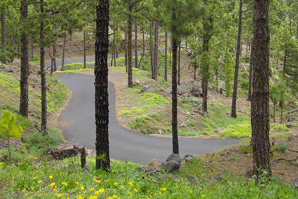
At the beginning of the road a sign said that the path to the caldera is closed, but I kept going. Luckily when I reached the entrance of the national park, the lady at the barrier said that I can go in (and by the time I was coming back, the barriers were even open). This was the smoothest stretch of road which I have climbed this week, perfect asphalt, though only one and a half lane wide. Perfectly enough for me ;)

At the beginning the road was quite straight, climbing higher and higher on the left side of the valley among the so often seen pine trees of the island. A system of tubes carried down the freshwater from higher parts of the natural reserve along the road, and they were leaking here and there, but because of the tremendously high pressure, these leaks appeared as fountains of several meters high ;) The steepest one kilometer had a gradient of 11%, and that was the point where the road got very curvy.

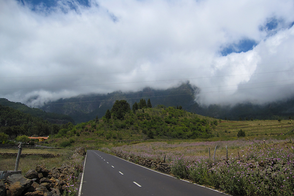
Unluckily the top was again in the cloud layer, so instead of the amazing view to the inside of the caldera I saw a grey wall and nothing else beyond :(

But it was a very nice climb, so it was worth going up. And the downhill was also very nice on the smooth and quite straight road ;) Then already after leaving the pine tree forest and the national park behind, I had a short period of sunshine when I could look back towards the caldera, but that’s the most I have seen that day.

From here, I still had to climb back to El Pilar, up into the cold clouds, and now even facing the chilly and strong headwind. But it was the last climb.

10.69 km @ 5.9% with a maximum over 100 meters of 10.2% (2nd category)

Luckily this side of the mountain was much easier, though the wind and cold made it a bit miserable. Also the road quality here was a bit below European standards. Unluckily I could not see too much of the numerous volcanic calderas which I have passed here, because all what I could make out was the grey slopes right next to me, but the rest was lost in the mist. I have to admit the situation had a special atmosphere, because the moving (more and less dense) clouds created the illusion of volcanic smoke. Again, on the top it was not more than 11°C, so the descent was freaking cold. And because of the low visibility (50-100 meters all the way down till 750 m ASL) and the wet and steep road, I had to be very careful and break a lot. I did not enjoy it that much… But as soon as I came out of the cloud layer, it was a nice roll all the way to Santa Cruz (where I even had a bit of sunshine to close the day in a sunny mood).

So I finished my last day on La Palma with 82.8 km and 2645 meters of elevation gain (and a pizza of course, as every day this week :D). Yeah, ‘easy day’ :D GPS details here. Luckily I specifically asked for a later connection in Madrid knowing that it is impossible to make it with IBERIA if you only have 55 minutes of transfer time, because now I am sitting in the airport of Tenerife, and we already have a delay of one hour… Yeah IBERIA, damn it!

Thanks for reading, this was the last part :)

Cycling on La Palma – Day 3

After a day of resting, and seeing bikes only on the television, I hit the road again on Friday. The plan was simple: bike around the island. This does not give you too much freedom of choice, because there is basically only one way to do this. I decided to go in the ant-clockwise direction, so I could complete the hardest parts first, and by the time I get tired, only the easy climbs or downhill sections are left to be done. I left around nine (if I remember correctly), and took the LP-1 road towards the North. The weather was not too nice, but based on the satellite pictures I have seen in the morning, I was expecting some sunshine on the western part of the island later on. After a short climb and descent, I have arrived to the first categorized section of the day, starting at the 4.05 km mark, it was:

7.01 km @ 5.1% with a maximum over 100 meters of 11.8% (3rd category)

Basically the first 4 kilometers are hard, with an average of 8% (and some tunnels through the ridges), then the rest is almost flat. But to make it more difficult, halfway into the hard part the rain started to fall, so I had to stop and put on my rain-cover. It lasted for only a quarter of an hour, and luckily this was also the last part I have encountered precipitation during the day. From here, there was a nice descent with views to the sea, with a short climb somewhere in between. There were also road works here and there, so sometimes I had to wait at the red light, because half of the road was closed down. Then starting in Los Sauces, at km 23.7 came the longest climb of the day:

18.6 km @ 4.9% with a maximum over 100 meters of 12.4% (1st category)

It is a long climb, but not too hard (the steepest kilometer is only 7.8%, and there is no other over 7%). I knew the rod till Barloveneto from last year, but back then I continued on LP-1, and now I took a smaller road (LP-111) which goes a bit higher up. This was a really nice part, with perfect road quality, only one lane, small and dark tunnels through the steep ridges, and with a real rainforest around.
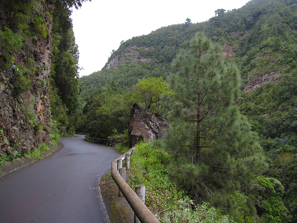
At least it looked like a rainforest while I was riding in the cloud layer, with near 100% humidity, wet road, and water dripping from the trees. I even made a small video at this point :) Oh, and there were basically no cars here! After I have reached the top of the climb, there were still thee shorter uphill sections (with short descents in between), with gradients of 13-15%… The third (and last one) of them even got categorized, starting at 55.75 km:

5.6 km @ 4.9% with a maximum over 100 meters of 10.1% (3rd category)

So soon after hitting the 60 km mark, I already had more than 2000 meters of elevation gain in my legs, which was pretty reassuring given that it was almost 2/3 of the total, while I was not even halfway into the total distance. (Yes, the first part was pretty hard.) I passed the point where last year and two days earlier I turned left to climb (or continue to climb) up to the Roque, but this time I continued straight on. Soon the highly anticipated descent started (with lots of curves in the first part, where my brakes were really loud for some reason), and the sun appeared from behind the clouds too!
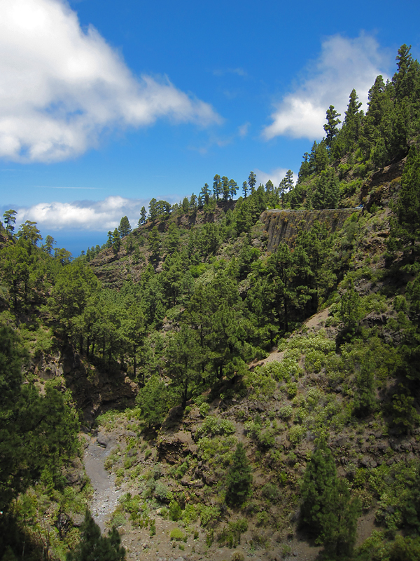
It was almost continuous descent from an elevation of 1200 meter to 100 meter (except for that tricky climb gaining ~200 meters in elevation in the middle), through really nice landscapes, and really great views down towards the sea in the valleys.
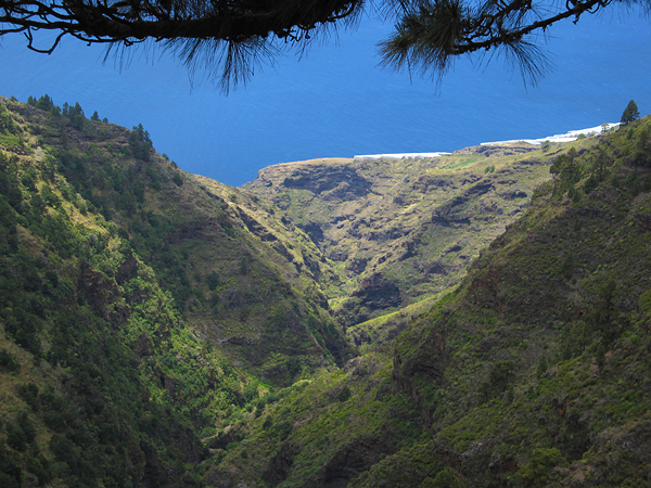
One of the most interesting sights was the El Time lookout point, on the edge of a huge canyon which connects the port of Tazacorte with the Caldera de Taburiente. In optimal conditions, I could have just looked up all the way to the Roque de los Muchachos, but unluckily now it was hiding behind a massive layer of clouds. Still the view to the canyon and the curvy road down to its bottom was quite spectacular.
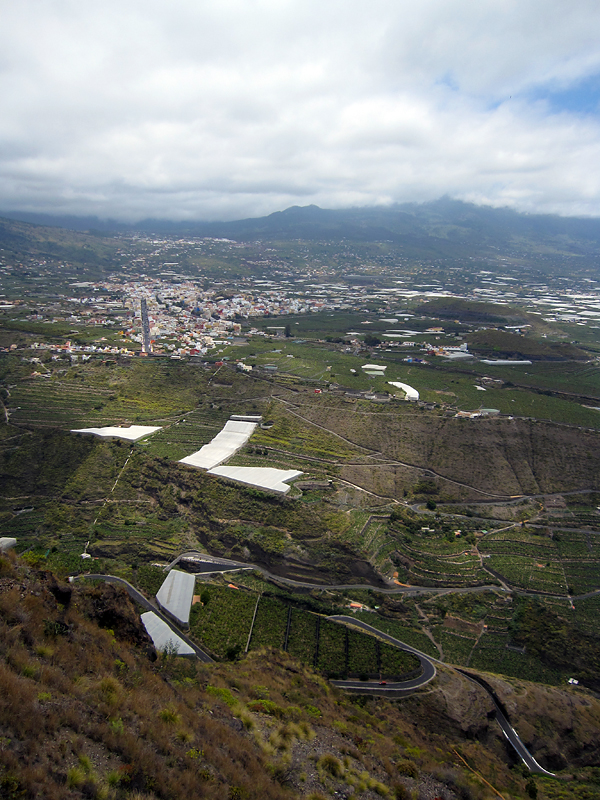
It really is a shame, that the weather was not better. I bough some water in the restaurant here, then started the descent. It was a really great roll down, with the road cutting through the steep rocks which were standing high along the sides and in the bottom of the canyon. Then immediately after reaching the lowest point, the next climb started at the 94.32 km mark:

22.3 km @ 3.1% with a maximum over 100 meters of 8.6% (2nd category)

With only the first 4 kilometers having a steeper gradient than 5%, and the rest typically around 3%, it was an easy climb, though the headwind and the fact that I already had lots of kilometer and climbs in my leg made it slightly harder than it might seem to be from the plain numbers. I biked through banana fields, then the colorful city of Los Llanos, from where I continued my journey on the LP-2 road. At the final kilometers of the climb, I reached the famous lava flows (of course they are not really flowing anymore) of this (southwestern) side of the island.
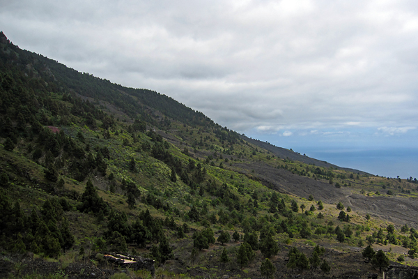
This was again a memorable part of the day, with not just the grey volcanic rivers of rock, but also the rich vegetation around.

Pine trees, cacti and colorful flowers everywhere. Also the road quality was nice, and the car traffic was extremely low (as it is in general on La Palma). It was really interesting to see how the lava flows solidified, preserving the shape of collapsed channels all the way down towards the sea. Then the road turned downhills towards Fuencaliente. From there, I took the same road back to Santa Cruz as on my first ride. I even had a bit of sunshine at one point!

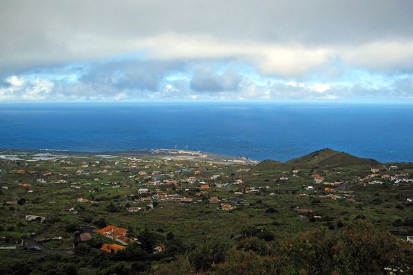
Then I stopped once in Villa de Mazo, because there was a nice view towards Santa Cruz, from just below the cloud layer. It is shocking how deep blue the ocean looked as the clods were only staying above the island, so the reflection of the sky was visible on the open waters – and the fact that the water surface was lit by sunlight made the contrast even bigger.
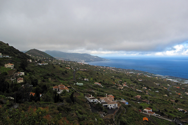
Also the airport was well visible from this point. Then on the last descent (the curvy road along the remnants of an old caldera just above Santa Cruz – I have climbed it on Day 1, and then on Day 4 again), when I was already happy about accomplishing another big ride, in one curve three dogs started running towards me while barking loudly, so I got a half heart attack meanwhile I was trying to avoid running into the dogs… It was a quite close call (and I can only hope that the Spanish lady was shouting “leave him alone” to her dogs, and not “catch the cyclist” :D).
So I arrived back to La Palma after 154.1 km and 3246 m of elevation gain. It is really amazing, that I just rode around the island and still I had more than three kilometers of elevation gain. No wonder La Palma is known as the steepest island of the world. Even if you go around, you can not just follow the shoreline, because sometimes even the lowest road has to go over a 1000 meters in elevation, to make it through a lava flow, or a gorge, or a ridge… But again, it was an epic day! (And again, I had company from the NOT for dinner, so no eating alone!) GPS data of the day can be found here.

To be continued…
Cycling on La Palma – Day 2

The second day brought madness all over my mind ;) I decided to ride up to the Roque de los Muchachos, but from both sides to make it a bit more difficult. Ok, I have to admit it was not an instantaneous decision, but a plan made already a long time ago… As I knew it would take me a long time to accomplish my idea, I got up at 7 and left around half past eight. The morning was beautiful and sunny. Last autumn I rode up from Santa Cruz once already, so I knew the route, except for the first kilometers, where I had to take different (and very steep) streets due to ongoing (pre-election) roadworks. Now this was the menu for the first half of the day (till reaching the Roque for the first time):

34.61 km @ 6.5% with a maximum over 100 meters of 12.3% (HC)
3.69 km @ 7.3% with a maximum over 100 meters of 11.6% (3rd category)

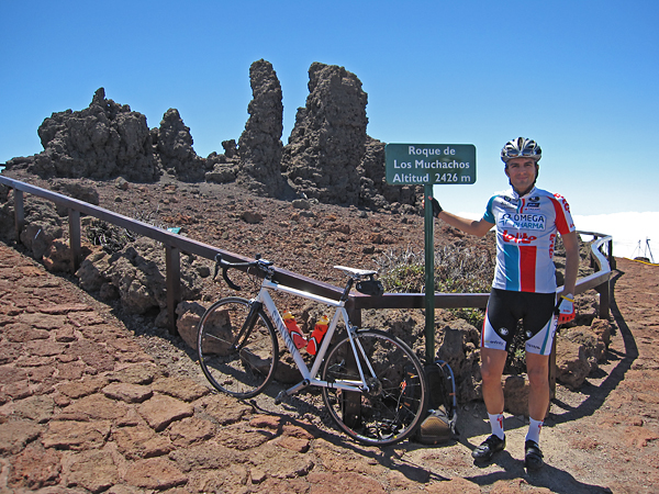
I tried not to push myself too much, because after arriving to the top, I knew I would still have almost half the elevation gain to be done… Still, I felt it much easier than last time (though I have reached the summit almost exactly as fast as last time), so I felt very confident about the rest of the day while taking a short break on top of La Palma. (The Omega-Pharma Lotto colours fit me pretty well, don’t they?)

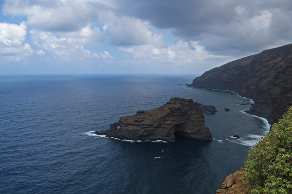
I also refilled my hydration pack with water (and Isostar) here – although my two 0.75 liter bottles were still full. (It is so nice to climb with some excess weight, isn’t it? :D) As the weather was really chilly (and cloudy towards the north side of the island), I got my knee and arm warmers, my wind west and even my rain jacket (still only against the cold wind) on, before I started my descent towards Garafia. Still, I was honestly freezing downhills. Cutting through 13°C air with 50 km/h feels really cold… It was a real revival when I finally reached to the lowest possible point on this side of the island (a lookout point on the edge of the cliffs below Garafia), where the temperature was 25°C. And the view (plus the plants; bushes, flowers and cacti) was also quite spectacular.

I did not spend too much time here (although I really liked this spot), as I still had a lot of climbing to do… So, here is the menu for the second part of the day (the second climb is already after the top, on the way ‘down’):

30.88 km @ 7.3% with a maximum over 100 meters of 16.8% (HC)
3.06 km @ 5.0% with a maximum over 100 meters of 8.7% (4th category)

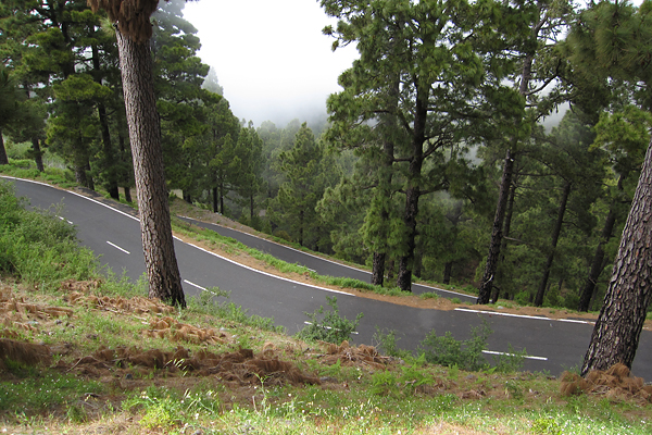
The first section back up was really painful (the 16.8% – and this is an average over 100 meters, the peak gradient was around 20% – was right there at the beginning – definitely out of the saddle pedaling there), then the slope became significantly less brutal (but much more humid entering the cloud layer pretty soon). Then after km 15, the steepest kilometers came with 10.2% and 11.2%, but I already knew that part from last year… I think expecting this section really mad it less painful – at least now I had to stop only once. (Look at the picture below, it is so steep looking down the road, that the horizontal level is outside the top of the frame, though it is a 28 mm wide angle shot!)

At this point I got really fed up with the energy bars and gels. Now I have to explain this situation a bit more, because my non-cyclist readers might not get the full picture without this. So first of all, I could not carry enough normal food for a full day of intensive cycling. Moreover, I could not even eat normal food on the bike after some hours, because I completely loose my appetite in the saddle. But this is normal, when you do sports intensively for an extended period of time. So what can you do? You still need to refill you energy reserves, so you have to eat, no matter how. To fulfill this fuel requirement of the body, cyclists usually eat energy bars and gels (while riding, not for dinner). They have an excellent weight to useful energy content ratio (most importantly carbohydrates), but they can get very boring really quickly, and they are just damn sweet and sticky, and that’s what I really hate. But there is no better solution… This is not a sponsored post, but here are some details. I usually buy Isostar products (and I had their Long Energy isotonic drink with me also this time), but now I bought (along with some other goods via internet) PowerBar items. I had their Banana Punch Bars (203 kcal in 55 g) and the Caffeinated Green Apple Gels (107 kcal in 41 g along with 50 mg of caffeine – a half cup of instant coffee if you wish). I really hated the latter first, but now I think it is really good (and especially very effective – the taste is still so-so, but at least it goes down very easily). Just to give you something to hold onto, I consumed 6 bars and 5 gels during this ride (while I have burnt ~6000 kcal of energy)… So eating is my biggest concern, and when I get fed up with these things, that is not healthy for my mind either…

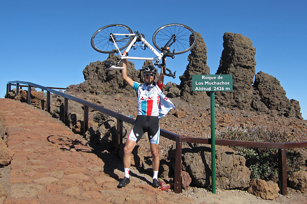
Anyway back to the climb. I kept pedaling (though my pace really fell after the two very steep kilometers and my psychological food problem), first escaping from the cloud layer, then passing the last trees and finally I arrived to the vast volcanic landscape of the Observatory. I took a final nap laying down at one of the helicopter landing sites (on the nice, warm asphalt, bathing in sunshine – I really enjoyed those minutes there) before I rode the last kilometers to the top. Near the peak the wind got very strong, so the last hundreds of meters were again damn hard. But then I was very happy when I finally arrived, though it was very cold (I put my warm clothes on right after the picture below was taken), but it was clearly a huge success to ride up from sea level to the top of La Palma for the second time on the same day. I think my happiness is evident on the picture below :)

The way down (with still a 4th category climb soon after leaving the territory of the Observatory) was cold (again) and uneventful (no torrential rain or dogs attacking), but beautifully clear and sunny, with nice views onto Santa Cruz from the hillside. I could even ride onto the fresh asphalt (where the road was still blocked on the morning) and enjoy a smooth roll during the final kilometers. On the evening I had dinner with a colleague from the Nordic Optical Telescope, then I went to bed after watching the Tour of California for a while on TV… It was a really crazy but awesome and epic day of 147.4 km with an elevation gain of 5069 meters! GPS data of the day is here. The next day I did not go anywhere, just stayed at home, watched the Giro and ate a lot :D Oh, and on the evening, I had dinner with now all the people from the NOT!

To be continued!