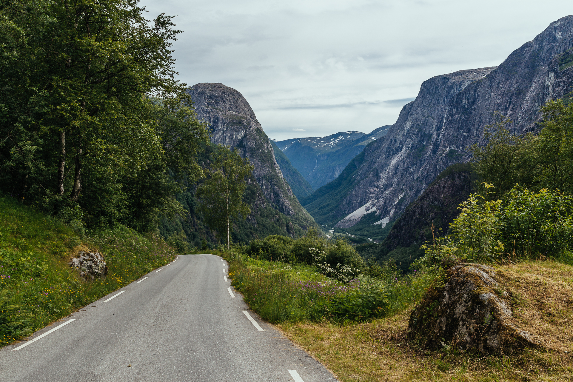
Today we left our great AirBnB apartment around 09:00, and started driving Northeast from Bergen. The weather was still quite warm all day long (around 20°C), and while it stayed dry, we rarely saw the sun or the blue colour of the sky. Our first stop was at the Tvindefossen, which was pretty, but after all the huge waterfalls two days ago, we are not so easily impressed anymore in this category. Later on we left the E16 for a short while to drive down through the thirteen hairpin corners of the steepest road of North Europe, the Stalheimskleiva. It is 1.7 km long with a 20% gradient (and so narrow that it was turned into a one way road not long ago), and the views from it towards the valley below are quite amazing.
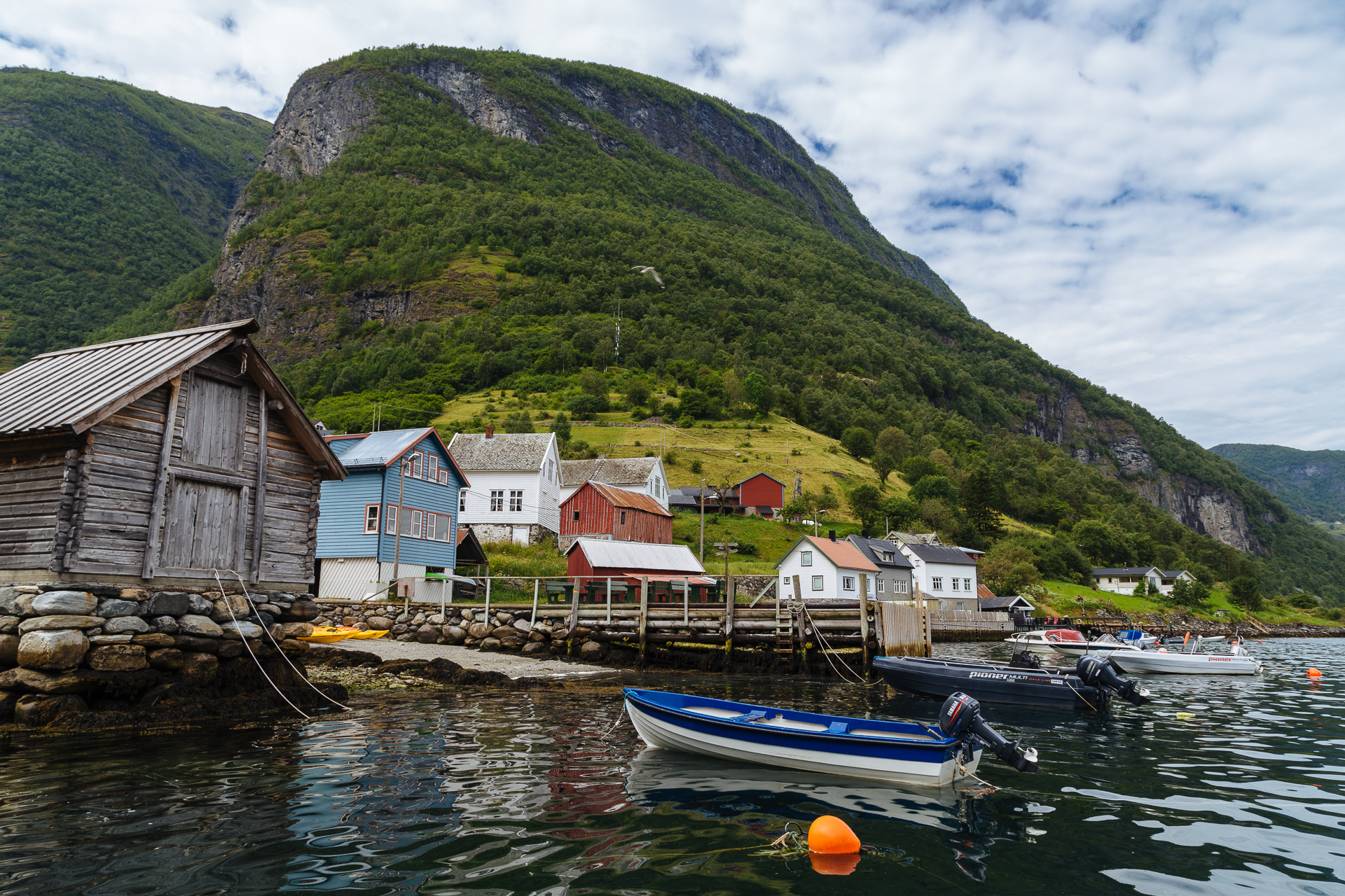
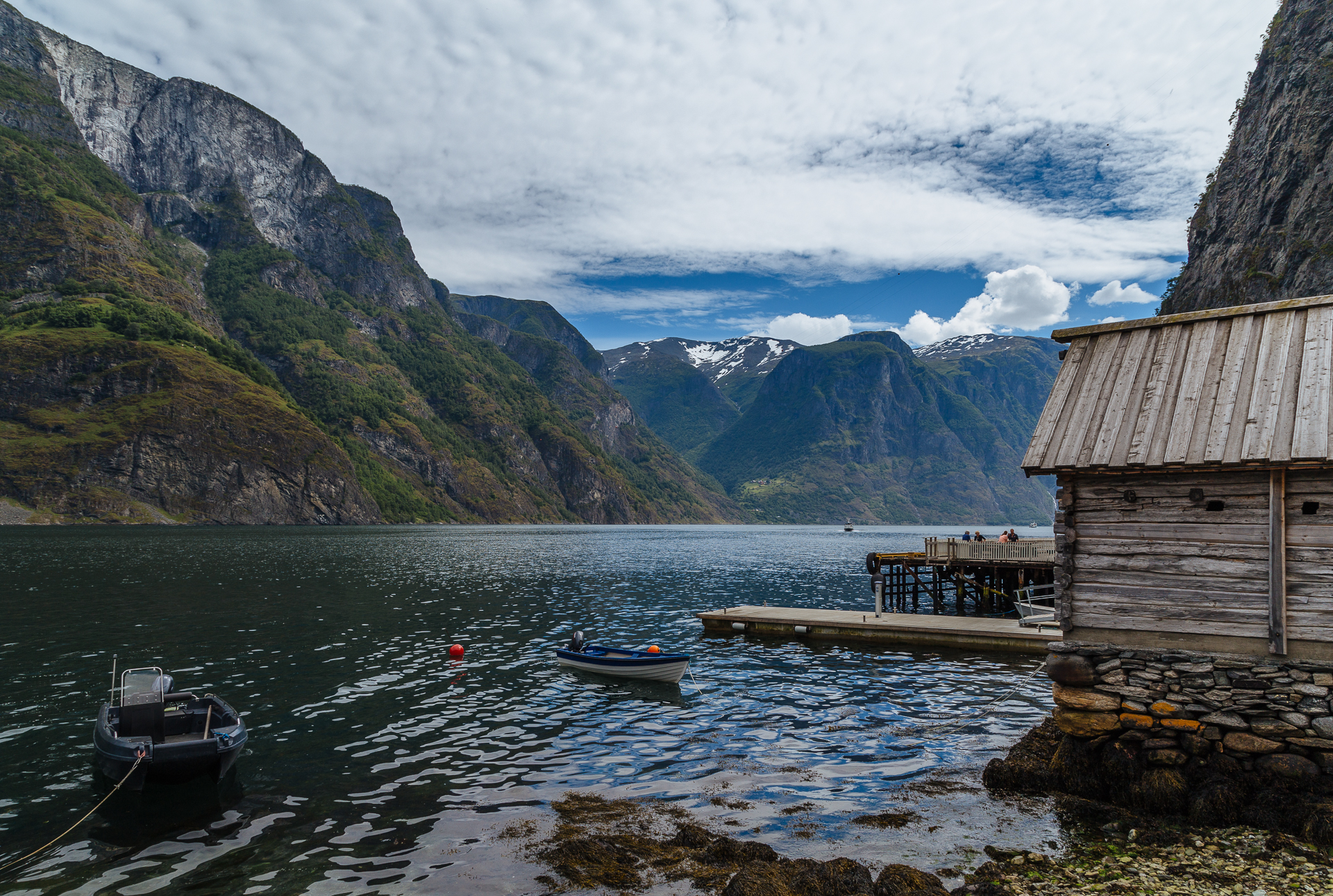
Afterwards we made three stops at different endpoints of the Sognefjorden (one of the largest fjords in the world): at Gudvangen (for a hot dog), in Undredal (for very pretty views in a small and quite town, that is skipped by most people so it is still mostly untouched by tourism), and Flåm (to get a nice pastry and then run away from the Chinese and American tourists). The original plan was to take the Flåmsbana train here, but Clio told me the day before that she would not really want to do it (maybe the years of commuting to Brussels have taken their toll on her), and since I have already done it once in my life, I did not mind not doing it again at all. At least I had more time to stop for pictures along the road later on.
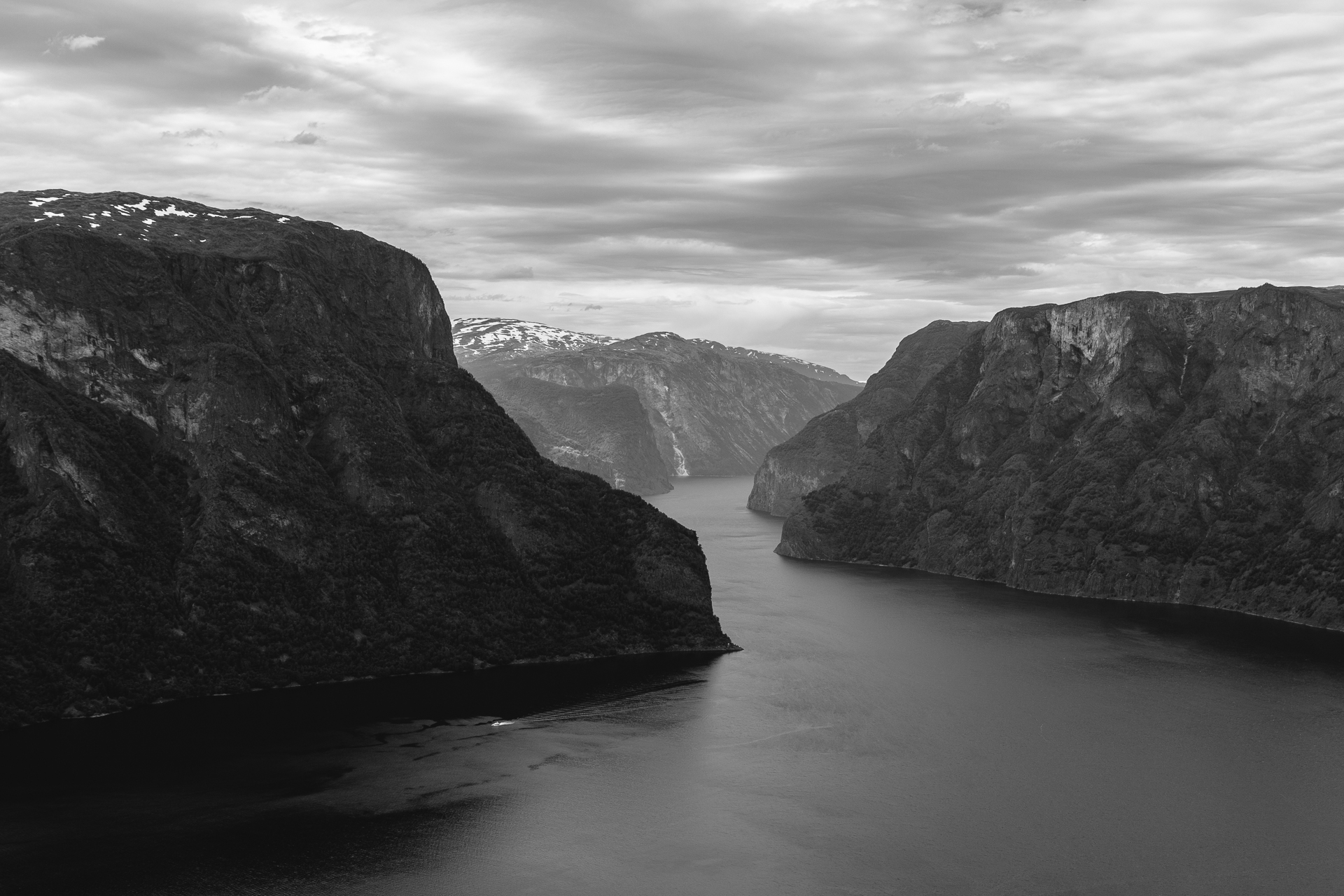
From here we drove on to the Aurlandsfjellet National Tourist Route. The first section of the road that climbs up to the Stegastein lookout point is only one lane wide, so there were many occasions where I had to reverse back a few metres into a broadening to let the oncoming traffic pass. They said that the Stalheimskleiva is not for novice drivers, but this road was much more demanding. The views from the lookout platform over the fjord and the mountains were magnificent.
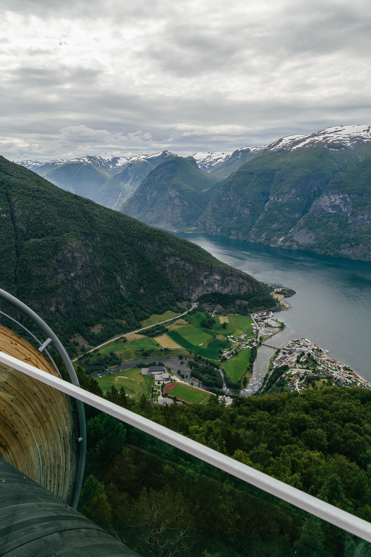
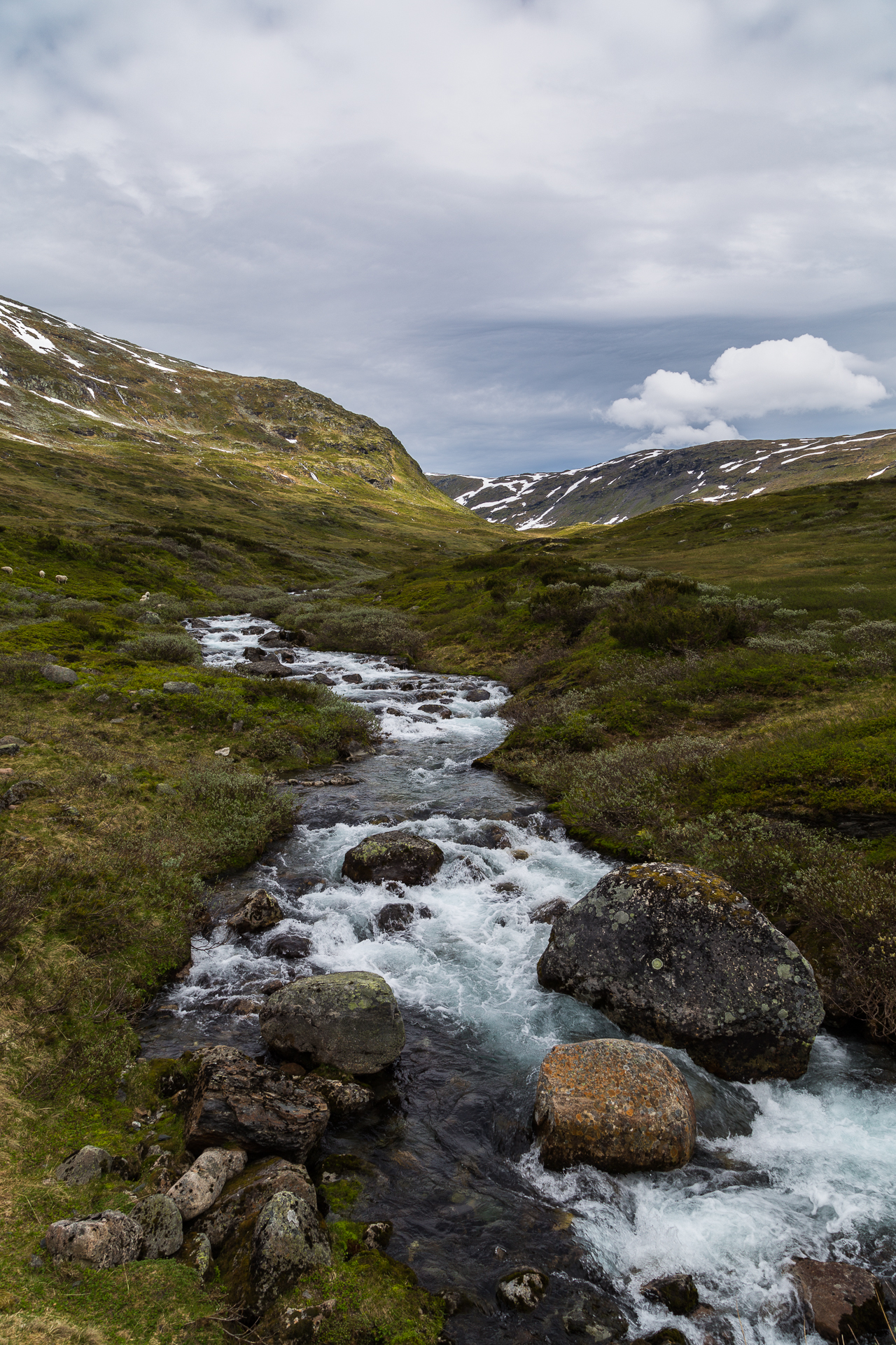
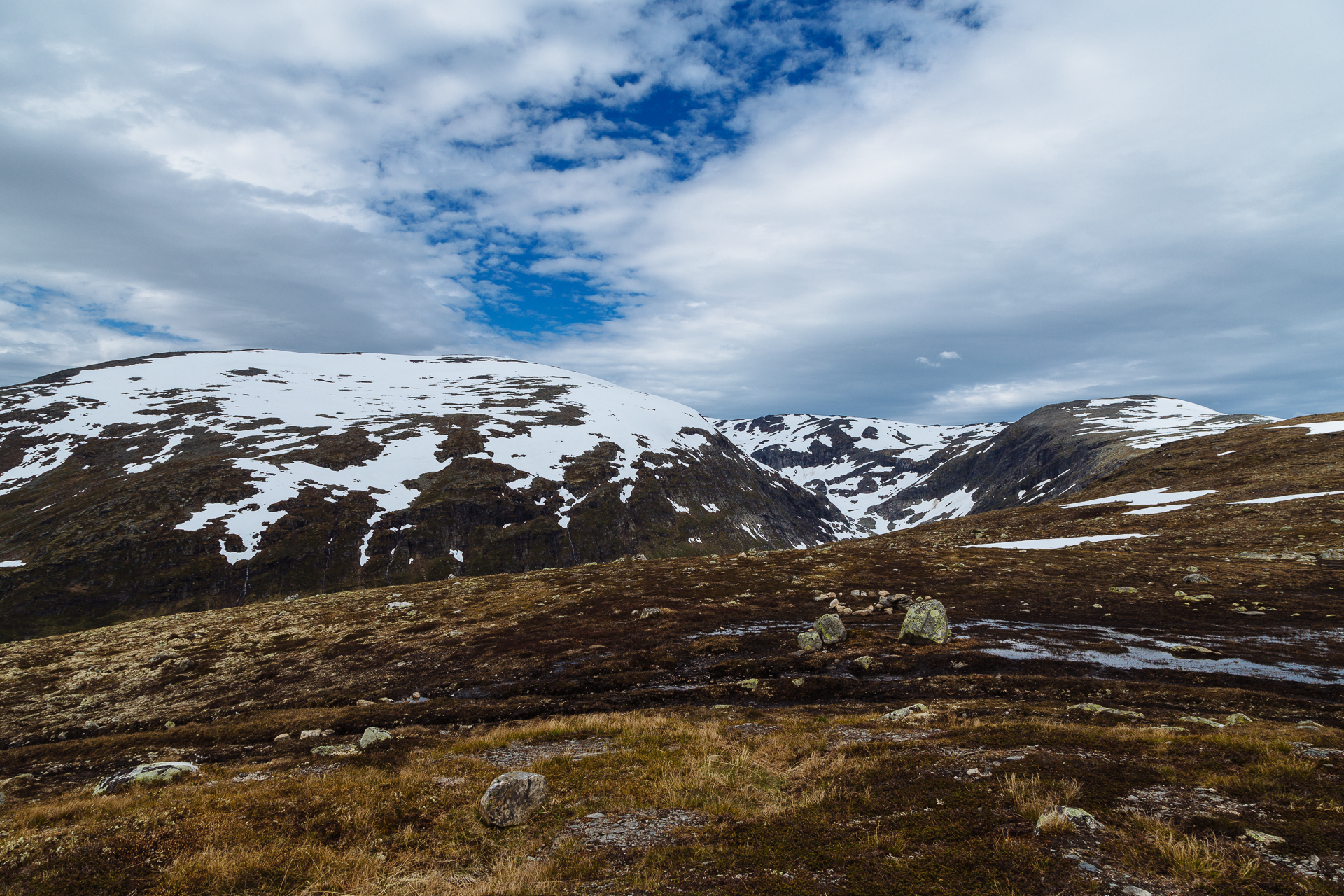
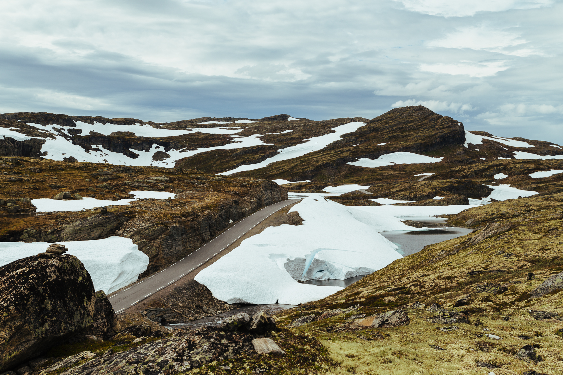
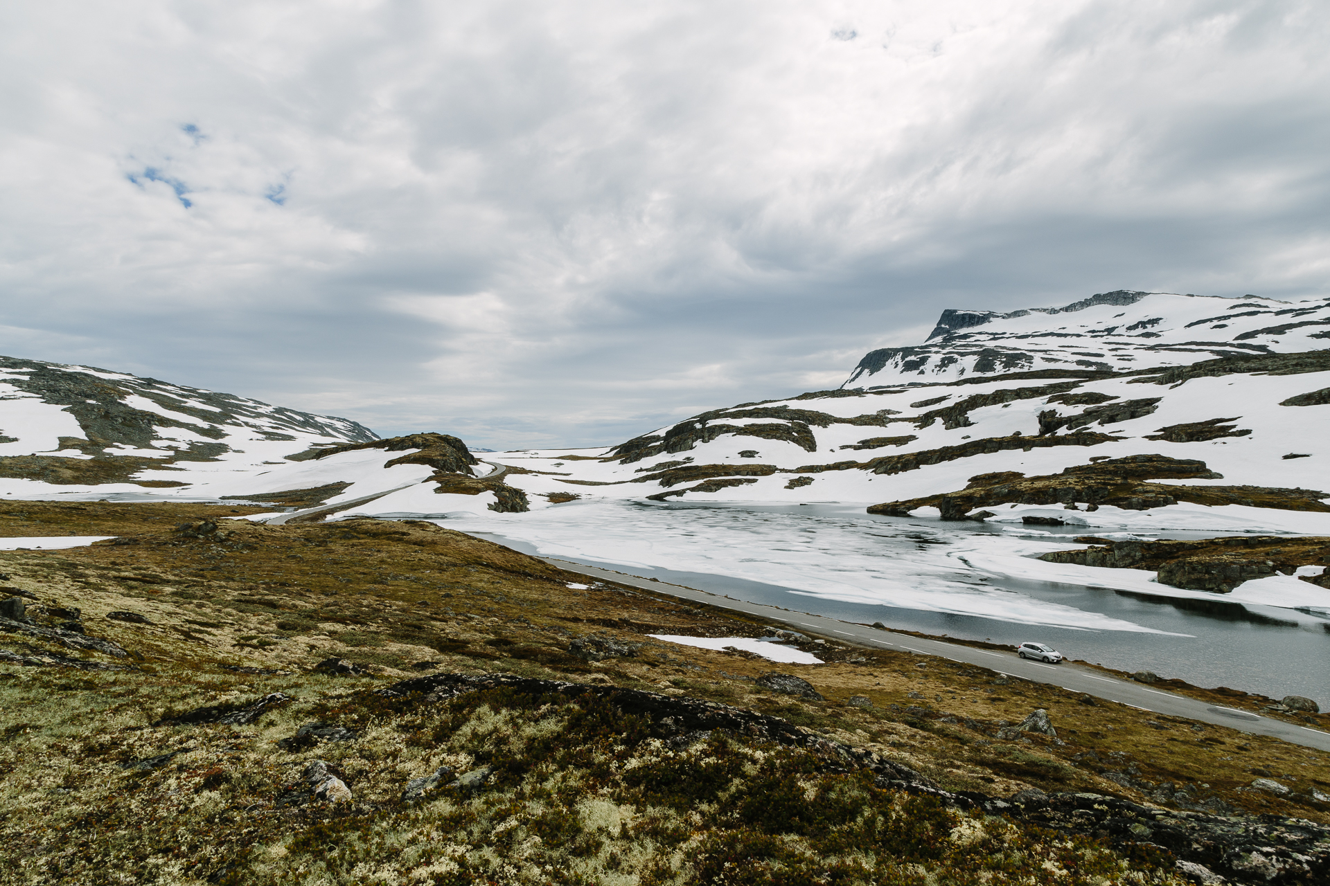
From here the road continued to climb up until 1306 metres above sea (or fjord) level, leaving the tree line behind and entering a barren, rock and snow covered plateau. It was beautiful, I think I must have stopped at least ten times to take pictures of the changing landscape.
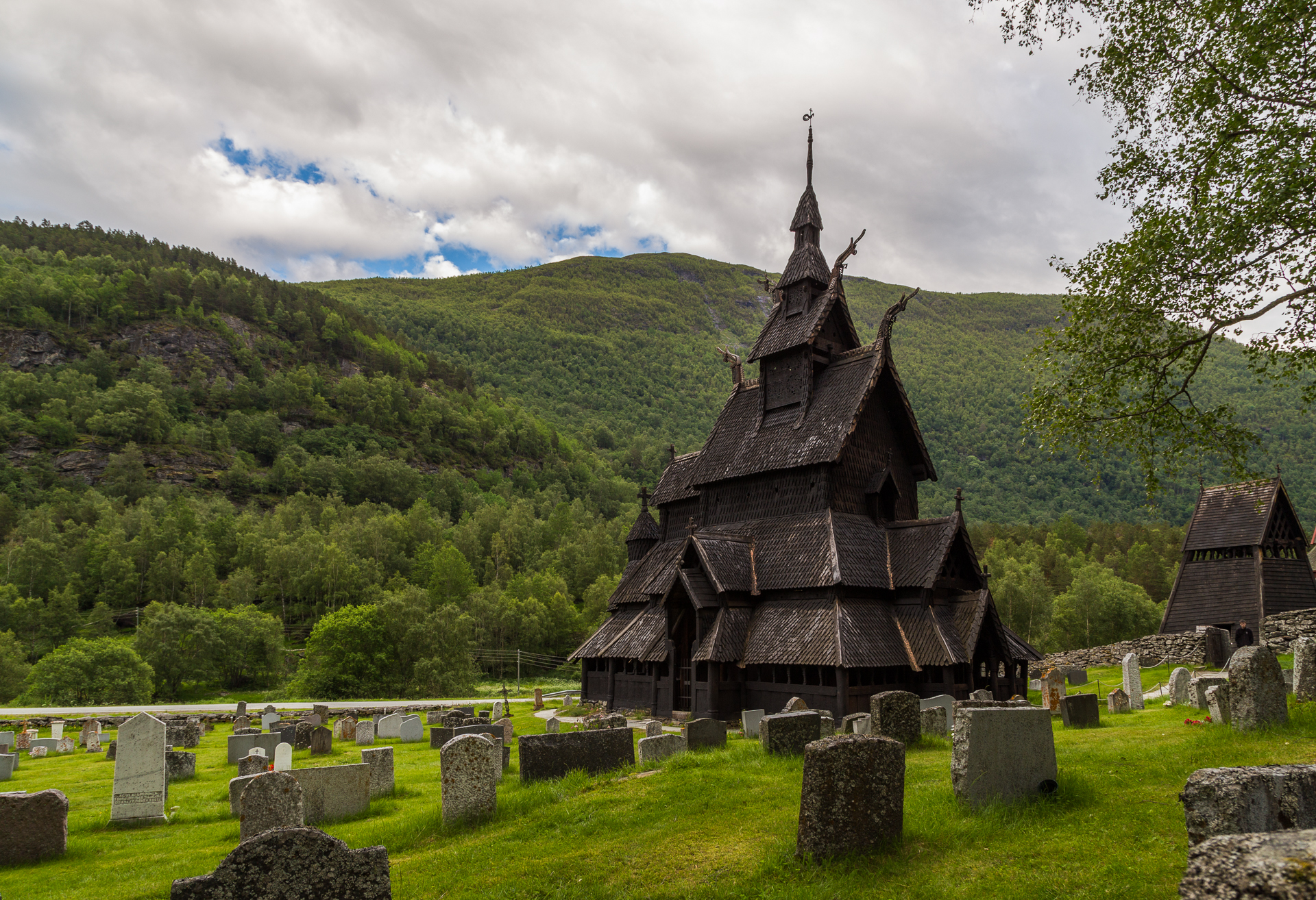
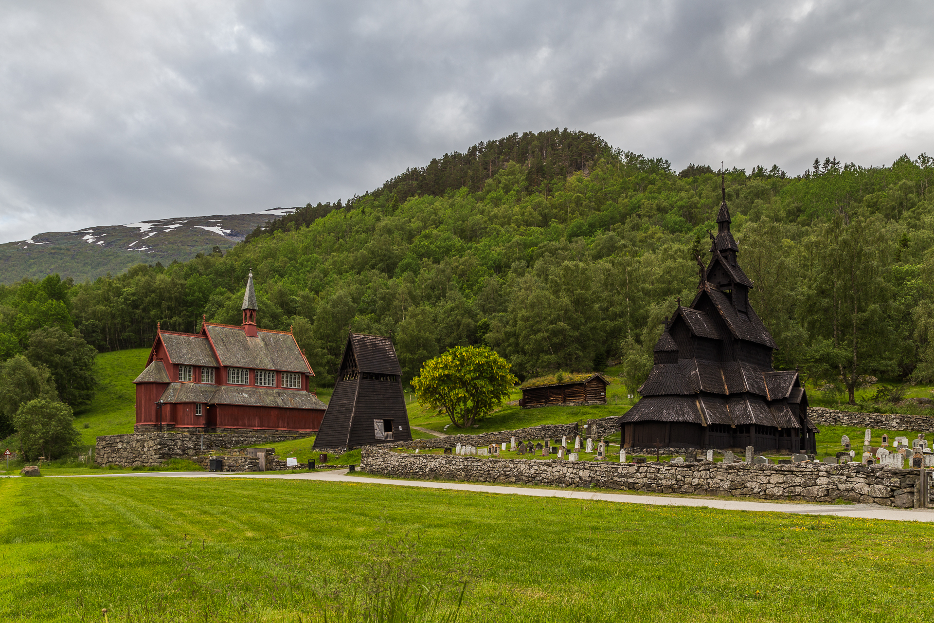
While this section of the road was wide enough for two way traffic, the descent towards Lærdal was narrow again. We arrived to the Lærdal Ferie- og Fritidspark around 16:30, where we have a small apartment for the night. After an early dinner in the restaurant of the camping, we decided to still drive to the Borgund stave church, because the weather forecast for tomorrow was not looking so good. This way we could also save some time, because Borgund is actually not along the main route that we will have to follow. The church (actually, churches) was (were) nice, and thanks to the late hour, very quiet.
On the way back we took the old (historic) road that follows the steep walled valleys (popular fly fishing spots), instead of driving through the tunnels that cut through them. Tomorrow is going to be a long day of driving to the North.
Odometer reading at the end of the day: 2138 km (of which 300 km was today).